Liste des lieux patrimoniaux du comté de Haldimand
Cet article recense les lieux patrimoniaux du comté de Haldimand inscrits au répertoire des lieux patrimoniaux du Canada, qu'ils soient de niveau provincial, fédéral ou municipal.
Liste[modifier | modifier le code]
| [1] | Lieu patrimonial | Illustration | Adresse | Coordonnées | No | Constr. | Prot.[2] | Rec. | Notes |
|---|---|---|---|---|---|---|---|---|---|
| M | Caledonia Town Hall | 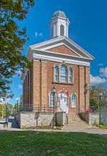
|
80, Caithness Street E. | 43.0731 -79.9488 |
10808 | 1857 | Municipal Heritage Designation (Part IV) | 1982 | |
| P | Caledonia Town Hall | 
|
80, Caithness Street | 43.0731 -79.9488 |
18022 | 1857 | Ontario Heritage Foundation Easement | 1982 | |
| M | Campbell-Pine House | 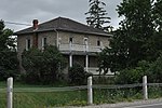
|
396, Highway #3 | 42.9454 -79.8454 |
10807 | 1847 | Municipal Heritage Designation (Part IV) | 1989 | |
| M | Charles Reicheld House | 
|
601, Regional Road 12 | 42.8411 -79.888 |
10900 | 1886 | Municipal Heritage Designation (Part IV) | 1991 | |
| M | Cottonwood Mansion | 
|
740, Regional Road 53 | 42.8185 -79.9251 |
10896 | Municipal Heritage Designation (Part IV) | 1989 | ||
| M | Cook-Peart House | 
|
3355, River Road | 43.0034 -79.8789 |
10264 | Municipal Heritage Designation (Part IV) | 1989 | ||
| M | Cranston Post Office | 
|
915, Regional Road 29 | 43.0075 -79.9511 |
10909 | Municipal Heritage Designation (Part IV) | 1991 | ||
| M | Dochstader Hotel | 
|
3220, River Road | 43.0048 -79.879 |
10954 | Municipal Heritage Designation (Part IV) | 1989 | ||
| M | Duff House | 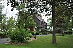
|
5, Mohawk Street E. | 42.9523 -79.8554 |
10957 | Municipal Heritage Designation (Part IV) | 1995 | ||
| M | Edmondson-Weaver House | 
|
1613, Concession 13 | 42.8924 -80.1679 |
10976 | Municipal Heritage Designation (Part IV) | 1992 | ||
| M | Empire School | 
|
3038, Regional Road 9 (York Rd.) | 43.0368 -79.9439 |
15226 | 1850 | Municipal Heritage Designation (Part IV) | 2000 | |
| M | Enniskillen Lodge | 
|
39, Front Street | 43.0368 -79.9439 |
11108 | 1862 | Municipal Heritage Designation (Part IV) | 1983 | |
| M | Furry Tavern | 
|
2511, North Shore Road | 42.924 -79.4779 |
10089 | 1821 | Municipal Heritage Designation (Part IV) | 2004 | |
| M | Gibson-Alderson House | 
|
4830, Highway #6 | 43.059 -79.9682 |
10834 | Municipal Heritage Designation (Part IV) | 1989 | ||
| M | Gibson-Bunn Building | 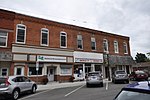
|
19, Cayuga Street N | 42.871 -79.7815 |
10098 | Municipal Heritage Designation (Part IV) | 2002 | ||
| M | Gypsum Mines School | 
|
1256, Regional Road 17 | 42.9227 -79.7902 |
11000 | 1874 | Municipal Heritage Designation (Part IV) | 1986 | |
| M | Hoover Log House | 
|
95, Concession 4 | 42.829 -79.9299 |
11109 | Municipal Heritage Designation (Part IV) | 2000 | ||
| M | Jeffrey Residence | 
|
1615, Concession 13 | 42.8924 -80.1675 |
11141 | Municipal Heritage Designation (Part IV) | 1982 | ||
| M | John Fry House | 
|
1915, Regional Road 3 | 42.8583 -79.6927 |
11142 | Municipal Heritage Designation (Part IV) | 1990 | ||
| M | Jones-Doughty Residence | 
|
53, Talbot Street E. | 42.8851 -80.1094 |
11143 | 1865 | Municipal Heritage Designation (Part IV) | 1990 | |
| M | Kirkland House | 
|
3062, River Road | 42.9133 -79.787 |
11144 | Municipal Heritage Designation (Part IV) | 1990 | ||
| M | Lalor Estate | 
|
241, Broad Street W. | 42.9049 -79.6212 |
11149 | 1905 | Municipal Heritage Designation (Part IV) | 2004 | |
| M | McKinnon-Smith Residence | 
|
156, Caithness Street E. | 43.0724 -79.9465 |
10931 | Municipal Heritage Designation (Part IV) | 1990 | ||
| M | Mooney Residence | 
|
210, Broad St. W. | 42.9047 -79.6207 |
11164 | Municipal Heritage Designation (Part IV) | 2006 | ||
| M | Murray-Walton House and Farm | 
|
266, Irish Line | 42.9287 -79.8655 |
11167 | Municipal Heritage Designation (Part IV) | 1995 | ||
| F | Nanticoke | 
|
38, Rainham Road | 42.7973 -80.053 |
17701 | LHN | 1924 | ||
| M | Old Caledonia Mill | 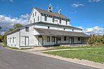
|
149, Forfar Street W. | 43.0717 -79.958 |
11169 | 1857 | Municipal Heritage Designation (Part IV) | 1983 | |
| F | Phare | 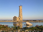
|
Reserve nationale de la faune de l'île Mohawk | 42.8345 -79.5226 |
9770 | 1848 | Recognized Federal Heritage Building | 1993 | |
| P | Ruthven | 
|
243, Highway 54 | 42.989 -79.8682 |
10564 | 1845 | Ontario Heritage Foundation Easement | 1996 | |
| P | Ruthven Gatehouse | 
|
243, Highway # 54 | 42.9813 -79.8719 |
10547 | 1845 | Ontario Heritage Foundation Easement | 1996 | |
| F | Ruthven Park | 
|
243 Highway 54 | 42.989 -79.8682 |
12099 | 1846 | LHN | 1995 | |
| M | Ruthven Park | 
|
243, Highway 54 | 42.9684 -79.867 |
11134 | Municipal Heritage Designation (Part IV) | 1998 | ||
| M | Seneca Bridge | 
|
651, Caithness Street E. | 43.0647 -79.9316 |
11173 | 1913 | Municipal Heritage Designation (Part IV) | 1984 | |
| M | St. John's Parish Hall | 
|
0, Front Street | 43.0368 -79.9439 |
11176 | Municipal Heritage Designation (Part IV) | 1983 | ||
| M | The Gore School | 
|
699, Haldimand Road 9 | 42.9616 -79.9717 |
11177 | 1882 | Municipal Heritage Designation (Part IV) | 1984 | |
| M | Thompson-Colwell House | 
|
86, Sutherland Street E. | 43.0743 -79.9479 |
11178 | Municipal Heritage Designation (Part IV) | 1990 | ||
| M | Toll House | 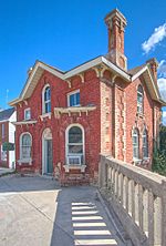
|
4, Argyle Street N. | 43.0734 -79.9518 |
10932 | 1875 | Municipal Heritage Designation (Part IV) | 1988 | |
| M | Union School | 
|
34, Main St. W. | 42.8346 -79.9261 |
11179 | 1918 | Municipal Heritage Designation (Part IV) | 1983 | |
| M | Upper Farm Cemetery | 
|
863, Keith Richardson Parkway | 42.8937 -80.1413 |
10606 | Municipal Heritage Designation (Part IV) | 1982 | ||
| M | Vanderburgh House | 
|
4163, Highway 3 | 42.871 -79.7815 |
10869 | 1890 | Municipal Heritage Designation (Part IV) | 1990 | |
| M | Wilson Pugsley MacDonald Museum | 
|
3513, Rainham Road | 42.9002 -80.004 |
10591 | 1872 | Municipal Heritage Designation (Part IV) | 1982 |
Notes et références[modifier | modifier le code]
- Niveau de la désignation: F: Fédéral, P: Provincial, M: Municipal
- (fr) Répertoire canadien des lieux patrimoniaux : Manuel de normes de documentation, Annexe A : Vocabulaires contrôlés, p.59-78
(en) Canadian Register of Historic Places: Documentation Standards Handbook, Appendix A: Controlled Vocabulary, p.57-75
Annexes[modifier | modifier le code]
Articles connexes[modifier | modifier le code]
Liens externes[modifier | modifier le code]
Pour l'ensemble des points mentionnés sur cette page : voir sur OpenStreetMap (aide), Bing Cartes (aide) ou télécharger au format KML (aide).
- « Lieux patrimoniaux du Canada »
- « Annuaire des désignations patrimoniales fédérales », sur Parcs Canada
