Liste des lieux patrimoniaux de Mississauga
Cet article recense les lieux patrimoniaux de Mississauga inscrits au répertoire des lieux patrimoniaux du Canada, qu'ils soient de niveau provincial, fédéral ou municipal.
Le reste de la municipalité régionale de Peel est traité dans Mississauga est traité dans la liste des lieux patrimoniaux de la municipalité régionale de Peel.
Liste[modifier | modifier le code]
| [1] | Lieu patrimonial | Illustration | Adresse | Coordonnées | No | Constr. | Prot.[2] | Rec. | Notes |
|---|---|---|---|---|---|---|---|---|---|
| M | 47 Queen Street South | 
|
47, Queen Street South | 43.5859 -79.7194 |
15500 | 1855 | Municipal Heritage Designation (Part IV) | 1986 | |
| M | Abigail Street House | 
|
27, Mill Street | 43.5817 -79.711 |
13815 | Municipal Heritage Designation (Part IV) | 1985 | ||
| M | Adamson Estate | 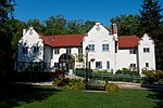
|
850, Enola Avenue | 43.5628 -79.5683 |
9996 | 1920 | Municipal Heritage Designation (Part IV) | 1978 | |
| M | Bamford House | 
|
292, Queen Street South | 43.5789 -79.71 |
13816 | Municipal Heritage Designation (Part IV) | 1982 | ||
| M | Benares | 
|
1507, Clarkson Road North | 43.5271 -79.6373 |
13907 | Municipal Heritage Designation (Part IV) | 1977 | ||
| M | Bradley Museum | 
|
1620, Orr Road | 43.5132 -79.6113 |
14886 | Municipal Heritage Designation (Part IV) | 1983 | ||
| M | Britannia United Church and Cemetery | 
|
5961, Hurontario | 43.625 -79.6776 |
15022 | 1843 | Municipal Heritage Designation (Part IV) | 1981 | |
| M | Brown/McCaughtery House | 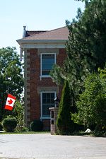
|
1614, Wintergrove Gardens | 43.5857 -79.7014 |
15023 | Municipal Heritage Designation (Part IV) | 1983 | ||
| M | Bussell House | 
|
7420, Ninth | 43.5851 -79.8016 |
16721 | Municipal Heritage Designation (Part IV) | 1996 | ||
| M | Canavan House | 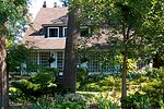
|
1173, Queen Victoria Avenue | 43.5314 -79.616 |
15538 | Municipal Heritage Designation (Part IV) | 2002 | ||
| M | Cawthra-Elliot Estate | 
|
1507, Cawthra Road | 43.5797 -79.5797 |
3024 | 1926 | Municipal Heritage Designation (Part IV) | 1992 | |
| M | Charles Hamilton House | 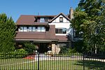
|
84, High Street East | 43.5556 -79.5834 |
15537 | Municipal Heritage Designation (Part IV) | 2007 | ||
| M | Cherry Hill House | 
|
680, Silver Creek Boulevard | 43.5964 -79.6036 |
15539 | Municipal Heritage Designation (Part IV) | 1978 | ||
| M | Clarke Memorial Hall | 
|
161, Lakeshore | 43.5483 -79.5891 |
14441 | 1923 | Municipal Heritage Designation (Part IV) | 1986 | |
| M | Copeland House | 
|
1050, Burnhamthorpe | 43.6152 -79.6104 |
14967 | Municipal Heritage Designation (Part IV) | 1978 | ||
| M | Cotton-Hawksworth House | 
|
1234, Old River | 43.5594 -79.5886 |
14973 | Municipal Heritage Designation (Part IV) | 1985 | ||
| M | Credit Valley Railway Station | 
|
78, William Street | 43.5845 -79.7193 |
15595 | 1879 | Municipal Heritage Designation (Part IV) | 1979 | |
| M | Crozier Farmhouse | 
|
4265, Perivale Road | 43.5768 -79.667 |
15596 | 1846 | Municipal Heritage Designation (Part IV) | 2001 | |
| M | Derry House | 
|
875, Enola Avenue | 43.5629 -79.5682 |
15491 | 1932 | Municipal Heritage Designation (Part IV) | 1993 | |
| M | Derry West Cemetery | 
|
25, Derry Road West | 43.6455 -79.7068 |
13843 | Municipal Heritage Designation (Part IV) | 2007 | ||
| M | Eden Cemetery | 
|
2830, Derry | 43.5909 -79.7679 |
14948 | 1840 | Municipal Heritage Designation (Part IV) | 2007 | |
| M | Elliott House | 
|
5732, Kennedy Road | 43.63 -79.6609 |
15492 | Municipal Heritage Designation (Part IV) | 1981 | ||
| M | Franklin House | 
|
263, Queen Street South | 43.5798 -79.7111 |
14102 | Municipal Heritage Designation (Part IV) | 1983 | ||
| M | Graydon House | 
|
62, Queen Street South | 43.5854 -79.7186 |
15494 | Municipal Heritage Designation (Part IV) | 2002 | ||
| M | Graydon-Atkinson House | 
|
157, Queen Street South | 43.5826 -79.7149 |
14577 | Municipal Heritage Designation (Part IV) | 1998 | ||
| M | Herbert Denison House | 
|
1207, Lorne Park Road | 43.5312 -79.6175 |
15652 | Municipal Heritage Designation (Part IV) | 1983 | ||
| M | Howard Eaton Confectionary | 
|
228, Queen Street South | 43.5806 -79.7124 |
14578 | Municipal Heritage Designation (Part IV) | 1997 | ||
| M | Hyde Mill Ruins | 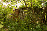
|
0, Ontario Street | 43.5864 -79.7167 |
13848 | 1840 | Municipal Heritage Designation (Part IV) | 1992 | |
| M | The Kindree Family Cemetery | 
|
3790, Derry Road West | 43.579 -79.7814 |
3027 | Municipal Heritage Designation (Part IV) | 2000 | ||
| M | Leslie Log House | 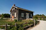
|
4415, Mississauga Road | 43.5639 -79.6895 |
15495 | 1826 | Municipal Heritage Designation (Part IV) | 1994 | |
| M | Lislehurst | 
|
3359, Mississauga | 43.5546 -79.668 |
14962 | Municipal Heritage Designation (Part IV) | 1985 | ||
| M | Matthew Cunningham House | 
|
11, Barry Avenue | 43.5792 -79.7108 |
13818 | Municipal Heritage Designation (Part IV) | 1982 | ||
| M | McClure House | 
|
2075, Derry Road West | 43.6061 -79.752 |
15653 | Municipal Heritage Designation (Part IV) | 1989 | ||
| M | Meadowvale Village Hall | 
|
6970, Second Line West | 43.6264 -79.727 |
15496 | 1871 | Municipal Heritage Designation (Part IV) | 1980 | |
| M | Meadowvale Village Heritage Conservation District | 
|
43.6271 -79.7276 |
15170 | Heritage Conservation District (Part V) | 1980 | |||
| M | Middle Road Bridge | 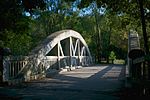
|
1700, Sherway Drive | 43.607 -79.569 |
3026 | 1910 | Municipal Heritage Designation (Part IV) | 1986 | |
| M | Montreal House | 
|
210, Queen Street South | 43.5809 -79.713 |
14584 | 1821 | Municipal Heritage Designation (Part IV) | 1991 | |
| M | Moore's Cemetery | 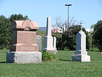
|
2030, Derry | 43.6854 -79.6628 |
15132 | Municipal Heritage Designation (Part IV) | 2007 | ||
| M | Moore-Stanfield House | 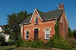
|
1295, Burnhamthorpe | 43.6188 -79.6065 |
15158 | Municipal Heritage Designation (Part IV) | 1989 | ||
| M | Old Erindale Public School | 
|
3057, Mississauga | 43.5443 -79.6616 |
15110 | 1922 | Municipal Heritage Designation (Part IV) | 1983 | |
| M | Old Grammar School | 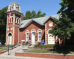
|
327, Queen Street South | 43.592 -79.725 |
14583 | 1851 | Municipal Heritage Designation (Part IV) | 1977 | |
| M | Old Port Credit Heritage Conservation District | 
|
43.5477 -79.5862 |
15169 | 1835 | Heritage Conservation District (Part V) | 2004 | ||
| M | Paterson Manning House | 
|
13, Thomas Street | 43.5798 -79.7124 |
14591 | 1847 | Municipal Heritage Designation (Part IV) | 1978 | |
| M | Riverwood | 
|
1447, Burnhamthorpe Road | 43.563 -79.6709 |
14143 | 1920 | Municipal Heritage Designation (Part IV) | 2004 | |
| M | Robert Sloan House | 
|
831, Sunningdale Bend | 43.5142 -79.6201 |
15655 | Municipal Heritage Designation (Part IV) | 2008 | ||
| M | Robinson-Adamson House | 
|
1921, Dundas Street West | 43.5395 -79.6635 |
15498 | Municipal Heritage Designation (Part IV) | 1977 | ||
| M | Sayers/Larson Residence | 
|
1723, Birchwood Drive | 43.5233 -79.6304 |
16326 | 1922 | Municipal Heritage Designation (Part IV) | 2001 | |
| M | St. Andrew's Presbyterian Church | 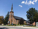
|
295, Queen Street South | 43.5788 -79.7098 |
14593 | 1867 | Municipal Heritage Designation (Part IV) | 1987 | |
| M | St. Lawrence Starch Limited Administration Building | 
|
141, Lakeshore Road East | 43.5553 -79.5815 |
13846 | 1932 | Municipal Heritage Designation (Part IV) | 1993 | |
| M | St. Peter's Rectory | 
|
1556, Dundas | 43.5462 -79.6527 |
15189 | 1861 | Municipal Heritage Designation (Part IV) | 1980 | |
| M | Streetsville Village Hall | 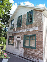
|
280, Queen Street South | 43.579 -79.7105 |
15522 | Municipal Heritage Designation (Part IV) | 1994 | ||
| M | Sylvan Oaks | 
|
7564, Tenth | 43.5974 -79.7949 |
14983 | Municipal Heritage Designation (Part IV) | 1979 | ||
| M | Timothy Street House | 
|
41, Mill Street | 43.5826 -79.71 |
15499 | 1825 | Municipal Heritage Designation (Part IV) | 1977 | |
| M | Tomlinson-Johnston House | 
|
16, Scarboro Street | 43.7057 -79.6478 |
13822 | 1884 | Municipal Heritage Designation (Part IV) | 1987 | |
| M | W. T. Gray House | 
|
90, High Street East | 43.556 -79.583 |
15673 | 1909 | Municipal Heritage Designation (Part IV) | 2005 | |
| M | William Barber House | 
|
5155, Mississauga Road | 43.5714 -79.6995 |
13821 | Municipal Heritage Designation (Part IV) | 1982 | ||
| M | William Cunningham House | 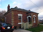
|
19, Barry Avenue | 43.5788 -79.7116 |
13817 | Municipal Heritage Designation (Part IV) | 2004 |
Notes et références[modifier | modifier le code]
- Niveau de la désignation: F: Fédéral, P: Provincial, M: Municipal
- (fr) Répertoire canadien des lieux patrimoniaux : Manuel de normes de documentation, Annexe A : Vocabulaires contrôlés, p.59-78
(en) Canadian Register of Historic Places: Documentation Standards Handbook, Appendix A: Controlled Vocabulary, p.57-75
Annexes[modifier | modifier le code]
Articles connexes[modifier | modifier le code]
Liens externes[modifier | modifier le code]
Pour l'ensemble des points mentionnés sur cette page : voir sur OpenStreetMap (aide), Bing Cartes (aide) ou télécharger au format KML (aide).
- « Lieux patrimoniaux du Canada »
- « Annuaire des désignations patrimoniales fédérales », sur Parcs Canada
