Bohuslavice (district de Prostějov)
Apparence
| Bohuslavice | |
 Bohuslavice : église Saint-Barthélemy. | |
 |
 |
| Administration | |
|---|---|
| Pays | |
| Région | |
| District | Prostějov |
| Région historique | Moravie |
| Maire | Roman Jedlička |
| Code postal | 798 56 |
| Démographie | |
| Population | 452 hab. (2020) |
| Géographie | |
| Coordonnées | 49° 37′ 15″ nord, 16° 57′ 16″ est |
| Altitude | 409 m |
| Localisation | |
| Liens | |
| Site web | www.obec-bohuslavice.cz |
| modifier |
|
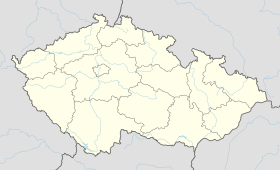
Bohuslavice (en allemand : Bohuslawitz) est une commune du district de Prostějov, dans la région d'Olomouc, en République tchèque. Sa population s'élevait à 452 habitants en 2020[1].
Géographie
Bohuslavice se trouve à 20 km au nord-ouest de Prostějov, à 22 km à l'ouest d'Olomouc, à 54 km au nord-est de Brno et à 188 km à l'est-sud-est de Prague[2].
La commune est limitée par Luká au nord, par Vilémov et Olbramice à l'est, par Laškov et Raková u Konice au sud, par Hačky et Polomí à l'ouest[3].
Histoire
La première mention écrite de la localité remonte à 1288.
Transports
Par la route, Bohuslavice se trouve à 7,5 km de Konice, à 24 km de Prostějov, à 25,4 km d'Olomouc et à 239 km de Prague[4].
Notes et références
- (cs) Population des communes de la République tchèque au 1er janvier 2020.
- Distances à vol d'oiseau ou distances orthodromiques.
- D'après geoportal.gov.cz.
- Selon www.viamichelin.fr.


