
Fichier:Micronesia and Marshall islands bathymetry.pdf
Taille de cet aperçu JPG pour ce fichier PDF : 800 × 518 pixels. Autres résolutions : 320 × 207 pixels | 640 × 415 pixels | 1 024 × 663 pixels | 1 280 × 829 pixels | 2 560 × 1 658 pixels | 8 231 × 5 331 pixels.
Fichier d’origine (8 231 × 5 331 pixels, taille du fichier : 16,49 Mio, type MIME : application/pdf)
Ce fichier et sa description proviennent de Wikimedia Commons.
Description
| Description |
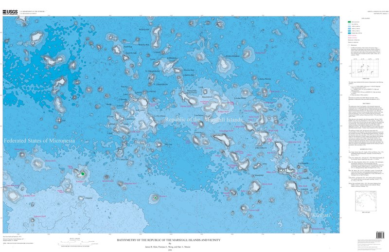
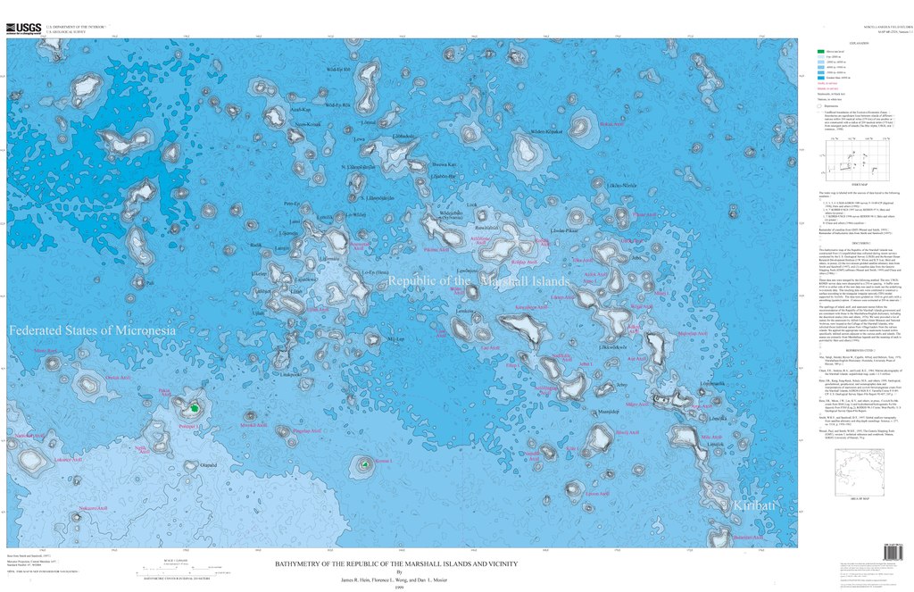
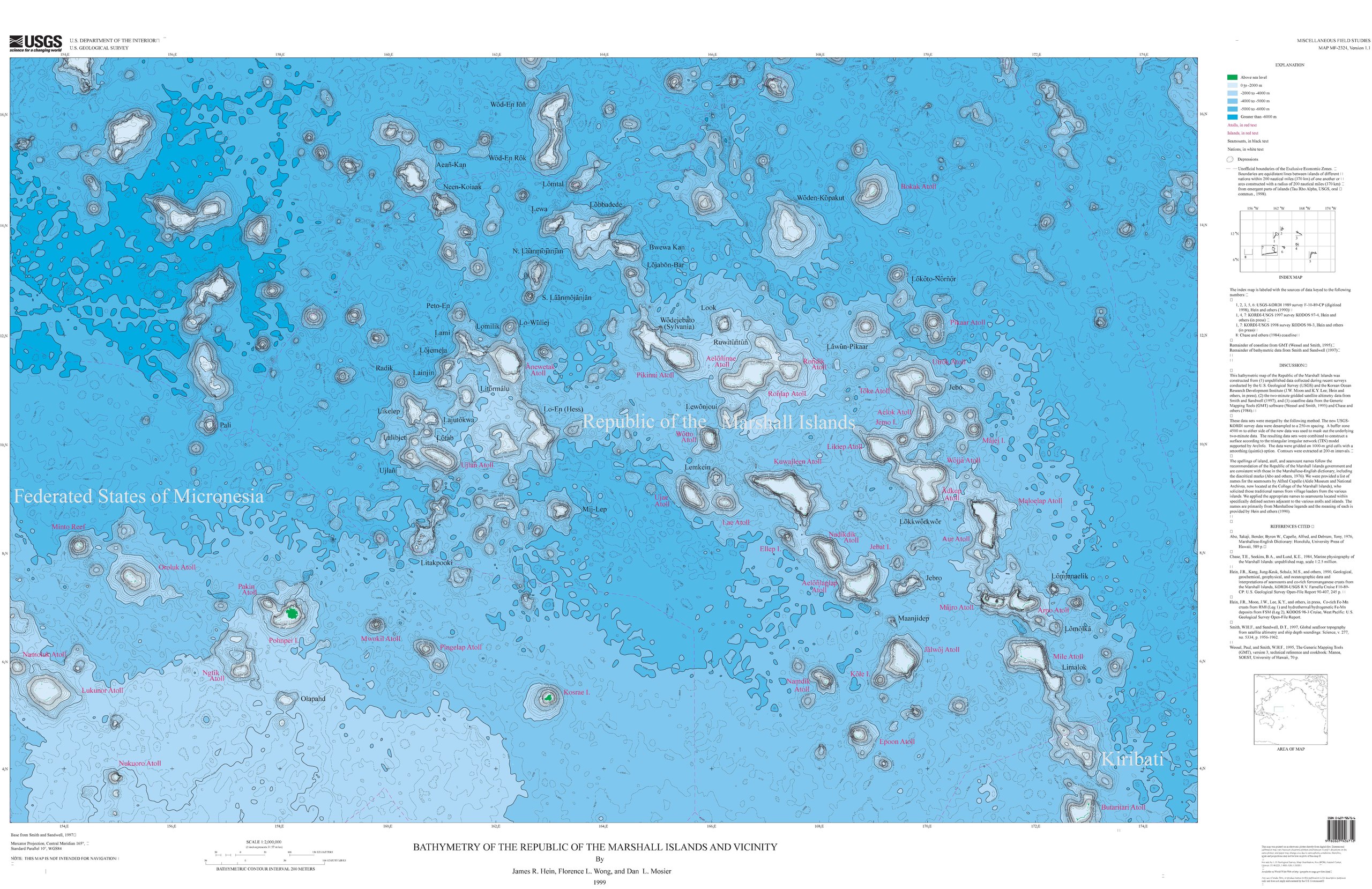
Français : Carte bathymétrique des monts sous-marins et des îles de Micronésie et des Îles Marshall. |
| Date | |
| Source | https://ngmdb.usgs.gov/Prodesc/proddesc_33349.htm |
| Auteur | James R. Hein, Florence L. Wong, Dan L. Mosier |
Conditions d’utilisation
Cette image est placée dans le domaine public parce qu'elle contient des éléments issus de l'United States Geological Survey, une agence du Département de l'Intérieur des États-Unis. Pour plus d'information, consultez la politique officielle de copyright de l'USGS (en anglais)
|
Historique du fichier
Cliquer sur une date et heure pour voir le fichier tel qu'il était à ce moment-là.
| Date et heure | Vignette | Dimensions | Utilisateur | Commentaire | |
|---|---|---|---|---|---|
| actuel | 17 septembre 2019 à 21:56 |  | 8 231 × 5 331 (16,49 Mio) | Sémhur | == {{int:filedesc}} == {{Information |Description = A bathymetric map of seamounts and islands in Micronesia and the Marshall Islands |Source = https://ngmdb.usgs.gov/Prodesc/proddesc_33349.htm |Date = 1999 |Author = James R. Hein, Florence L. Wong, Dan L. Mosier }} == {{int:license-header}} == {{PD-USGov-USGS}} Category:Geography of the Marshall Islands Category:Geography of the Federated States of Micronesia |
Utilisation du fichier
La page suivante utilise ce fichier :
Usage global du fichier
Les autres wikis suivants utilisent ce fichier :
- Utilisation sur de.wikipedia.org
- Utilisation sur en.wikipedia.org
- Utilisation sur ru.wikipedia.org