
Fichier:Greater Manchester County (3).png
Taille de cet aperçu : 800 × 582 pixels. Autres résolutions : 320 × 233 pixels | 640 × 466 pixels | 1 024 × 745 pixels | 1 280 × 931 pixels | 2 560 × 1 862 pixels | 3 358 × 2 443 pixels.
Fichier d’origine (3 358 × 2 443 pixels, taille du fichier : 713 kio, type MIME : image/png)
Ce fichier et sa description proviennent de Wikimedia Commons.
.png?uselang=fr)
Description
| Description |
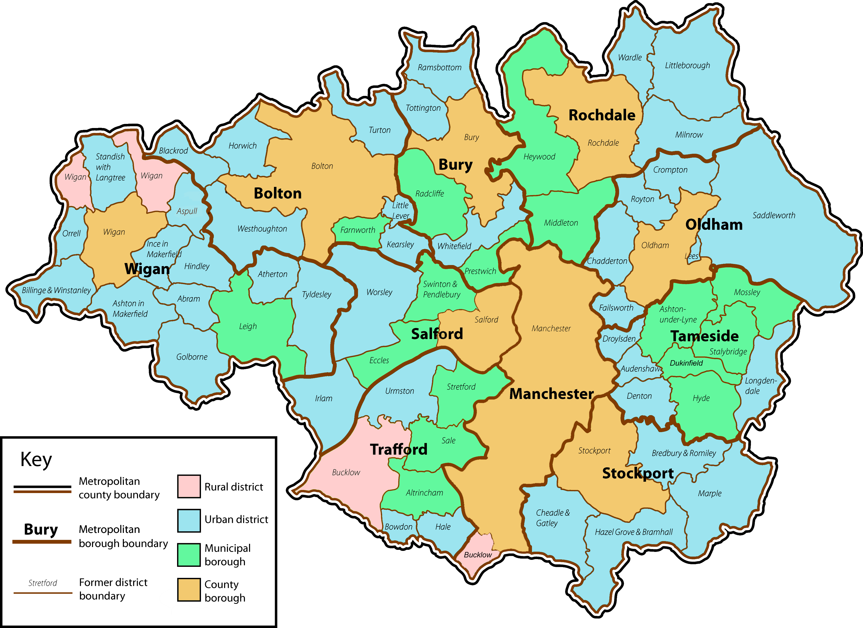
English: A map of the metropolitan county of Greater Manchester with the status of the former local government districts which now lie within its county boundaries. |
| Date | |
| Source | Own work by uploader. Content is verified at Her Majesty's Stationery Office (1974) Local Government in England and Wales: A Guide to the New System, Londres : HMSO ISBN : 0117508470. |
| Auteur | Jhamez84 |
| Autres versions |
 .png) |
Conditions d’utilisation
| Moi, propriétaire des droits d’auteur sur cette œuvre, la place dans le domaine public. Ceci s'applique dans le monde entier. Dans certains pays, ceci peut ne pas être possible ; dans ce cas : J’accorde à toute personne le droit d’utiliser cette œuvre dans n’importe quel but, sans aucune condition, sauf celles requises par la loi. |
Historique du fichier
Cliquer sur une date et heure pour voir le fichier tel qu'il était à ce moment-là.
| Date et heure | Vignette | Dimensions | Utilisateur | Commentaire | |
|---|---|---|---|---|---|
| actuel | 14 janvier 2009 à 04:12 | | 3 358 × 2 443 (713 kio) | Jza84 | fix Bucklow, Dukinfield and colour of Manchester and Salford. |
| 2 juillet 2008 à 15:20 |  | 3 358 × 2 443 (711 kio) | Jza84 | minor cosmetic amendments | |
| 2 juillet 2008 à 02:22 |  | 3 358 × 2 443 (715 kio) | Jza84 | fix key | |
| 2 juillet 2008 à 02:04 |  | 3 358 × 2 443 (715 kio) | Jza84 | {{Information |Description={{en|1=A map of the metropolitan county of Greater Manchester with the status of the former local government districts which now lie within its county boundaries.}} |Source=Own work by uploader |Author=Jhamez84 |
Utilisation du fichier
Les 2 pages suivantes utilisent ce fichier :
Usage global du fichier
Les autres wikis suivants utilisent ce fichier :
- Utilisation sur ast.wikipedia.org
- Utilisation sur bn.wikipedia.org
- Utilisation sur dag.wikipedia.org
- Utilisation sur en.wikipedia.org
- Greater Manchester
- Greater Manchester County Council
- Civil parishes in Greater Manchester
- Longendale Urban District
- User:Jza84
- Wikipedia talk:WikiProject Greater Manchester/Archive 16
- User:Skinsmoke/Sandbox/Civil parishes/Greater Manchester
- Wikipedia:Graphics Lab/Map workshop/Archive/Dec 2010
- Grade I listed buildings in Greater Manchester
- Utilisation sur es.wikipedia.org
- Utilisation sur fa.wikipedia.org
- Utilisation sur he.wikipedia.org
- Utilisation sur it.wikipedia.org
- Utilisation sur ru.wikipedia.org
- Utilisation sur zh.wikipedia.org
.png)