
Fichier:Zayyanids1300-1500.png

Taille de cet aperçu : 800 × 490 pixels. Autres résolutions : 320 × 196 pixels | 640 × 392 pixels | 858 × 526 pixels.
Fichier d’origine (858 × 526 pixels, taille du fichier : 18 kio, type MIME : image/png)
Ce fichier et sa description proviennent de Wikimedia Commons.
Description
| Description |
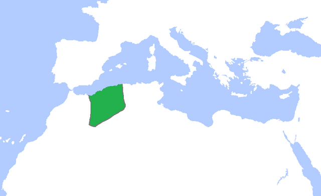
English: Locator map of the lands ruled by the Zayyanid/Abdalwadid dynasty, c. 1300-1500.
(Partially based on Atlas of World History (2007) - The World 1200-1300, 1300-1400, 1400-1500 map) |
| Date | |
| Source | Travail personnel |
| Auteur | Gabagool |
Conditions d’utilisation
Moi, en tant que détenteur des droits d’auteur sur cette œuvre, je la publie sous la licence suivante :
Ce fichier est disponible selon les termes de la licence Creative Commons Attribution 3.0 Non transposée.
- Vous êtes libre :
- de partager – de copier, distribuer et transmettre cette œuvre
- d’adapter – de modifier cette œuvre
- Sous les conditions suivantes :
- paternité – Vous devez donner les informations appropriées concernant l'auteur, fournir un lien vers la licence et indiquer si des modifications ont été faites. Vous pouvez faire cela par tout moyen raisonnable, mais en aucune façon suggérant que l’auteur vous soutient ou approuve l’utilisation que vous en faites.
Historique du fichier
Cliquer sur une date et heure pour voir le fichier tel qu'il était à ce moment-là.
| Date et heure | Vignette | Dimensions | Utilisateur | Commentaire | |
|---|---|---|---|---|---|
| actuel | 7 novembre 2022 à 02:24 | | 858 × 526 (18 kio) | Mouath14 | Editor claims this is a fixed version, no where does it indicate this map is wrong. please refrain from making further changes to this map. |
| 27 octobre 2022 à 23:23 |  | 2 417 × 1 674 (136 kio) | Takiva | fix | |
| 24 mai 2009 à 17:14 |  | 858 × 526 (18 kio) | Gabagool | cropped | |
| 8 mai 2009 à 17:55 |  | 1 481 × 902 (46 kio) | Gabagool | {{Information |Description={{en|1=Locator map of the lands ruled by the Zayyanid/Abdalwadid dynasty, c. 1300-1500. (Partially based on ''Atlas of World History'' (2007) - The World 1200-1300, 1300-1400, 1400-1500 map)}} |Source=Own work by uploader |Aut |
Utilisation du fichier
La page suivante utilise ce fichier :
Usage global du fichier
Les autres wikis suivants utilisent ce fichier :
- Utilisation sur ar.wikipedia.org
- Utilisation sur de.wikipedia.org
- Utilisation sur en.wikipedia.org
- Utilisation sur eu.wikipedia.org
- Utilisation sur ja.wikipedia.org
- Utilisation sur oc.wikipedia.org
- Utilisation sur pt.wikipedia.org
- Utilisation sur ru.wikipedia.org
- Utilisation sur sk.wikipedia.org
- Utilisation sur sl.wikipedia.org
- Utilisation sur tr.wikipedia.org
- Utilisation sur uk.wikipedia.org
- Utilisation sur www.wikidata.org