
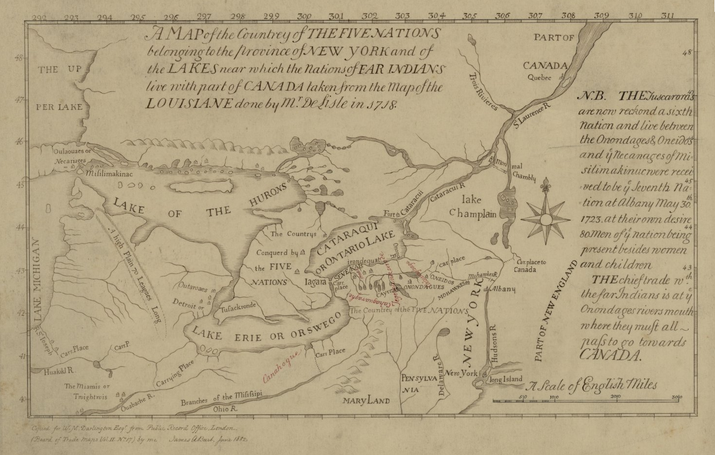
Fichier:Map of the Country of the Five Nations belonging to the province of New York and of the Lakes near which the Nations of Far Indians live with part of Canada taken from the Map of the Louisiane done 1730.png
Taille de cet aperçu : 800 × 510 pixels. Autres résolutions : 320 × 204 pixels | 640 × 408 pixels | 1 024 × 653 pixels | 1 451 × 925 pixels.
Fichier d’origine (1 451 × 925 pixels, taille du fichier : 1,52 Mio, type MIME : image/png)
Ce fichier et sa description proviennent de Wikimedia Commons.
Description
| Description |
English: This is a map of the Five Nations that is part of the Darlington map collection housed in the Archives Service Center, University Library System, University of Pittsburgh, Pittsburgh Pittsburgh, PA US |
| Date | |
| Source | The Darlington Collection |
| Auteur | Auteur inconnu |
Conditions d’utilisation
|
Ceci est une reproduction photographique fidèle d'une œuvre d'art originale en deux dimensions. L'œuvre d'art elle-même est dans le domaine public pour la raison suivante :
La position officielle de la Fondation Wikimedia est que « les représentations fidèles des œuvres d'art du domaine public en deux dimensions sont dans le domaine public et les exigences contraires sont une attaque contre le concept même de domaine public ». Pour plus de détails, voir Commons:Quand utiliser le bandeau PD-Art.
Cette reproduction photographique est donc également considérée comme étant élevée dans le domaine public. Merci de noter qu'en fonction des lois locales, la réutilisation de ce contenu peut être interdite ou restreinte dans votre juridiction. Voyez Commons:Reuse of PD-Art photographs. | ||||
Historique du fichier
Cliquer sur une date et heure pour voir le fichier tel qu'il était à ce moment-là.
| Date et heure | Vignette | Dimensions | Utilisateur | Commentaire | |
|---|---|---|---|---|---|
| actuel | 16 juin 2021 à 17:40 | | 1 451 × 925 (1,52 Mio) | Psiĥedelisto | (Slightly) higher quality version from same source. |
| 29 août 2020 à 14:26 |  | 936 × 585 (705 kio) | User-duck | Cropped narrower using CropTool with precise mode. | |
| 13 juin 2017 à 00:17 |  | 980 × 593 (799 kio) | Barbara (WVS) | User created page with UploadWizard |
Utilisation du fichier
Les 2 pages suivantes utilisent ce fichier :
Usage global du fichier
Les autres wikis suivants utilisent ce fichier :
- Utilisation sur azb.wikipedia.org
- Utilisation sur en.wikipedia.org
- Utilisation sur en.wikisource.org
- Utilisation sur es.wikipedia.org
- Utilisation sur pt.wikipedia.org
- Utilisation sur ro.wikipedia.org
- Utilisation sur vi.wikipedia.org
- Utilisation sur www.wikidata.org