
Fichier:Jahreszeiten Jahresringe.jpg
Taille de cet aperçu : 600 × 600 pixels. Autres résolutions : 240 × 240 pixels | 480 × 480 pixels | 768 × 768 pixels | 1 024 × 1 024 pixels | 2 497 × 2 497 pixels.
Fichier d’origine (2 497 × 2 497 pixels, taille du fichier : 3,4 Mio, type MIME : image/jpeg)
Ce fichier et sa description proviennent de Wikimedia Commons.
Description
| Description |
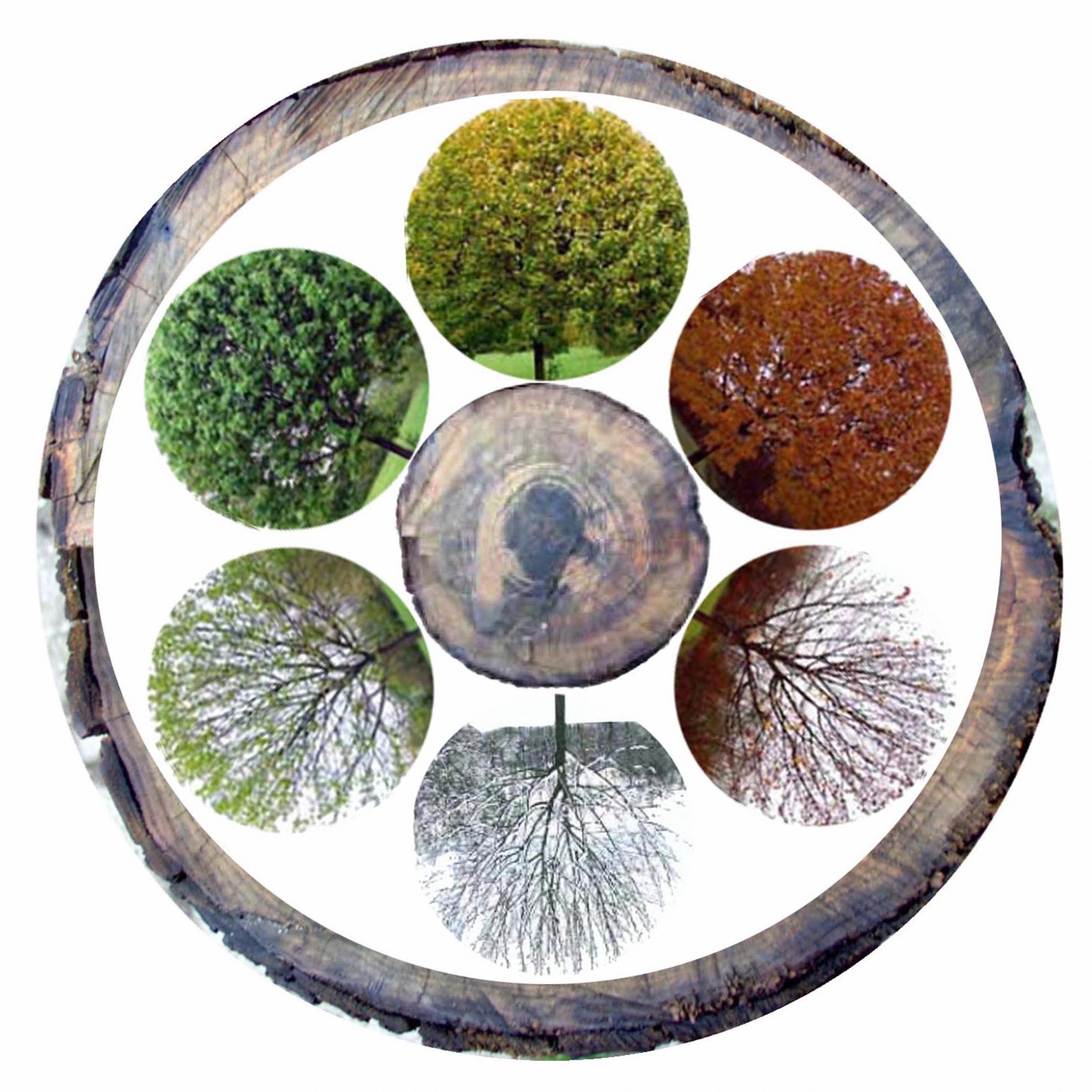
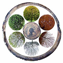
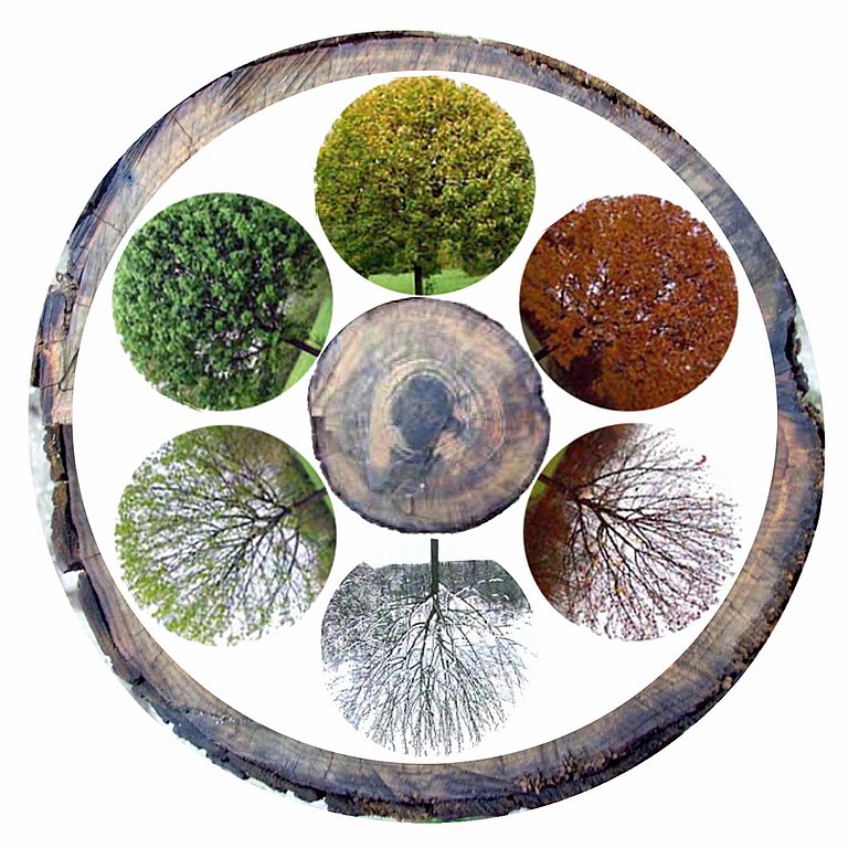
English: Seasons /Annual rings The six ecological seasons. From bottom, clockwise: prevernal, vernal, estival, serotinal, autumnal, hibernal Deutsch: Jahreszeiten / Jahresring |
| Date | |
| Source | Travail personnel |
| Auteur | Meinolf Wewel |
Conditions d’utilisation
Moi, en tant que détenteur des droits d’auteur sur cette œuvre, je la publie sous la licence suivante :
Ce fichier est disponible selon les termes de la licence Creative Commons Attribution 3.0 Non transposée.
- Vous êtes libre :
- de partager – de copier, distribuer et transmettre cette œuvre
- d’adapter – de modifier cette œuvre
- Sous les conditions suivantes :
- paternité – Vous devez donner les informations appropriées concernant l'auteur, fournir un lien vers la licence et indiquer si des modifications ont été faites. Vous pouvez faire cela par tout moyen raisonnable, mais en aucune façon suggérant que l’auteur vous soutient ou approuve l’utilisation que vous en faites.
| Annotations | Cette image est annotée : Voir les annotations sur Wikimedia Commons |
Historique du fichier
Cliquer sur une date et heure pour voir le fichier tel qu'il était à ce moment-là.
| Date et heure | Vignette | Dimensions | Utilisateur | Commentaire | |
|---|---|---|---|---|---|
| actuel | 6 mai 2018 à 03:00 | | 2 497 × 2 497 (3,4 Mio) | Hohum | Cropped |
| 12 octobre 2012 à 20:55 |  | 2 953 × 2 953 (4,17 Mio) | Meinolf Wewel | {{Information |Description ={{en|1=Seasons /Annual rings}} {{de|1=Jahreszeiten / Jahresring}} |Source ={{own}} |Author =Meinolf Wewel |Date =19.03.2006 |Permission = |other_versions = }} [[Catego... |
Utilisation du fichier
La page suivante utilise ce fichier :
Usage global du fichier
Les autres wikis suivants utilisent ce fichier :
- Utilisation sur af.wikipedia.org
- Utilisation sur ar.wikipedia.org
- Utilisation sur ast.wikipedia.org
- Utilisation sur bh.wikipedia.org
- Utilisation sur br.wikipedia.org
- Utilisation sur cs.wikipedia.org
- Utilisation sur da.wikipedia.org
- Utilisation sur de.wikipedia.org
- Utilisation sur dty.wikipedia.org
- Utilisation sur en.wikipedia.org
- Aridity
- World Climate Programme
- Surface Ocean Lower Atmosphere Study
- Mesothermal
- Megathermal
- Interdecadal Pacific oscillation
- Polar High
- Icelandic Low
- EdGCM
- International Programme for Antarctic Buoys
- Pluvial
- Moisture recycling
- Transient climate simulation
- Salt storm
- MIT General Circulation Model
- Land surface models (climate)
- Canadian Land Surface Scheme
- Baseline Surface Radiation Network
- Intermediate General Circulation Model
- Okhotsk High
- VAMOS Ocean-Cloud-Atmosphere-Land Study
- Pacific–North American teleconnection pattern
- Global Land Project
- Tundra climate
- Maritime Continent
- Norwegian-U.S. Scientific Traverse of East Antarctica
- South Pacific High
- Spatial Synoptic Classification system
- GrADS
- Regional climate levels in viticulture
- HadGEM1
- South Atlantic Convergence Zone
- Season
- Climograph
- GO-ESSP
- North Pacific High
- North Pacific Oscillation
- Tropical Warm Pool
- Model year (computer modeling)
- Colorado low
Voir davantage sur l’utilisation globale de ce fichier.