
Fichier:1864 Mitchell Map of Baltimore, Maryland - Geographicus - Baltimore-mitchell-1864.jpg

Taille de cet aperçu : 700 × 600 pixels. Autres résolutions : 280 × 240 pixels | 560 × 480 pixels | 896 × 768 pixels | 1 195 × 1 024 pixels | 2 389 × 2 048 pixels | 3 458 × 2 964 pixels.
Fichier d’origine (3 458 × 2 964 pixels, taille du fichier : 2,14 Mio, type MIME : image/jpeg)
Ce fichier et sa description proviennent de Wikimedia Commons.
| Samuel Augustus Mitchell : Plan of Baltimore.
( |
||||||||||||||||||||
|---|---|---|---|---|---|---|---|---|---|---|---|---|---|---|---|---|---|---|---|---|
| Artiste |
|
|||||||||||||||||||
| Titre |
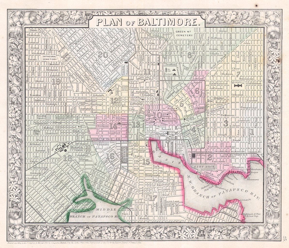
Plan of Baltimore. |
|||||||||||||||||||
| Description |
English: A beautiful example of S. A. Mitchell Jr.’s 1864 map Baltimore, Maryland. Offers wonderful detail at the street level including references to the important buildings, trains, canals, and roads. Colored coded with pastels according to city wards. Surrounded by the attractive floral border common to Mitchell atlases between 1860 and 1865. One of the more attractive atlas maps of Baltimore to appear in the mid 19th century. Prepared by S. A Mitchell Jr. for inclusion as plate 25 in the 1864 issue of Mitchell’s New General Atlas . Dated and copyrighted, “Entered according to Act of Congress in the Year 1860 by S. Augustus Mitchell Jr. in the Clerk’s Office of the District Court of the U.S. for the Eastern District of Pennsylvania. |
|||||||||||||||||||
| Date | 1860 (dated) | |||||||||||||||||||
| Dimensions | hauteur : 9,5 pouces (24,1 cm) ; largeur : 11 pouces (27,9 cm) | |||||||||||||||||||
| Numéro d’inventaire |
liens Geographicus : Baltimore-mitchell-1864 |
|||||||||||||||||||
| Source / photographe |
Mitchell's New General Atlas, containing Maps of the Various Countries of the World, Plans of Cities, Etc., Embraced in Fifty-three Quarto Maps, forming a series of Eighty-Four Map and Plans, together with Valuable Statistical Tables. (1864 Edition)
|
|||||||||||||||||||
| Autorisation (Réutilisation de ce fichier) |
|
|||||||||||||||||||
Historique du fichier
Cliquer sur une date et heure pour voir le fichier tel qu'il était à ce moment-là.
| Date et heure | Vignette | Dimensions | Utilisateur | Commentaire | |
|---|---|---|---|---|---|
| actuel | 16 mars 2011 à 15:26 | | 3 458 × 2 964 (2,14 Mio) | BotMultichill | {{subst:User:Multichill/Geographicus |link=http://www.geographicus.com/P/AntiqueMap/Baltimore-mitchell-1864 |product_name=1864 Mitchell Map of Baltimore, Maryland |map_title=Plan of Baltimore. |description=A beautiful example of S. A. Mitchell Jr.’s 186 |
Utilisation du fichier
La page suivante utilise ce fichier :
Usage global du fichier
Les autres wikis suivants utilisent ce fichier :
- Utilisation sur en.wikipedia.org