
Fichier:Syna Most sur la carte de Brüx.jpg
Taille de cet aperçu : 448 × 599 pixels. Autres résolutions : 179 × 240 pixels | 604 × 808 pixels.
Fichier d’origine (604 × 808 pixels, taille du fichier : 573 kio, type MIME : image/jpeg)
Ce fichier et sa description proviennent de Wikimedia Commons.
Description
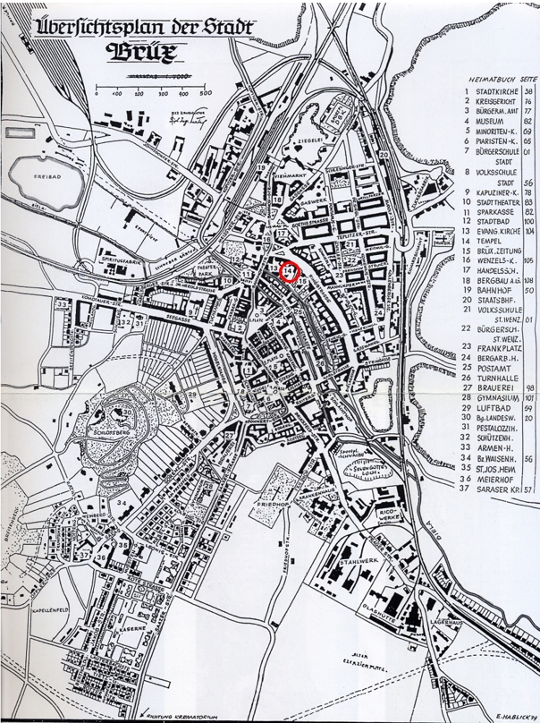
| Description | Map of Brüx (Most) in Czech Republic before WWI with mention of the location of the synagogue |
| Date | before WWI |
| Source | map |
| Auteur | Auteur inconnu |
Conditions d’utilisation
|
Cette œuvre est également dans le domaine public dans tous les pays pour lesquels le droit d’auteur a une durée de vie de 70 ans ou moins après la mort de l’auteur. Cette œuvre est dans le domaine public aux États-Unis car elle a été publiée avant le 1er janvier 1929. | |
| Ce fichier a été identifié comme étant exempt de restrictions connues liées au droit d’auteur, y compris tous les droits connexes et voisins. | |
Historique du fichier
Cliquer sur une date et heure pour voir le fichier tel qu'il était à ce moment-là.
| Date et heure | Vignette | Dimensions | Utilisateur | Commentaire | |
|---|---|---|---|---|---|
| actuel | 29 novembre 2023 à 15:53 | | 604 × 808 (573 kio) | FLLL | {{Information |Description= Map of Brüx (Most) in Czech Republic before WWI with mention of the location of the synagogue |Source= map |Date= before WWI |Author= unknown |Permission= |other_versions= }} Category:Synagogue in Most Category:Maps of Most |
Utilisation du fichier
La page suivante utilise ce fichier :