
Fichier:Capt John Smith's map of Virginia 1624.jpg

Fichier d’origine (2 520 × 1 944 pixels, taille du fichier : 1,02 Mio, type MIME : image/jpeg)
Ce fichier et sa description proviennent de Wikimedia Commons.
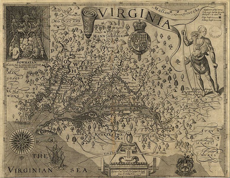
Description
| Titre |
A Map of Virginia: With a Description of the Countrey, the Commodities, People, Government and Religion |
|||||||||
| Légende de la carte |
Discovered and discribed by Captaijn John Smith 1606. Graven by William Hole. |
|||||||||
| Date |
|
|||||||||
| Source | ||||||||||
| Créé par |
William Hole (engraver, d. 1624) |
|||||||||
| Autorisation (Réutilisation de ce fichier) |
|
|||||||||
| Données géotemporelles | ||||||||||
| Date représentée |
|
|||||||||
| Lieu |
Virginia, United States |
|||||||||
| Type de carte |
Historical map |
|||||||||
| Rectangle englobant |
|
|||||||||
| Géoréférencement | ||||||||||
| Données bibliographiques | ||||||||||
| Publication |
A Map of Virginia: With a Description of the Countrey, the Commodities, People, Government and Religion |
|||||||||
| Auteur |
Captain John Smith |
|||||||||
| Langue |
English |
|||||||||
| Lieu de publication |
Oxford |
|||||||||
| Éditeur de publication |
Joseph Barnes |
|||||||||
| Données d'archives | ||||||||||
| Dimensions | hauteur : 32 cm ; largeur : 41 cm | |||||||||
| Technique / matériaux | gravure sur papier | |||||||||
Conditions d’utilisation
|
Cette œuvre est également dans le domaine public dans tous les pays pour lesquels le droit d’auteur a une durée de vie de 100 ans ou moins après la mort de l’auteur. | |
| Ce fichier a été identifié comme étant exempt de restrictions connues liées au droit d’auteur, y compris tous les droits connexes et voisins. | |
Historique du fichier
Cliquer sur une date et heure pour voir le fichier tel qu'il était à ce moment-là.
| Date et heure | Vignette | Dimensions | Utilisateur | Commentaire | |
|---|---|---|---|---|---|
| actuel | 20 juin 2011 à 02:24 | | 2 520 × 1 944 (1,02 Mio) | Frank Schulenburg | Source: http://www.virtualjamestown.org/maps1.html |
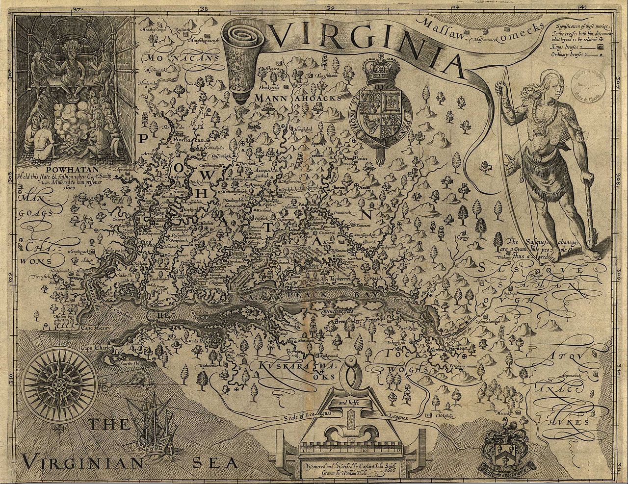
| 16 juin 2010 à 22:03 |  | 1 000 × 849 (242 kio) | MarmadukePercy | {{Information |Description={{en|1=John Smith's map of Virginia from "The Generall Historie of Virginia, New-England, and the Summer Isles," published in London, 1624. Courtesy of University of North Carolina Libraries.}} |Source=http://www.learnnc.org/lp/ |
Utilisation du fichier
Les 2 pages suivantes utilisent ce fichier :
Usage global du fichier
Les autres wikis suivants utilisent ce fichier :
- Utilisation sur en.wikipedia.org
- Utilisation sur fy.wikipedia.org
- Utilisation sur he.wikipedia.org
- Utilisation sur hy.wikipedia.org
- Utilisation sur incubator.wikimedia.org
- Utilisation sur it.wikipedia.org
- Utilisation sur la.wikipedia.org