
Fichier:C73189s1 Ant.Map Coulman Island.jpg

Taille de cet aperçu : 740 × 599 pixels. Autres résolutions : 296 × 240 pixels | 593 × 480 pixels | 948 × 768 pixels | 1 264 × 1 024 pixels | 2 529 × 2 048 pixels | 4 005 × 3 244 pixels.
Fichier d’origine (4 005 × 3 244 pixels, taille du fichier : 1,75 Mio, type MIME : image/jpeg)
Ce fichier et sa description proviennent de Wikimedia Commons.
Description
| Description |
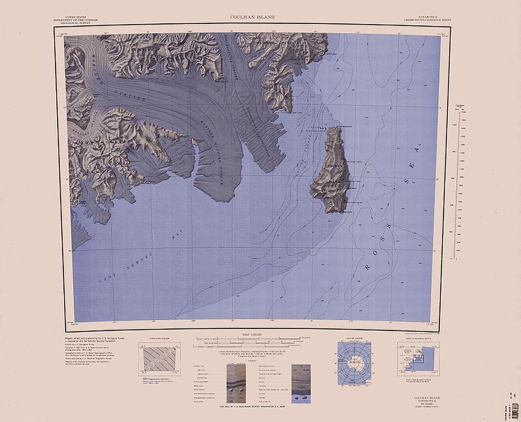
English: 1:250,000-scale topographic reconnaissance map of the Coulman Island area from 166°30'-171°E to 73°-74°S in Antarctica, including Mariner and Borchgrevink Glaciers. Mapped, edited and published by the U.S. Geological Survey in cooperation with the National Science Foundation. |
|||
| Date | ||||
| Source | http://usarc.usgs.gov/drg_dload.shtml | |||
| Auteur | United States Geological Survey | |||
| Autorisation (Réutilisation de ce fichier) |
|
Historique du fichier
Cliquer sur une date et heure pour voir le fichier tel qu'il était à ce moment-là.
| Date et heure | Vignette | Dimensions | Utilisateur | Commentaire | |
|---|---|---|---|---|---|
| actuel | 3 avril 2005 à 19:55 | | 4 005 × 3 244 (1,75 Mio) | Achim Raschka | Map of Antarctica by the United States Antarctic Ressource Center of the US Geological Society. {{PD-US}} Copyrights and Trademarks USGS-authored or produced data and information are in the public domain. While the content of most USGS web pages is in th |
Utilisation du fichier
Les 2 pages suivantes utilisent ce fichier :
Usage global du fichier
Les autres wikis suivants utilisent ce fichier :
- Utilisation sur bg.wikipedia.org
- Utilisation sur ceb.wikipedia.org
- Utilisation sur de.wikipedia.org
- Utilisation sur en.wikipedia.org
- Utilisation sur he.wikipedia.org
- Utilisation sur it.wikipedia.org
- Utilisation sur ja.wikipedia.org
- Utilisation sur nds.wikipedia.org
- Utilisation sur nn.wikipedia.org
- Utilisation sur no.wikipedia.org
- Utilisation sur th.wikipedia.org
- Utilisation sur www.wikidata.org
- Utilisation sur zh.wikipedia.org
Voir davantage sur l’utilisation globale de ce fichier.