
Fichier:TXMap-doton-Laredo.PNG
Pas de plus haute résolution disponible.
TXMap-doton-Laredo.PNG (300 × 284 pixels, taille du fichier : 16 kio, type MIME : image/png)
Ce fichier et sa description proviennent de Wikimedia Commons.
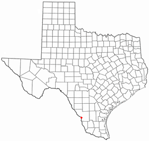
Locator maps U.S. cities derived from PD state maps by different users from en.wikipedia.
the filename has sometimes been adapted to the general syntax

|
Vous avez la permission de copier, distribuer et modifier ce document selon les termes de la GNU Free Documentation License version 1.2 ou toute version ultérieure publiée par la Free Software Foundation, sans sections inaltérables, sans texte de première page de couverture et sans texte de dernière page de couverture. Un exemplaire de la licence est inclus dans la section intitulée GNU Free Documentation License. |
| Ce fichier est disponible selon les termes de la licence Creative Commons Attribution – Partage dans les Mêmes Conditions 3.0 (non transposée). | ||
| ||
| Ce bandeau de licence a été ajouté à ce fichier dans le cadre de la procédure de mise à jour des licences des images sous GFDL. |
Historique du fichier
Cliquer sur une date et heure pour voir le fichier tel qu'il était à ce moment-là.
| Date et heure | Vignette | Dimensions | Utilisateur | Commentaire | |
|---|---|---|---|---|---|
| actuel | 29 juillet 2007 à 13:29 | | 300 × 284 (16 kio) | Ö | Reverted to earlier revision |
| 29 juillet 2007 à 00:08 |  | 630 × 594 (92 kio) | AMAPO | {{Information |Description=Texas County Map showing Laredo, Texas Location |Source=Modified from http://es.wikipedia.org/wiki/Imagen:Texas_map_-_Dallas_County.svg |Date=July 2007 |Author=drumguy8800 / AMAPO |Permission=GNU Free |other_versions=http://es.w | |
| 10 février 2006 à 23:54 |  | 300 × 284 (16 kio) | Michiel1972 | Locator maps U.S. cities derived from PD state maps by different users from en.wikipedia. <small>the filename has sometimes been adapted to the general syntax</small> {{GFDL}} category:Location maps of U.S. cities |
Utilisation du fichier
Aucune page n’utilise ce fichier.
Usage global du fichier
Les autres wikis suivants utilisent ce fichier :
- Utilisation sur da.wikipedia.org
- Utilisation sur fa.wikipedia.org
- Utilisation sur id.wikipedia.org
- Utilisation sur no.wikipedia.org
- Utilisation sur sv.wikipedia.org