
Fichier:OxfordshireSouth.png
Pas de plus haute résolution disponible.
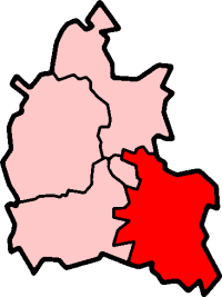
OxfordshireSouth.png (200 × 267 pixels, taille du fichier : 16 kio, type MIME : image/png)
Ce fichier et sa description proviennent de Wikimedia Commons.
South Oxfordshire in Oxfordshire
Created by en:User:Morwen

|
Vous avez la permission de copier, distribuer et modifier ce document selon les termes de la GNU Free Documentation License version 1.2 ou toute version ultérieure publiée par la Free Software Foundation, sans sections inaltérables, sans texte de première page de couverture et sans texte de dernière page de couverture. Un exemplaire de la licence est inclus dans la section intitulée GNU Free Documentation License. |
| Ce fichier est disponible selon les termes de la licence Creative Commons Attribution – Partage dans les Mêmes Conditions 3.0 (non transposée). | ||
| ||
| Ce bandeau de licence a été ajouté à ce fichier dans le cadre de la procédure de mise à jour des licences des images sous GFDL. |
Historique du fichier
Cliquer sur une date et heure pour voir le fichier tel qu'il était à ce moment-là.
| Date et heure | Vignette | Dimensions | Utilisateur | Commentaire | |
|---|---|---|---|---|---|
| actuel | 30 juillet 2005 à 01:25 | | 200 × 267 (16 kio) | Cnyborg | South Oxfordshire i Oxfordshire, England. From en:Image:OxfordshireSouth.png by en:User:Morwen {{GFDL-en}} |
Utilisation du fichier
Aucune page n’utilise ce fichier.
Usage global du fichier
Les autres wikis suivants utilisent ce fichier :
- Utilisation sur de.wikipedia.org
- Utilisation sur en.wikipedia.org
- Henley-on-Thames
- Wallingford, Oxfordshire
- Garsington
- Didcot
- Thame
- Towersey
- South Oxfordshire
- Elsfield
- Dorchester on Thames
- Brightwell-cum-Sotwell
- Goring-on-Thames
- Shotover
- Whitchurch-on-Thames
- Culham
- Roke
- Wantage (UK Parliament constituency)
- Henley (UK Parliament constituency)
- Shiplake
- Nettlebed
- Crowmarsh Gifford
- Benson, Oxfordshire
- Sonning Eye
- Cholsey
- Waterstock
- Ewelme
- Berrick Salome
- Adwell
- Watlington, Oxfordshire
- Wheatley, Oxfordshire
- South Stoke, Oxfordshire
- Great Milton
- Clifton Hampden
- Chinnor
- Pishill
- Aston Tirrold
- Aston Upthorpe
- Aston Rowant
- Beckley and Stowood
- Berinsfield
- Binfield Heath
- Bix and Assendon
- Henley Rural District
- Rotherfield Greys
- Waterperry
- Playhatch
- Dunsden Green
- Sandford-on-Thames
- Bullingdon Rural District
- Culham Rural District
Voir davantage sur l’utilisation globale de ce fichier.