
Fichier:Map of USA highlighting Corn Belt.png
Pas de plus haute résolution disponible.
Map_of_USA_highlighting_Corn_Belt.png (280 × 183 pixels, taille du fichier : 41 kio, type MIME : image/png)
Ce fichier et sa description proviennent de Wikimedia Commons.
Description
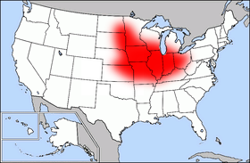
| Description | Public domain map courtesy of The General Libraries, The University of Texas at Austin, modified (by • Benc • 00:30, 13 Aug 2004 (UTC)) to highlight regions. |
| Date | 13 août 2004 (date de téléversement originale) |
| Source | Transféré de en.wikipedia à Commons. |
| Auteur | Benc sur Wikipédia anglais |
Conditions d’utilisation
| Cette œuvre a été placée dans le domaine public par son auteur, Benc sur Wikipédia anglais. Ceci s’applique dans le monde entier. Dans certains pays, ceci peut ne pas être possible ; dans ce cas : Benc accorde à toute personne le droit d’utiliser cette œuvre dans n’importe quel but, sans aucune condition, sauf celles requises par la loi. |
Journal des téléversements d’origine
La page de description originale était ici. Tous les noms d'utilisateur qui suivent se rapportent à en.wikipedia.
- 2004-08-13 00:29 Benc 280×183×8 (41627 bytes) PD map, modified by myself
Historique du fichier
Cliquer sur une date et heure pour voir le fichier tel qu'il était à ce moment-là.
| Date et heure | Vignette | Dimensions | Utilisateur | Commentaire | |
|---|---|---|---|---|---|
| actuel | 24 mars 2007 à 12:55 | | 280 × 183 (41 kio) | PDD | {{Information |Description=Public domain map courtesy of [http://www.lib.utexas.edu/ The General Libraries, The University of Texas at Austin], modified (by • Benc • 00:30, 13 Aug 2004 (UTC)) to highlight regio |
Utilisation du fichier
Aucune page n’utilise ce fichier.
Usage global du fichier
Les autres wikis suivants utilisent ce fichier :
- Utilisation sur ar.wikipedia.org
- Utilisation sur ast.wikipedia.org
- Utilisation sur ca.wikipedia.org
- Utilisation sur cs.wikipedia.org
- Utilisation sur de.wikipedia.org
- Utilisation sur eo.wikipedia.org
- Utilisation sur es.wikipedia.org
- Utilisation sur he.wikipedia.org
- Utilisation sur pl.wikipedia.org
- Utilisation sur pt.wikipedia.org
- Utilisation sur pt.wikibooks.org
- Utilisation sur www.wikidata.org