
Fichier:The River Moy at Foxford - geograph.org.uk - 486800.jpg
Pas de plus haute résolution disponible.
The_River_Moy_at_Foxford_-_geograph.org.uk_-_486800.jpg (640 × 396 pixels, taille du fichier : 104 kio, type MIME : image/jpeg)
Ce fichier et sa description proviennent de Wikimedia Commons.
Description
| Description |
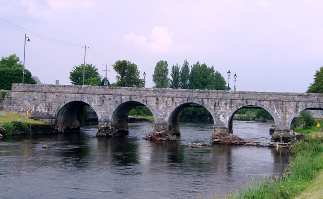
English: The River Moy at Foxford Marks on the pillars of the bridge show the height of the river water before the channel was deepened 40 years ago to alleviate flooding. The water used to cover the bank and path at the bottom right of the picture |
| Date | |
| Source | From geograph.org.uk |
| Auteur | Liz McCabe |
| Attribution (imposé par la licence) | Liz McCabe / The River Moy at Foxford / |
| Lieu de la prise de vue | | Voir cet endroit et d’autres images sur : OpenStreetMap |
|---|
_heading:0.00&language=fr)
| Position de l'objet | | Voir cet endroit et d’autres images sur : OpenStreetMap |
|---|
_heading:0.00&language=fr)
Conditions d’utilisation

|
Cette image provient de la collection du projet Geograph British Isles. Pour obtenir les coordonnées du photographe, veuillez consulter cette page de description de l'image sur le site du projet. Les droits d'auteurs sur cette image sont détenus par Liz McCabe ; l'image est placée sous une licence Creative Commons avec mention de paternité et partage à l'identique (CC-By-SA) en version 2.0.
|
Ce fichier est disponible selon les termes de la licence Creative Commons Attribution – Partage dans les Mêmes Conditions 2.0 Générique
Attribution: Liz McCabe
- Vous êtes libre :
- de partager – de copier, distribuer et transmettre cette œuvre
- d’adapter – de modifier cette œuvre
- Sous les conditions suivantes :
- paternité – Vous devez donner les informations appropriées concernant l'auteur, fournir un lien vers la licence et indiquer si des modifications ont été faites. Vous pouvez faire cela par tout moyen raisonnable, mais en aucune façon suggérant que l’auteur vous soutient ou approuve l’utilisation que vous en faites.
- partage à l’identique – Si vous modifiez, transformez, ou vous basez sur cette œuvre, vous devez distribuer votre contribution sous la même licence ou une licence compatible avec celle de l’original.
Historique du fichier
Cliquer sur une date et heure pour voir le fichier tel qu'il était à ce moment-là.
| Date et heure | Vignette | Dimensions | Utilisateur | Commentaire | |
|---|---|---|---|---|---|
| actuel | 5 février 2011 à 04:57 | | 640 × 396 (104 kio) | GeographBot | == {{int:filedesc}} == {{Information |description={{en|1=The River Moy at Foxford Marks on the pillars of the bridge show the height of the river water before the channel was deepened 40 years ago to alleviate flooding. The water used to cover the bank an |
Utilisation du fichier
La page suivante utilise ce fichier :
Usage global du fichier
Les autres wikis suivants utilisent ce fichier :
- Utilisation sur cs.wikipedia.org
- Utilisation sur en.wikipedia.org
- Utilisation sur fy.wikipedia.org
- Utilisation sur gl.wikipedia.org
- Utilisation sur uk.wikipedia.org