
Fichier:Ocean Beach San Francisco aerial view.jpg
Taille de cet aperçu : 800 × 533 pixels. Autres résolutions : 320 × 213 pixels | 640 × 426 pixels | 1 024 × 682 pixels | 1 500 × 999 pixels.
Fichier d’origine (1 500 × 999 pixels, taille du fichier : 787 kio, type MIME : image/jpeg)
Ce fichier et sa description proviennent de Wikimedia Commons.
| Description |
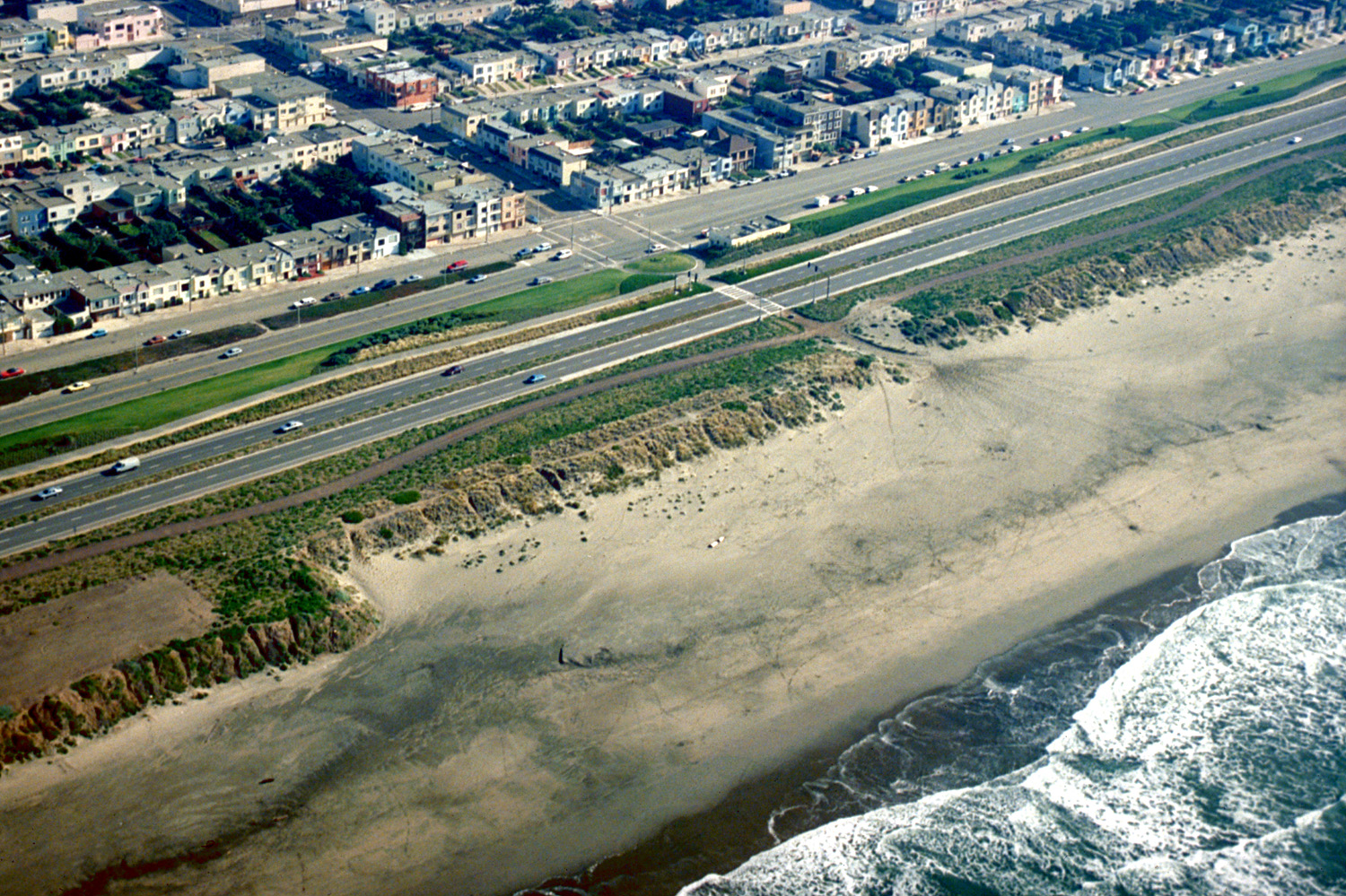
English: Aerial view of the Ocean Beach neighborhood on the Pacific Ocean in San Francisco, California, USA. This photograph appears to be centered on the intersection of Taraval Street and Great Highway. View is to the southeast.
Coordinates: 37°44′30.1″N 122°30′24.56″W / 37.741694°N 122.5068222°W |
|||
| Date | not specified or unknown | |||
| Source |
U.S. Army Corps of Engineers Digital Visual Library Image page Image description page Digital Visual Library home page |
|||
| Auteur | Robert Campbell, U.S. Army Corps of Engineers | |||
| Autorisation (Réutilisation de ce fichier) |
|
|||
| Lieu | San Francisco, California, USA |
Historique du fichier
Cliquer sur une date et heure pour voir le fichier tel qu'il était à ce moment-là.
| Date et heure | Vignette | Dimensions | Utilisateur | Commentaire | |
|---|---|---|---|---|---|
| actuel | 3 mai 2007 à 06:44 | | 1 500 × 999 (787 kio) | DanMS | {{Information | Description = {{en|Aerial view of the Ocean Beach neighborhood on the Pacific Ocean in San Francisco, California, USA. This photograph appears to be centered on the intersection of Taraval Street and Great Highway. View is to the southe |
Utilisation du fichier
La page suivante utilise ce fichier :
Usage global du fichier
Les autres wikis suivants utilisent ce fichier :
- Utilisation sur en.wikipedia.org
- Utilisation sur en.wikivoyage.org
- Utilisation sur es.wikipedia.org