
Fichier:Nunavut Kivalliq Region.png
Pas de plus haute résolution disponible.
Nunavut_Kivalliq_Region.png (320 × 425 pixels, taille du fichier : 11 kio, type MIME : image/png)
Ce fichier et sa description proviennent de Wikimedia Commons.
Description
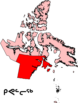
| Description | Map of Kivalliq Region in Nunavut, Canada |
| Date | |
| Source | English Wikipedia |
| Auteur | en:User:Keith Edkins |
| Autorisation (Réutilisation de ce fichier) |
GFDL content from English Wikipedia |
Conditions d’utilisation
| Ce fichier est disponible selon les termes de la licence Creative Commons Attribution – Partage dans les Mêmes Conditions 3.0 (non transposée). Sujet aux avertissements. | ||
| ||
| Ce bandeau de licence a été ajouté à ce fichier dans le cadre de la procédure de mise à jour des licences des images sous GFDL. |

|
Vous avez la permission de copier, distribuer et modifier ce document selon les termes de la GNU Free Documentation License version 1.2 ou toute version ultérieure publiée par la Free Software Foundation, sans sections inaltérables, sans texte de première page de couverture et sans texte de dernière page de couverture. Un exemplaire de la licence est inclus dans la section intitulée GNU Free Documentation License. Sujet aux avertissements. |
Historique du fichier
Cliquer sur une date et heure pour voir le fichier tel qu'il était à ce moment-là.
| Date et heure | Vignette | Dimensions | Utilisateur | Commentaire | |
|---|---|---|---|---|---|
| actuel | 16 août 2006 à 21:58 | | 320 × 425 (11 kio) | TeVe | {{Information |Description=Map of Kivalliq Region in Nunavut, Canada |Source=[http://en.wikipedia.org/wiki/Image:Nunavut_Kivalliq_Region.png English Wikipedia] |Date=2 August 2004 |Author=en:User:Keith Edkins |Permission=GFDL content from English Wik |
Utilisation du fichier
Les 2 pages suivantes utilisent ce fichier :
Usage global du fichier
Les autres wikis suivants utilisent ce fichier :
- Utilisation sur ar.wikipedia.org
- Utilisation sur ast.wikipedia.org
- Utilisation sur ca.wikipedia.org
- Utilisation sur de.wikipedia.org
- Utilisation sur en.wikipedia.org
- Kasba Lake
- Qikiqtaaluk (Foxe Basin)
- Nagjuttuuq
- Baker Lake (Nunavut)
- Wager Bay
- Aberdeen Lake (Nunavut)
- Keewatin Region
- Chesterfield Inlet
- Iqalugaarjuup Nunanga Territorial Park
- Cape Fullerton
- McConnell River Migratory Bird Sanctuary
- Beverly Lake (Nunavut)
- Yathkyed Lake
- Kaminak Lake
- Tavani, Nunavut
- Ferguson River (Nunavut)
- Comer Strait
- Frozen Strait
- Roes Welcome Sound
- Pitsiulartok
- Promise Island
- McConnell River
- Aiqqujat Islands
- Ascension Islands
- Inuujarvik Territorial Park
- Bell Peninsula
- Back Peninsula
- Mount Minto (Nunavut)
- Deer Island (Kivalliq Region)
- Boulder Island
- Centre Island (Nunavut)
- Camp Cove Island
- Iripajuk Island
- South Imilit Island
- North Imilit Island
- Moor Island
- Apqusiurniq Island
- Hanbury Island
- Rockhouse Island
- Akreavenek Island
- Pintail Island
- Reference Island
- South Midway Island
Voir davantage sur l’utilisation globale de ce fichier.