
Fichier:LocationRomanEmpire.png
Taille de cet aperçu : 800 × 520 pixels. Autres résolutions : 320 × 208 pixels | 640 × 416 pixels | 1 084 × 705 pixels.
Fichier d’origine (1 084 × 705 pixels, taille du fichier : 34 kio, type MIME : image/png)
Ce fichier et sa description proviennent de Wikimedia Commons.

|
Une version vectorielle de cette image existe, dans le format « SVG ». Si elle n’est pas inférieure, elle devrait être utilisée à la place de la présente version pour des affichages en plus grandes dimensions ou nécessitant une meilleure résolution.
File:LocationRomanEmpire.png → File:Map of the Roman Empire at its height.svg
Pour plus d’informations sur les images vectorielles, consultez la page de transition de Commons vers le format SVG. Voir aussi les informations à propos de la manière dont le logiciel MediaWiki gère les images au format SVG. |
 |
| Description |
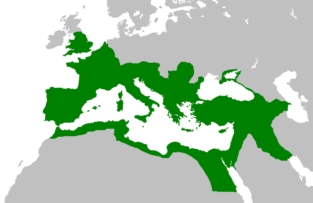
English: Map of the Roman Empire at its height, under Trajan.
Esperanto: Mapo de la Roma Imperio je ĝia plej vasta etendo, sub la imperiestro Trajano.
Español: El Imperio Romano a su máxima extensión, durante el reinado de Trajano.
Suomi: Rooman valtakunta Trajanuksen aikana.
Français : L'Empire romain à son apogée, sous Trajan.
Italiano: Mappa dell'Impero Romano al culmine della sua estensione, sotto Traiano.
日本語: 117年(トラヤヌス帝の時代)のローマ帝国の最大領土
Português: Localização do Império Romano em sua extensão máxima. |
||||||||
| Date | |||||||||
| Source | Previous version | ||||||||
| Auteur | User:Jrockley / User:Kasper Holl | ||||||||
| Autorisation (Réutilisation de ce fichier) |
|
||||||||
| Autres versions |
|

Historique du fichier
Cliquer sur une date et heure pour voir le fichier tel qu'il était à ce moment-là.
| Date et heure | Vignette | Dimensions | Utilisateur | Commentaire | |
|---|---|---|---|---|---|
| actuel | 2 juin 2007 à 16:44 | | 1 084 × 705 (34 kio) | Medievalista | Ok, sorry, my mistake... here is the new map |
| 2 juin 2007 à 16:42 |  | 1 084 × 705 (34 kio) | Medievalista | Update of the previous map: less of teritory in Africa, withdraw in Britain up to the future Hadrianic wall and improve the trace of the Rhine-Danube frontier | |
| 5 février 2007 à 05:45 |  | 1 084 × 705 (35 kio) | Jrockley | lil bit more Africa, lil less Scandinavia | |
| 5 février 2007 à 05:28 |  | 1 259 × 756 (41 kio) | Jrockley | Much larger version, as faithful as possible | |
| 9 août 2005 à 14:24 |  | 250 × 175 (8 kio) | Kasper Holl | Map of the location of the Roman Empire at its height, under Trajan. Made from the Blank Map World. |
Utilisation du fichier
Aucune page n’utilise ce fichier.
Usage global du fichier
Les autres wikis suivants utilisent ce fichier :
- Utilisation sur en.wikipedia.org
- Utilisation sur he.wikipedia.org
- Utilisation sur hy.wikipedia.org
- Utilisation sur it.wikipedia.org
- Utilisation sur kk.wikipedia.org