
Fichier:Larrys Creek Covered Bridge 2.JPG
Taille de cet aperçu : 800 × 600 pixels. Autres résolutions : 320 × 240 pixels | 640 × 480 pixels | 1 024 × 768 pixels | 1 280 × 960 pixels | 2 048 × 1 536 pixels.
Fichier d’origine (2 048 × 1 536 pixels, taille du fichier : 1,23 Mio, type MIME : image/jpeg)
Ce fichier et sa description proviennent de Wikimedia Commons.
Description
|
Ceci est une photographie d’un monument référencé dans le National Register of Historic Places des États-Unis sous le numéro 80003567. |
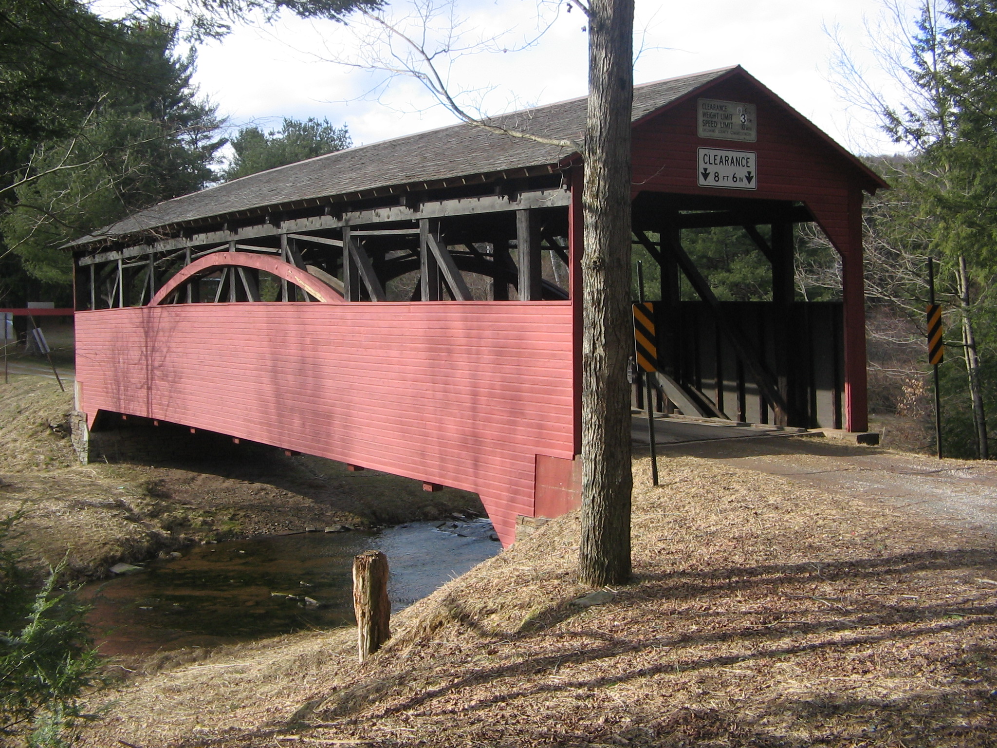
| Description | Larrys Creek Covered Bridge (also known as Cogan House Covered Bridge and Buckhorn Covered Bridge) over Larrys Creek in Cogan House Township, Pennsylvania, USA. Bridge built 1877, rehabilitated 1998. On the US National Register of Historic Places. A Burr arch truss bridge. |
| Date | |
| Source | Photographed it myself |
| Auteur | User:Ruhrfisch |
| Autorisation (Réutilisation de ce fichier) |
GFDL |
| Position de l'objet | | Voir cet endroit et d’autres images sur : OpenStreetMap |
|---|
Conditions d’utilisation
I, Ruhrfisch, en tant que détenteur des droits d’auteur sur cette œuvre, la publie sous les licences suivantes :

|
Vous avez la permission de copier, distribuer et modifier ce document selon les termes de la GNU Free Documentation License version 1.2 ou toute version ultérieure publiée par la Free Software Foundation, sans sections inaltérables, sans texte de première page de couverture et sans texte de dernière page de couverture. Un exemplaire de la licence est inclus dans la section intitulée GNU Free Documentation License. |
| Ce fichier est disponible selon les termes de la licence Creative Commons Attribution – Partage dans les Mêmes Conditions 3.0 (non transposée). | ||
| Attribution: I, Ruhrfisch | ||
| ||
| Ce bandeau de licence a été ajouté à ce fichier dans le cadre de la procédure de mise à jour des licences des images sous GFDL. |
Vous pouvez choisir l’une de ces licences.
Historique du fichier
Cliquer sur une date et heure pour voir le fichier tel qu'il était à ce moment-là.
| Date et heure | Vignette | Dimensions | Utilisateur | Commentaire | |
|---|---|---|---|---|---|
| actuel | 11 octobre 2007 à 12:19 | | 2 048 × 1 536 (1,23 Mio) | Ruhrfisch | {{Information |Description= Larrys Creek Covered Bridge (also known as Buckhorn Covered Bridge) over Larrys Creek in Cogan House Township, Pennsylvania, USA. Bridge built 1877, rehabilitated 1998. On the US National Register of Historic Places. A Burr arc |
Utilisation du fichier
Les 3 pages suivantes utilisent ce fichier :
Usage global du fichier
Les autres wikis suivants utilisent ce fichier :
- Utilisation sur de.wikipedia.org
- Utilisation sur en.wikipedia.org
- National Register of Historic Places listings in Pennsylvania
- User:Ruhrfisch/Frog
- National Register of Historic Places listings in Lycoming County, Pennsylvania
- User:Ruhrfisch/Milestones
- List of municipalities in Lycoming County, Pennsylvania
- Cogan House Covered Bridge
- Wikipedia talk:Featured list candidates/List of municipalities in Lycoming County, Pennsylvania/example
- Wikipedia:Recent additions/2007/October
- Wikipedia:Today's featured article/December 2011
- Wikipedia:Today's featured article/December 13, 2011
- Wikipedia:Main Page history/2011 December 13
- Portal:Geography/DYK
- Portal:Geography/DYK/9
- Utilisation sur es.wikipedia.org
- Utilisation sur ja.wikipedia.org
- Utilisation sur pt.wikipedia.org
- Utilisation sur www.wikidata.org