
Fichier:Kara seaIT.PNG
Pas de plus haute résolution disponible.
Kara_seaIT.PNG (710 × 534 pixels, taille du fichier : 18 kio, type MIME : image/png)
Ce fichier et sa description proviennent de Wikimedia Commons.
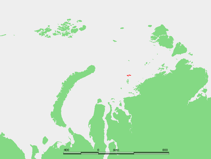
Description
| Description |
Беларуская: Астравы Весцяў ЦВК.
English: Location of the Izvestiy Tsik Islands in the Kara Sea.
Français : Localisation des Îles Izvesti TSIK dans la Mer de Kara.
Bahasa Indonesia: Lokasi Kepulauan Izvestiy Tsik di Laut Kara.
Norsk nynorsk: Plasseringa til Izvestij TSIK-øyane i Karahavet.
Polski: Położenie na mapie Rosji.
Русский: Положение Острова Известий ЦИК в Карском море. |
| Date | 4 novembre 2007 (date de téléversement originale) |
| Source | own work based on PD map |
| Auteur | edited by M.Minderhoud |
Conditions d’utilisation
This image is in the public domain because it came from the site https://www.demis.nl/products/web-map-server/examples/ and was released by the copyright holder. Permission is granted to copy, distribute and/or modify this map since it is based on free of copyright images from: www.demis.nl. See also approval email on de.wp and its clarification.
|
| This work has been released into the public domain by its copyright holder, www.demis.nl. This applies worldwide. Dans certains pays, ceci peut ne pas être possible ; dans ce cas : www.demis.nl accorde à toute personne le droit d’utiliser cette œuvre dans n’importe quel but, sans aucune condition, sauf celles requises par la loi.
|
Journal des téléversements d’origine
Transféré de en.wikipedia à Commons par Amdf.
La page de description originale était ici. Tous les noms d'utilisateur qui suivent se rapportent à en.wikipedia.
- 2007-11-04 10:17 Mohonu 710×534×8 (18620 bytes) This image is in the public domain because came from the site http://www.demis.nl/wms/mapclip.htm and was released by the copyright holder. Permission is granted to copy, distribute and/or modify this map since it is based on free of copyright images from
Historique du fichier
Cliquer sur une date et heure pour voir le fichier tel qu'il était à ce moment-là.
| Date et heure | Vignette | Dimensions | Utilisateur | Commentaire | |
|---|---|---|---|---|---|
| actuel | 10 mai 2008 à 11:58 | | 710 × 534 (18 kio) | File Upload Bot (Magnus Manske) | {{BotMoveToCommons|en.wikipedia}} {{Information |Description={{en|''no original description''}} |Source=Transferred from [http://en.wikipedia.org en.wikipedia]; Transfer was stated to be made by User:Amdf. |Date=2007-11-04 (original upload date) |Aut |
Utilisation du fichier
La page suivante utilise ce fichier :
Usage global du fichier
Les autres wikis suivants utilisent ce fichier :
- Utilisation sur az.wikipedia.org
- Utilisation sur be.wikipedia.org
- Utilisation sur en.wikipedia.org
- Utilisation sur es.wikipedia.org
- Utilisation sur id.wikipedia.org
- Utilisation sur it.wikipedia.org
- Utilisation sur ja.wikipedia.org
- Utilisation sur nl.wikipedia.org
- Utilisation sur nn.wikipedia.org
- Utilisation sur pl.wikipedia.org