
Fichier:Kansas Turnpike map.svg

Taille de cet aperçu PNG pour ce fichier SVG : 704 × 501 pixels. Autres résolutions : 320 × 228 pixels | 640 × 455 pixels | 1 024 × 729 pixels | 1 280 × 911 pixels | 2 560 × 1 822 pixels.
Fichier d’origine (Fichier SVG, nominalement de 704 × 501 pixels, taille : 341 kio)
Ce fichier et sa description proviennent de Wikimedia Commons.
Description
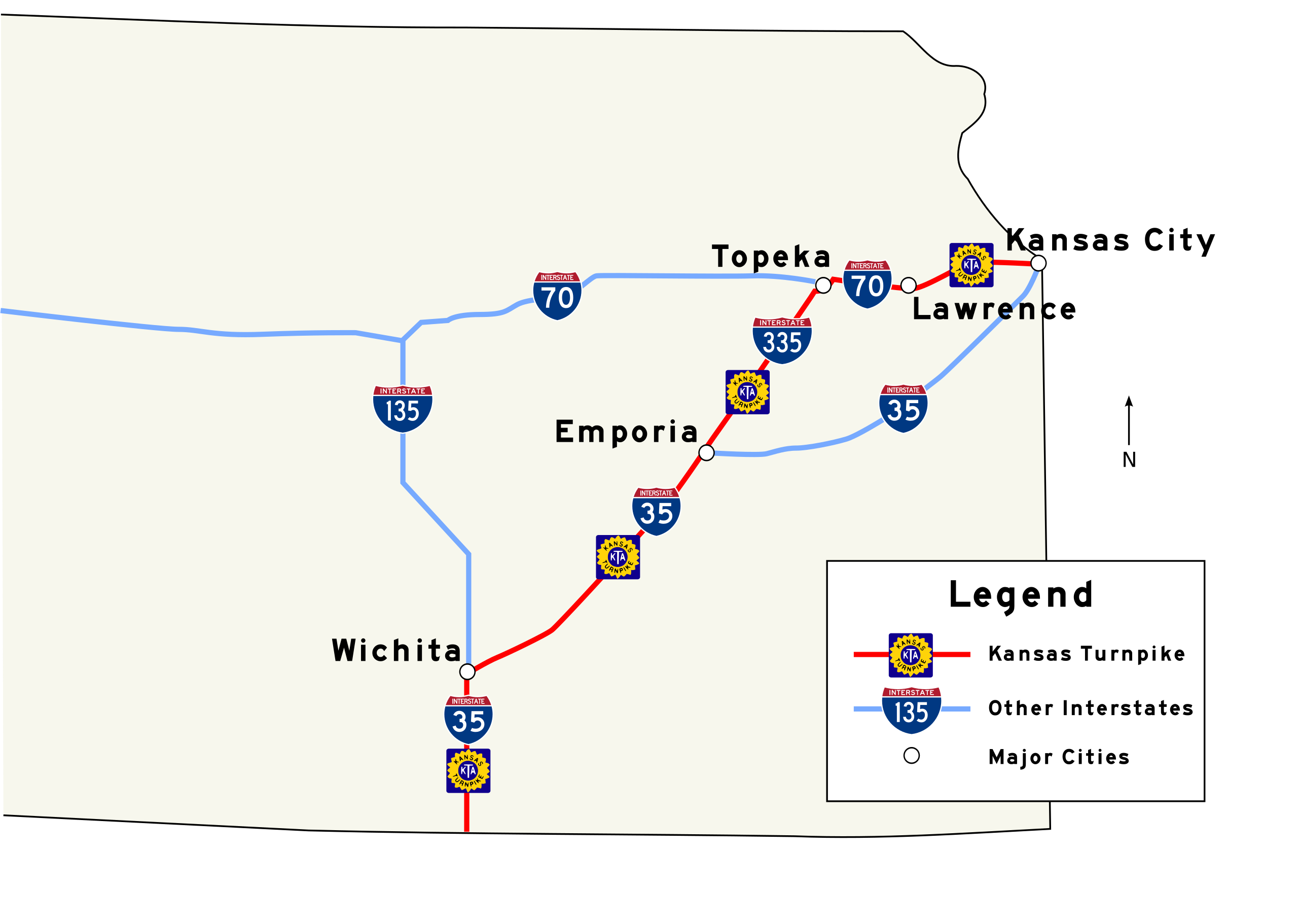
| Description | An SVG map of the Kansas Turnpike. Created by user in Inkscape, using SPUI's Interstate 35, 335, and 70 shields, part of Wapcaplet's w:Image:Map_of_USA_with_state_names.svg, and traced over a PDF version of the official Kansas State Highway map provided by KDOT. |
| Date | 18 janvier 2006 (date de téléversement originale) |
| Source | La source n’a pas pu être reconnue automatiquement. « Travail personnel » supposé (étant donné la revendication de droit d’auteur). |
| Auteur | L’auteur n’a pas pu être identifié automatiquement. Il est supposé qu'il s'agit de : Scott5114 (étant donné la revendication de droit d’auteur). |
Conditions d’utilisation
| Moi, propriétaire des droits d’auteur sur cette œuvre, la place dans le domaine public. Ceci s'applique dans le monde entier. Dans certains pays, ceci peut ne pas être possible ; dans ce cas : J’accorde à toute personne le droit d’utiliser cette œuvre dans n’importe quel but, sans aucune condition, sauf celles requises par la loi. |
Historique du fichier
Cliquer sur une date et heure pour voir le fichier tel qu'il était à ce moment-là.
| Date et heure | Vignette | Dimensions | Utilisateur | Commentaire | |
|---|---|---|---|---|---|
| actuel | 24 mars 2007 à 11:12 | | 704 × 501 (341 kio) | Scott5114 | update for consistency with w:WP:USRD/MTF standards |
| 30 mars 2006 à 20:28 |  | 704 × 501 (341 kio) | Scott5114 | Legend, north arrow | |
| 19 janvier 2006 à 01:14 |  | 704 × 501 (241 kio) | Scott5114 | Font fix | |
| 19 janvier 2006 à 00:59 |  | 744 × 501 (226 kio) | Scott5114 | An SVG map of the Kansas Turnpike. Created by user in Inkscape, using SPUI's Interstate 35, 335, and 70 shields, part of Wapcaplet's w:Image:Map_of_USA_with_state_names.svg, and traced over a PDF versi |
Utilisation du fichier
Les 2 pages suivantes utilisent ce fichier :
Usage global du fichier
Les autres wikis suivants utilisent ce fichier :
- Utilisation sur ar.wikipedia.org
- Utilisation sur en.wikipedia.org
- Utilisation sur www.wikidata.org