
Fichier:Irrigation along the Shebelle River.JPG

Taille de cet aperçu : 800 × 532 pixels. Autres résolutions : 320 × 213 pixels | 640 × 425 pixels | 1 024 × 681 pixels | 1 280 × 851 pixels | 2 560 × 1 701 pixels | 4 288 × 2 850 pixels.
Fichier d’origine (4 288 × 2 850 pixels, taille du fichier : 2,57 Mio, type MIME : image/jpeg)
Ce fichier et sa description proviennent de Wikimedia Commons.
Description
| Description |
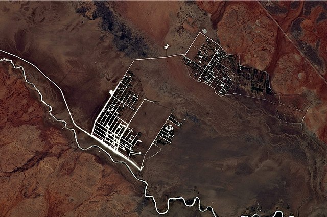
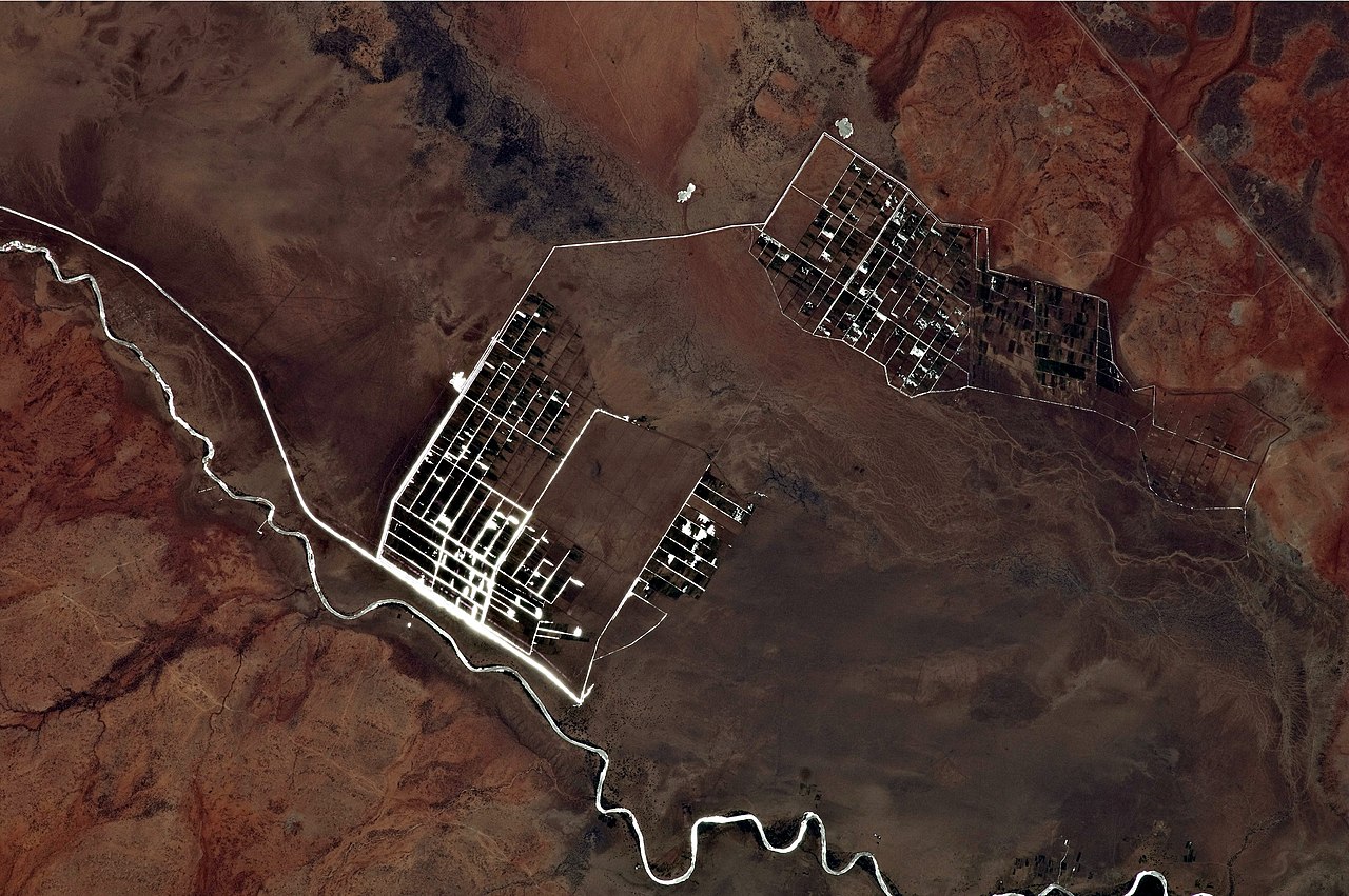
English: This astronaut photograph illustrates a network of irrigation canals and fields located approximately 42 kilometers to the west-northwest of the city of Gode. Floodplain sediments and soils are dark brown to gray (image center), and contrast with the reddish rocks and soils on the adjacent plateau. Vegetation in the flood plain (image top center) and agricultural fields is dark green.
Water in the Shebelle River and the irrigation canals has a bright, mirror-like appearance due to sun-glint, or light reflecting off the water surface back toward the International Space Station. |
| Date | |
| Source | NASA Earth Observatory |
| Auteur | ISS Expedition 27 crew |
| Lieu de la prise de vue | | Voir cet endroit et d’autres images sur : OpenStreetMap |
|---|
Cette image ou vidéo a été cataloguée par le Johnson Space Center de la National Aeronautics and Space Administration (NASA) des États-Unis sous Photo ID : ISS027-E-9564.Ce bandeau n’indique rien sur le statut de l’œuvre au regard du droit d'auteur. Un bandeau de droit d’auteur est requis. Voir Commons:À propos des licences pour plus d’informations. Autres langues :
|
Image acquired with a Nikon D2Xs digital camera using a 400 mm lens, and is provided by the ISS Crew Earth Observations experiment and Image Science & Analysis Laboratory, Johnson Space Center.
Conditions d’utilisation
| Ce fichier provient de la NASA. Sauf exception, les documents créés par la NASA ne sont pas soumis à copyright. Pour plus d'informations, voir la politique de copyright de la NASA. | ||
 |
Attention :
|
Historique du fichier
Cliquer sur une date et heure pour voir le fichier tel qu'il était à ce moment-là.
| Date et heure | Vignette | Dimensions | Utilisateur | Commentaire | |
|---|---|---|---|---|---|
| actuel | 11 avril 2011 à 19:09 | | 4 288 × 2 850 (2,57 Mio) | Originalwana | {{Information |Description ={{en|1=This astronaut photograph illustrates a network of irrigation canals and fields located approximately 42 kilometers to the west-northwest of the city of Gode. Floodplain sediments and soil |
Utilisation du fichier
La page suivante utilise ce fichier :
Usage global du fichier
Les autres wikis suivants utilisent ce fichier :
- Utilisation sur af.wikipedia.org
- Utilisation sur en.wikipedia.org