
Fichier:Historic Columbia River Highway 100 (no overlaps).svg

Taille de cet aperçu PNG pour ce fichier SVG : 800 × 444 pixels. Autres résolutions : 320 × 178 pixels | 640 × 356 pixels | 1 024 × 569 pixels | 1 280 × 711 pixels | 2 560 × 1 422 pixels | 1 152 × 640 pixels.
Fichier d’origine (Fichier SVG, nominalement de 1 152 × 640 pixels, taille : 191 kio)
Ce fichier et sa description proviennent de Wikimedia Commons.
.svg?uselang=fr)
Description
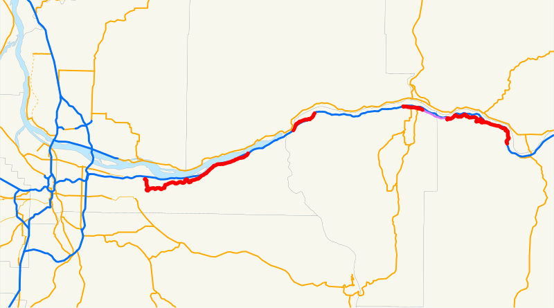
| Description | This is a map of the Historic Columbia River Highway No. 100 in Oregon, with closed-to-traffic portions in purple. Overlaps with I-84 are not shown. Email me if you would like a copy of the GIS data I created for the highways. |
| Date | 24 avril 2008 (date de téléversement originale) |
| Source | La source n’a pas pu être reconnue automatiquement. « Travail personnel » supposé (étant donné la revendication de droit d’auteur). |
| Auteur | L’auteur n’a pas pu être identifié automatiquement. Il est supposé qu'il s'agit de : NE2 (étant donné la revendication de droit d’auteur). |
Conditions d’utilisation
| Moi, propriétaire des droits d’auteur sur cette œuvre, la place dans le domaine public. Ceci s'applique dans le monde entier. Dans certains pays, ceci peut ne pas être possible ; dans ce cas : J’accorde à toute personne le droit d’utiliser cette œuvre dans n’importe quel but, sans aucune condition, sauf celles requises par la loi. |
Historique du fichier
Cliquer sur une date et heure pour voir le fichier tel qu'il était à ce moment-là.
| Date et heure | Vignette | Dimensions | Utilisateur | Commentaire | |
|---|---|---|---|---|---|
| actuel | 24 avril 2008 à 23:55 | | 1 152 × 640 (191 kio) | NE2 | == Summary == This is a map of the Historic Columbia River Highway No. 100 in Oregon, with closed-to-traffic portions in purple. Overlaps with I-84 are not shown. Email me if you would like a copy of the GIS data I created for th |
Utilisation du fichier
La page suivante utilise ce fichier :
Usage global du fichier
Les autres wikis suivants utilisent ce fichier :
- Utilisation sur de.wikipedia.org
- Utilisation sur en.wikipedia.org
- Utilisation sur www.wikidata.org
.svg)