
Fichier:HaverhillRaid1708.png
Taille de cet aperçu : 493 × 599 pixels. Autres résolutions : 197 × 240 pixels | 395 × 480 pixels | 948 × 1 152 pixels.
Fichier d’origine (948 × 1 152 pixels, taille du fichier : 2,21 Mio, type MIME : image/png)
Ce fichier et sa description proviennent de Wikimedia Commons.
Description
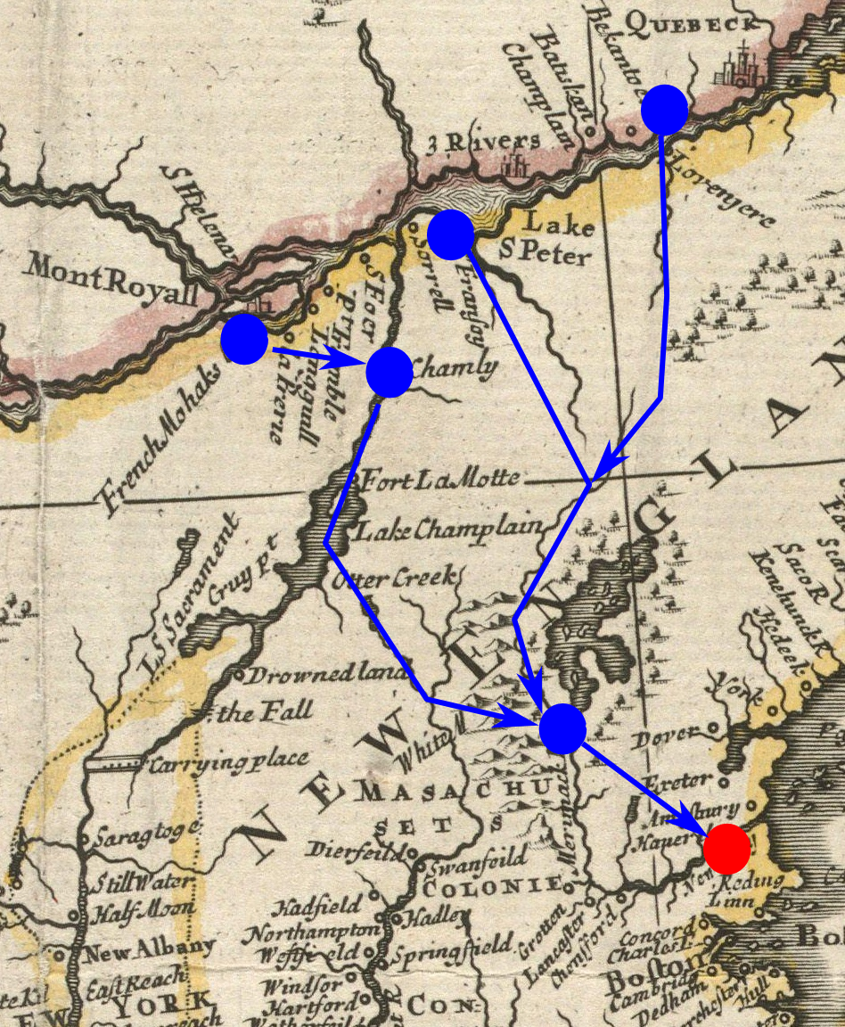
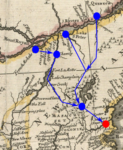
| Description | Detail from a 1719 map, annotated to show the routes taken (or expected to be taken) by French and Indian forces that raided Haverhill, Massachusetts in 1708. Haverhill is marked in red; the routes of the French and Indians, and their rendezvous and starting points, are marked in blue. | ||||||||||||||||
| Date | Base map published 1719 | ||||||||||||||||
| Source | From the Boston Public Library digital map collection: http://maps.bpl.org/details_13096/ | ||||||||||||||||
| Auteur |
|
||||||||||||||||
Conditions d’utilisation
The annotations are not sufficiently creative to merit copyright protection. The base image is:
Ce document est dans le domaine public aux États-Unis. Ceci s'applique aux travaux des États-Unis où le copyright a expiré, souvent parce que sa première publication s'est produite avant le 1er janvier 1929. Voir cette page pour davantage d'explication.
|
 | |
 |
Cette image peut ne pas être dans le domaine public en dehors des États-Unis (ceci s'applique particulièrement au Canada, en Chine (pas Hong Kong, Macao, ni Taïwan), en Allemagne ou en Suisse). Le créateur et l'année de la publication sont l'information essentielle et doivent être fournis.
|
Historique du fichier
Cliquer sur une date et heure pour voir le fichier tel qu'il était à ce moment-là.
| Date et heure | Vignette | Dimensions | Utilisateur | Commentaire | |
|---|---|---|---|---|---|
| actuel | 2 février 2011 à 15:53 | | 948 × 1 152 (2,21 Mio) | Magicpiano | {{Information |Description=Detail from a 1719 map, annotated to show the routes taken (or expected to be taken) by French and Indian forces that raided Haverhill, Massachusetts in 1708. |Source=From the Boston Public Library digita |
Utilisation du fichier
La page suivante utilise ce fichier :
Usage global du fichier
Les autres wikis suivants utilisent ce fichier :
- Utilisation sur cs.wikipedia.org
- Utilisation sur en.wikipedia.org
- Utilisation sur it.wikipedia.org
- Utilisation sur ja.wikipedia.org
- Utilisation sur nn.wikipedia.org