
Fichier:Greenwich-Island-location-map.png

Taille de cet aperçu : 800 × 548 pixels. Autres résolutions : 320 × 219 pixels | 640 × 439 pixels | 1 024 × 702 pixels | 1 280 × 877 pixels | 1 669 × 1 144 pixels.
Fichier d’origine (1 669 × 1 144 pixels, taille du fichier : 150 kio, type MIME : image/png)
Ce fichier et sa description proviennent de Wikimedia Commons.
Description
| Description |
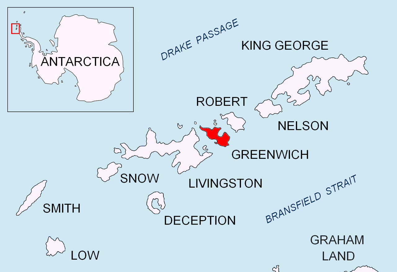
English: Location map of Greenwich Island in the South Shetland Islands. |
| Date | |
| Source | Travail personnel |
| Auteur | Apcbg |
Conditions d’utilisation
Moi, en tant que détenteur des droits d’auteur sur cette œuvre, je la publie sous les licences suivantes :
Ce fichier est disponible selon les termes de la licence Creative Commons Attribution – Partage dans les Mêmes Conditions 3.0 (non transposée).
- Vous êtes libre :
- de partager – de copier, distribuer et transmettre cette œuvre
- d’adapter – de modifier cette œuvre
- Sous les conditions suivantes :
- paternité – Vous devez donner les informations appropriées concernant l'auteur, fournir un lien vers la licence et indiquer si des modifications ont été faites. Vous pouvez faire cela par tout moyen raisonnable, mais en aucune façon suggérant que l’auteur vous soutient ou approuve l’utilisation que vous en faites.
- partage à l’identique – Si vous modifiez, transformez, ou vous basez sur cette œuvre, vous devez distribuer votre contribution sous la même licence ou une licence compatible avec celle de l’original.

|
Vous avez la permission de copier, distribuer et modifier ce document selon les termes de la GNU Free Documentation License version 1.2 ou toute version ultérieure publiée par la Free Software Foundation, sans sections inaltérables, sans texte de première page de couverture et sans texte de dernière page de couverture. Un exemplaire de la licence est inclus dans la section intitulée GNU Free Documentation License. |
Vous pouvez choisir l’une de ces licences.
Historique du fichier
Cliquer sur une date et heure pour voir le fichier tel qu'il était à ce moment-là.
| Date et heure | Vignette | Dimensions | Utilisateur | Commentaire | |
|---|---|---|---|---|---|
| actuel | 24 août 2010 à 19:21 | | 1 669 × 1 144 (150 kio) | Apcbg | + location in Antarctica |
| 27 avril 2010 à 21:01 |  | 1 669 × 1 144 (5,47 Mio) | Apcbg | {{Information |Description={{en|1=Location map of Greenwich Island in the South Shetland Islands.}} |Source={{own}} |Author=Apcbg |Date=2010-04-27 |Permission= |other_versions= }} Category:Maps of Antarctica |
Utilisation du fichier
La page suivante utilise ce fichier :
Usage global du fichier
Les autres wikis suivants utilisent ce fichier :
- Utilisation sur ar.wikipedia.org
- Utilisation sur az.wikipedia.org
- Utilisation sur bg.wikipedia.org
- Utilisation sur ceb.wikipedia.org
- Utilisation sur en.wikipedia.org
- Mount Plymouth
- Altsek Nunatak
- Archar Peninsula
- Breznik Heights
- Dryanovo Heights
- Haskovo Cove
- Hebrizelm Hill
- Hrabar Nunatak
- Kabile Island
- Kerseblept Nunatak
- Kotrag Nunatak
- Malamir Knoll
- Momchil Peak
- Murgash Glacier
- Musala Glacier
- Oborishte Ridge
- Panagyurishte Nunatak
- Pavlikeni Point
- Razgrad Peak
- Razlog Cove
- Sevtopolis Peak
- Shopski Cove
- Skaptopara Cove
- Targovishte Glacier
- Telerig Nunatak
- Terter Peak
- Teteven Glacier
- Tile Ridge
- Viskyar Ridge
- Vratsa Peak
- Wulfila Glacier
- Yakoruda Glacier
- Zheravna Glacier
- Bogdan Ridge
- Discovery Bay (Antarctica)
Voir davantage sur l’utilisation globale de ce fichier.