
Fichier:Geothermal springs map US.png
Taille de cet aperçu : 800 × 349 pixels. Autres résolutions : 320 × 140 pixels | 887 × 387 pixels.
Fichier d’origine (887 × 387 pixels, taille du fichier : 78 kio, type MIME : image/png)
Ce fichier et sa description proviennent de Wikimedia Commons.
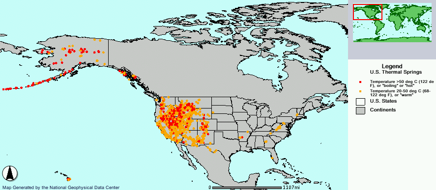
Geothermal hot springs in the United States.
Cette image est dans le domaine public car son contenu provient de la
National Oceanic and Atmospheric Administration , réalisé par un employé dans le cadre de ses activités professionnelles.
|
http://map.ngdc.noaa.gov/website/seg/hot_springs/viewer.htm
Historique du fichier
Cliquer sur une date et heure pour voir le fichier tel qu'il était à ce moment-là.
| Date et heure | Vignette | Dimensions | Utilisateur | Commentaire | |
|---|---|---|---|---|---|
| actuel | 15 février 2006 à 10:20 | | 887 × 387 (78 kio) | Napa | Geothermal hot springs in the United States. {{PD-USGov-DOC-NOAA}} http://map.ngdc.noaa.gov/website/seg/hot_springs/viewer.htm Category:Maps of North America |
Utilisation du fichier
La page suivante utilise ce fichier :
Usage global du fichier
Les autres wikis suivants utilisent ce fichier :
- Utilisation sur bn.wikipedia.org
- Utilisation sur de.wikipedia.org
- Utilisation sur de.wikivoyage.org
- Utilisation sur en.wikipedia.org
- Utilisation sur eo.wikipedia.org
- Utilisation sur it.wikipedia.org
- Utilisation sur ja.wikipedia.org
- Utilisation sur pt.wikipedia.org
- Utilisation sur zh.wikipedia.org