
Fichier:FukushimaMapCurrent.png

Taille de cet aperçu : 800 × 563 pixels. Autres résolutions : 320 × 225 pixels | 640 × 450 pixels | 1 024 × 720 pixels | 1 281 × 901 pixels.
Fichier d’origine (1 281 × 901 pixels, taille du fichier : 50 kio, type MIME : image/png)
Ce fichier et sa description proviennent de Wikimedia Commons.
Description
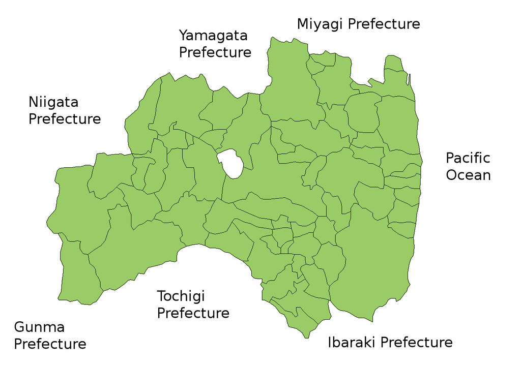
Map of Fukushima Prefecture, Japan.
Thanks to Aoki Shigenobu and [1]. Colors from Image:TokyoMapCurrent.png by User:Fg2.
Conditions d’utilisation

|
Shigenobu AOKI, détenteur des droits d'auteur sur cette œuvre autorise toute personne à l'utiliser pour tout usage y compris la redistribution sans restrictions, l'usage à titre commercial, et la modification.
|
Historique du fichier
Cliquer sur une date et heure pour voir le fichier tel qu'il était à ce moment-là.
| Date et heure | Vignette | Dimensions | Utilisateur | Commentaire | |
|---|---|---|---|---|---|
| actuel | 28 septembre 2011 à 17:58 | | 1 281 × 901 (50 kio) | Haaninjo | The city of Motomiya was created, and Iino merged into Fukushima. |
| 19 juillet 2006 à 07:31 |  | 1 281 × 901 (50 kio) | Akanemoto~commonswiki | Reverted to earlier revision | |
| 18 juillet 2006 à 14:23 |  | 1 050 × 800 (20 kio) | Akanemoto~commonswiki | remove texts | |
| 18 juillet 2006 à 12:43 |  | 1 281 × 901 (50 kio) | Akanemoto~commonswiki | Map of Fukushima Prefecture, Japan. Thanks to Aoki Shigenobu and [http://aoki2.si.gunma-u.ac.jp/map/map.html]. Colors from Image:TokyoMapCurrent.png by User:Fg2. Category:Maps of Fukushima prefecture Category:Maps in English |
Utilisation du fichier
Aucune page n’utilise ce fichier.
Usage global du fichier
Les autres wikis suivants utilisent ce fichier :
- Utilisation sur ast.wikipedia.org
- Utilisation sur az.wikipedia.org
- Utilisation sur ba.wikipedia.org
- Utilisation sur ckb.wikipedia.org
- Utilisation sur cs.wikipedia.org
- Utilisation sur es.wikipedia.org
- Utilisation sur eu.wikipedia.org
- Utilisation sur fa.wikipedia.org
- Utilisation sur gan.wikipedia.org
- Utilisation sur lt.wikipedia.org
- Utilisation sur ms.wikipedia.org
- Utilisation sur no.wikipedia.org
- Utilisation sur pam.wikipedia.org
- Utilisation sur pt.wikipedia.org
- Utilisation sur ru.wikipedia.org
- Utilisation sur su.wikipedia.org
- Utilisation sur vi.wikipedia.org