
Fichier:Flooding in Sirajganj 2020 (52423722318).jpg
Taille de cet aperçu : 800 × 584 pixels. Autres résolutions : 320 × 234 pixels | 640 × 468 pixels | 1 024 × 748 pixels.
Fichier d’origine (1 024 × 748 pixels, taille du fichier : 200 kio, type MIME : image/jpeg)
Ce fichier et sa description proviennent de Wikimedia Commons.
.jpg?uselang=fr)
Description
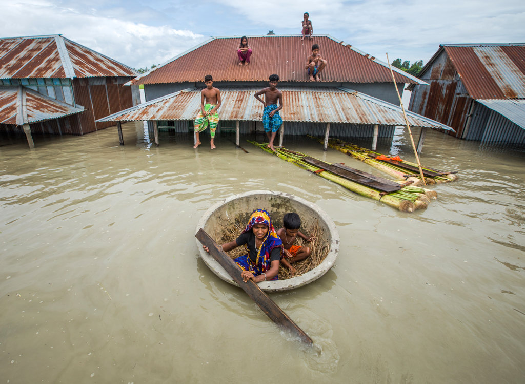
| Description | Bangladesh, 2020. Houses are nearly submerged due to flooding in Sirajganj, Bangladesh. Credit: Moniruzzaman Sazal / Climate Visuals Countdown, Creative Commons |
| Date | |
| Source | Bangladesh 2020 |
| Auteur | Oregon State University |
Conditions d’utilisation
Ce fichier est disponible selon les termes de la licence Creative Commons Attribution – Partage dans les Mêmes Conditions 2.0 Générique
- Vous êtes libre :
- de partager – de copier, distribuer et transmettre cette œuvre
- d’adapter – de modifier cette œuvre
- Sous les conditions suivantes :
- paternité – Vous devez donner les informations appropriées concernant l'auteur, fournir un lien vers la licence et indiquer si des modifications ont été faites. Vous pouvez faire cela par tout moyen raisonnable, mais en aucune façon suggérant que l’auteur vous soutient ou approuve l’utilisation que vous en faites.
- partage à l’identique – Si vous modifiez, transformez, ou vous basez sur cette œuvre, vous devez distribuer votre contribution sous la même licence ou une licence compatible avec celle de l’original.
| Cette image a été originellement postée sur Flickr par Oregon State University à l'adresse https://flickr.com/photos/33247428@N08/52423722318. Elle a été passée en revue le 4 mars 2023 par le robot FlickreviewR 2, qui a confirmé qu'elle se trouvait sous licence cc-by-sa-2.0. |
Historique du fichier
Cliquer sur une date et heure pour voir le fichier tel qu'il était à ce moment-là.
| Date et heure | Vignette | Dimensions | Utilisateur | Commentaire | |
|---|---|---|---|---|---|
| actuel | 4 mars 2023 à 02:29 | | 1 024 × 748 (200 kio) | Daniel Mietchen | Transferred from Flickr via #flickr2commons |
Utilisation du fichier
La page suivante utilise ce fichier :
Usage global du fichier
Les autres wikis suivants utilisent ce fichier :
- Utilisation sur ceb.wikipedia.org
- Utilisation sur de.wikipedia.org
- Utilisation sur en.wikipedia.org
- Utilisation sur en.wikivoyage.org
- Utilisation sur eo.wikipedia.org
- Utilisation sur it.wikipedia.org
- Utilisation sur nds.wikipedia.org
- Utilisation sur nl.wikipedia.org
- Utilisation sur no.wikipedia.org
- Utilisation sur pl.wikipedia.org
- Utilisation sur ro.wikipedia.org
- Utilisation sur ru.wikipedia.org
- Utilisation sur www.wikidata.org
.jpg)