
Fichier:Casey recreation limits 14598.jpg
Taille de cet aperçu : 800 × 566 pixels. Autres résolutions : 320 × 226 pixels | 640 × 453 pixels | 1 024 × 725 pixels | 1 280 × 906 pixels | 2 560 × 1 812 pixels | 3 507 × 2 482 pixels.
Fichier d’origine (3 507 × 2 482 pixels, taille du fichier : 4,98 Mio, type MIME : image/jpeg)
Ce fichier et sa description proviennent de Wikimedia Commons.
Description
| Description |
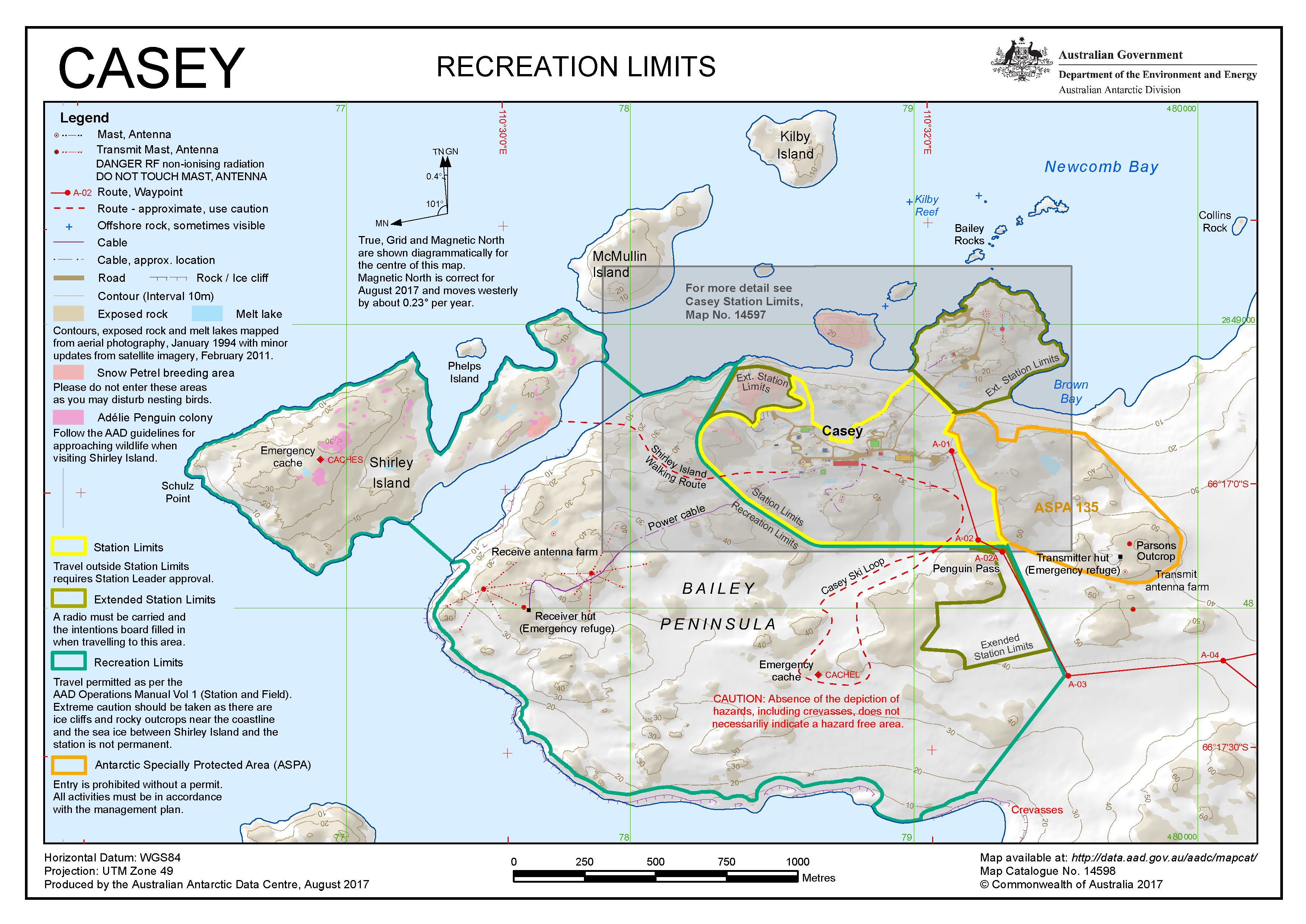
English: Map of the Bailey Peninsula, Antarctica, with adjacent islands and the Australian Casey Station |
||
| Date | |||
| Source | Map 14598: Casey: Recreation Limits | ||
| Auteur | Australian Antarctic Division (Australia) | ||
| Autorisation (Réutilisation de ce fichier) |
Ce fichier est disponible selon les termes de la licence Creative Commons Attribution 3.0 Non transposée.
|
||
| Autres versions |
 |
Historique du fichier
Cliquer sur une date et heure pour voir le fichier tel qu'il était à ce moment-là.
| Date et heure | Vignette | Dimensions | Utilisateur | Commentaire | |
|---|---|---|---|---|---|
| actuel | 8 juin 2020 à 15:32 | | 3 507 × 2 482 (4,98 Mio) | De728631 | {{Information |Description={{en|Map of the {{w|Bailey Peninsula}}, Antarctica, with adjacent islands and the Australian {{w|Casey Station}}}} |Source=[https://data.aad.gov.au/aadc/mapcat/display_map.cfm?map_id=14598 Map 14598: Casey: Recreation Limits] |Date=2017-08 |Author=Australian Antarctic Division (Australia) |Permission={{Cc-by-3.0}}{{license review}} |other_versions=100px|*.TIF }} Category:Windmill Islands Category:Casey Station |
Utilisation du fichier
La page suivante utilise ce fichier :
Usage global du fichier
Les autres wikis suivants utilisent ce fichier :
- Utilisation sur en.wikipedia.org
- Utilisation sur it.wikipedia.org
- Utilisation sur www.wikidata.org