
Fichier:Cape Girardeau Missouri 1993.jpg
Taille de cet aperçu : 800 × 534 pixels. Autres résolutions : 320 × 214 pixels | 640 × 427 pixels | 1 024 × 683 pixels | 1 500 × 1 001 pixels.
Fichier d’origine (1 500 × 1 001 pixels, taille du fichier : 534 kio, type MIME : image/jpeg)
Ce fichier et sa description proviennent de Wikimedia Commons.
| Description |
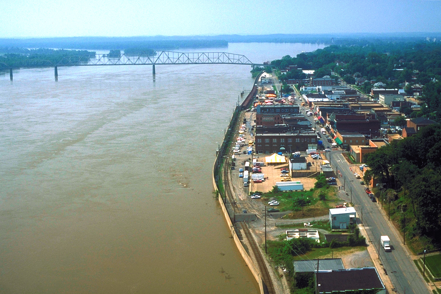
English: Aerial view of the waterfront section of Cape Girardeau, Missouri, USA, along the River. The picture was taken during the flood of 1993. The floowalls built by the U.S. Army Corps of Engineers are protecting the city from flooding. This picture was taken before the new bridge across the Mississippi was built in 2003. |
|||
| Date | ||||
| Source |
U.S. Army Corps of Engineers Digital Visual Library Image page Image description page Digital Visual Library home page |
|||
| Auteur | U.S. Army Corps of Engineers, photographer not specified or unknown | |||
| Autorisation (Réutilisation de ce fichier) |
|
|||
| Lieu | Cape Girardeau, Missouri, USA |
| Lieu de la prise de vue | | Voir cet endroit et d’autres images sur : OpenStreetMap |
|---|
Historique du fichier
Cliquer sur une date et heure pour voir le fichier tel qu'il était à ce moment-là.
| Date et heure | Vignette | Dimensions | Utilisateur | Commentaire | |
|---|---|---|---|---|---|
| actuel | 5 avril 2007 à 02:34 | | 1 500 × 1 001 (534 kio) | DanMS | {{Information | Description = {{en|Aerial view of the waterfront section of Cape Girardeau, Missouri, USA, along the Mississippi River. The picture was taken during the flood of 1993. The floowalls built by the U.S. Army Corps of Engineers are protecti |
Utilisation du fichier
La page suivante utilise ce fichier :
Usage global du fichier
Les autres wikis suivants utilisent ce fichier :
- Utilisation sur de.wikipedia.org
- Utilisation sur en.wikipedia.org
- Utilisation sur en.wikivoyage.org
- Utilisation sur fa.wikipedia.org
- Utilisation sur fi.wikipedia.org
- Utilisation sur vi.wikipedia.org