
Fichier:Alberta-central map.png

Taille de cet aperçu : 341 × 599 pixels. Autres résolutions : 136 × 240 pixels | 352 × 618 pixels.
Fichier d’origine (352 × 618 pixels, taille du fichier : 38 kio, type MIME : image/png)
Ce fichier et sa description proviennent de Wikimedia Commons.
Description
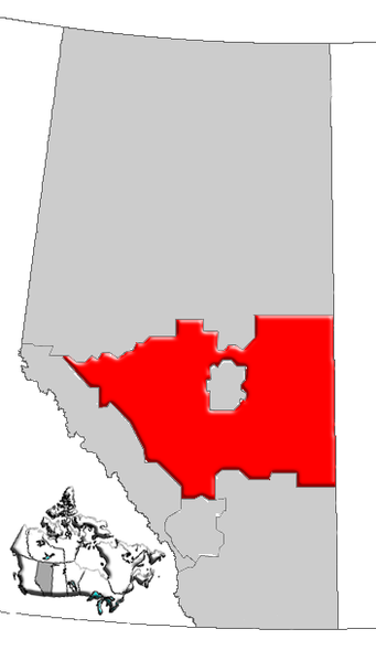
| Description | Map of Central Alberta, Canada |
| Date | |
| Source | GIS data |
| Auteur | Qyd (d · contributions) |
| Autorisation (Réutilisation de ce fichier) |
All |
Conditions d’utilisation
| Moi, propriétaire des droits d’auteur sur cette œuvre, la place dans le domaine public. Ceci s'applique dans le monde entier. Dans certains pays, ceci peut ne pas être possible ; dans ce cas : J’accorde à toute personne le droit d’utiliser cette œuvre dans n’importe quel but, sans aucune condition, sauf celles requises par la loi. |
Historique du fichier
Cliquer sur une date et heure pour voir le fichier tel qu'il était à ce moment-là.
| Date et heure | Vignette | Dimensions | Utilisateur | Commentaire | |
|---|---|---|---|---|---|
| actuel | 4 janvier 2007 à 18:19 | | 352 × 618 (38 kio) | Qyd | {{Information |Description=Map of Central Alberta, Canada |Source=GIS data |Date=Jan 2006 |Author={{User|Qyd}} |Permission=All |other_versions= }} Category:Maps of Alberta |
Utilisation du fichier
Aucune page n’utilise ce fichier.
Usage global du fichier
Les autres wikis suivants utilisent ce fichier :
- Utilisation sur de.wikipedia.org
- Utilisation sur en.wikipedia.org
- Tawatinaw
- Rochfort Bridge
- Buffalo Lake (Alberta)
- Canyon Ski Area
- Division No. 8, Alberta
- Cereal, Alberta
- Dewberry, Alberta
- Edberg, Alberta
- Edgerton, Alberta
- Pipestone Creek
- Pine Lake, Alberta
- Star, Alberta
- Niton Junction
- Blue Ridge, Alberta
- Rochon Sands
- Erskine, Alberta
- Brûlé Lake (Alberta)
- Red Deer Lake (Alberta)
- Abee
- Lac la Biche (Alberta)
- Abraham Lake
- Beaverhill Lake
- Sylvan Lake (Alberta)
- Bonnie Lake (Alberta)
- Peers, Alberta
- Marlboro, Alberta
- Central Alberta
- Mercoal, Alberta
- Hoselaw, Alberta
- Luscar, Alberta
- Mountain Park, Alberta
- Obed, Alberta
- Spruce View
- Chip Lake (Alberta)
- Pinedale, Alberta
- Silver Summit, Alberta
- Birch Cove
- Birchcliff
- Grandview, Alberta
- Larkspur, Alberta
- Norglenwold
- South View, Alberta
- Sunset Point, Alberta
- Val Quentin
- West Cove
- White Sands, Alberta
- Silver Sands, Alberta
- Stirlingville, Alberta
- Pine Shadows, Alberta
Voir davantage sur l’utilisation globale de ce fichier.