
Fichier:Administrative map of Vietnam from Aug2008.png

Taille de cet aperçu : 306 × 599 pixels. Autres résolutions : 122 × 240 pixels | 245 × 480 pixels | 392 × 768 pixels | 1 200 × 2 349 pixels.
Fichier d’origine (1 200 × 2 349 pixels, taille du fichier : 546 kio, type MIME : image/png)
Ce fichier et sa description proviennent de Wikimedia Commons.
Description
| Description |
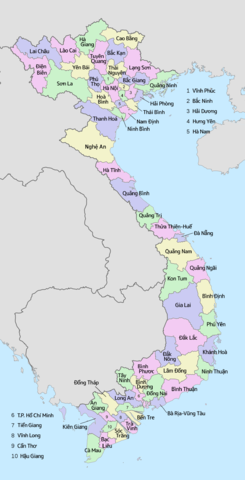
English: Administrative map of Vietnam from Aug2008. if you find something wrong, please send message to me. 日本語: ベトナムの行政地図(2008年8月以降)。不具合があればご連絡ください。 Tiếng Việt: Bản đồ hánh chình Việt Nam (từ tháng 8 năm 2008). Nếu có điều gì sai thì hãy gửi thông điệp ạ. |
| Date | |
| Source | Travail personnel |
| Auteur | Tonbi ko |
Conditions d’utilisation
Moi, en tant que détenteur des droits d’auteur sur cette œuvre, je la publie sous la licence suivante :
Ce fichier est sous la licence Creative Commons Attribution – Partage dans les Mêmes Conditions 4.0 International.
- Vous êtes libre :
- de partager – de copier, distribuer et transmettre cette œuvre
- d’adapter – de modifier cette œuvre
- Sous les conditions suivantes :
- paternité – Vous devez donner les informations appropriées concernant l'auteur, fournir un lien vers la licence et indiquer si des modifications ont été faites. Vous pouvez faire cela par tout moyen raisonnable, mais en aucune façon suggérant que l’auteur vous soutient ou approuve l’utilisation que vous en faites.
- partage à l’identique – Si vous modifiez, transformez, ou vous basez sur cette œuvre, vous devez distribuer votre contribution sous la même licence ou une licence compatible avec celle de l’original.
Historique du fichier
Cliquer sur une date et heure pour voir le fichier tel qu'il était à ce moment-là.
| Date et heure | Vignette | Dimensions | Utilisateur | Commentaire | |
|---|---|---|---|---|---|
| actuel | 10 décembre 2016 à 10:17 | | 1 200 × 2 349 (546 kio) | Tonbi ko | correct province name (Tiềng Giang -> Tiền Giang) |
| 25 février 2016 à 07:51 |  | 1 200 × 2 349 (546 kio) | Tonbi ko | correct: Cần Giờ district was not included to HCMC. and due to it, some color change. | |
| 29 août 2015 à 09:52 |  | 1 200 × 2 349 (546 kio) | Tonbi ko | Decrease colors (5 to 4), paint some islands (Đảo Bạch Long Vĩ Hải Phòng, Hòn Mê Thành Hoá, Đảo Lỳ Sơn Quảng Ngãi, Cù lao Thu Bình Thuận, Cù lao lớn ở Hậu giang Soc Trăng....) | |
| 28 août 2015 à 11:52 |  | 1 200 × 2 349 (548 kio) | Tonbi ko | User created page with UploadWizard |
Utilisation du fichier
La page suivante utilise ce fichier :
Usage global du fichier
Les autres wikis suivants utilisent ce fichier :
- Utilisation sur ja.wikipedia.org