
Fichier:2010 Eruption at Mount Merapi, Indonesia.jpg

Taille de cet aperçu : 681 × 599 pixels. Autres résolutions : 273 × 240 pixels | 545 × 480 pixels | 873 × 768 pixels | 1 164 × 1 024 pixels | 2 327 × 2 048 pixels | 2 770 × 2 438 pixels.
Fichier d’origine (2 770 × 2 438 pixels, taille du fichier : 1,57 Mio, type MIME : image/jpeg)
Ce fichier et sa description proviennent de Wikimedia Commons.
Description
| Description |
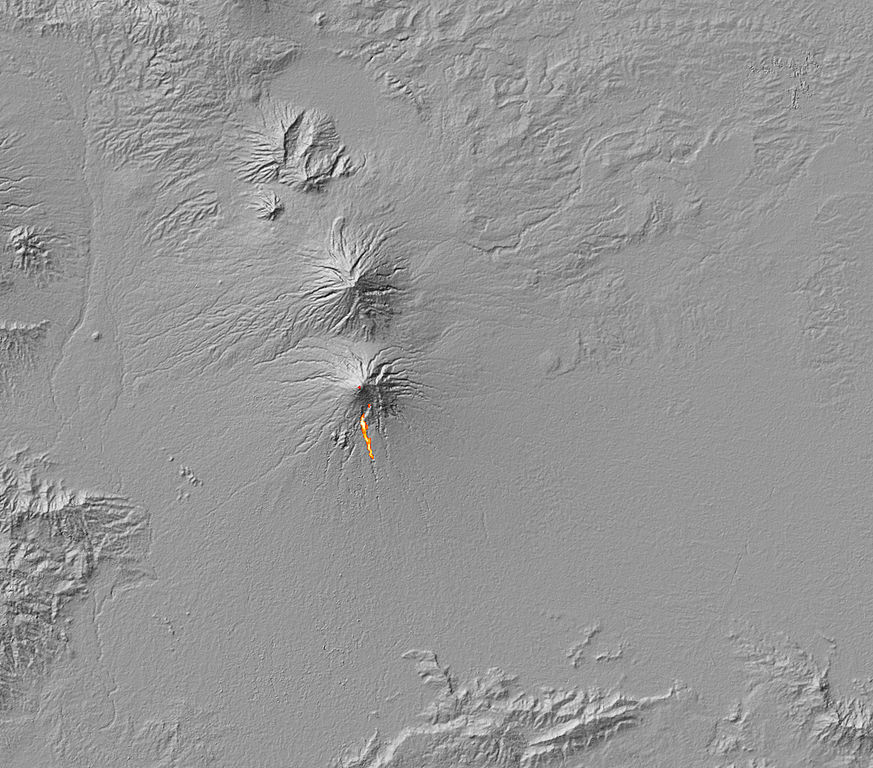
English: The thermal signature of hot ash and rock and a glowing lava dome on Mount Merapi. The thermal data is overlaid on a three-dimensional map of the volcano in this image to show the approximate location of the flow. The Center of Volcanology and Geological Hazard Mitigation reported that two pyroclastic flows moved down the volcano on October 30, 2010. A pyroclastic flow is an avalanche of extremely hot gas, ash, and rock that tears down the side of a volcano at high speeds. |
| Date | |
| Source | NASA Earth Observatory |
| Auteur | Robert Simmon and Jesse Allen |
Image captured by the Advanced Spaceborne Thermal Emission and Reflection Radiometer (ASTER) on NASA’s Terra satellite.
Conditions d’utilisation
| Ce fichier provient de la NASA. Sauf exception, les documents créés par la NASA ne sont pas soumis à copyright. Pour plus d'informations, voir la politique de copyright de la NASA. | ||
 |
Attention :
|
| Annotations | Cette image est annotée : Voir les annotations sur Wikimedia Commons |
Historique du fichier
Cliquer sur une date et heure pour voir le fichier tel qu'il était à ce moment-là.
| Date et heure | Vignette | Dimensions | Utilisateur | Commentaire | |
|---|---|---|---|---|---|
| actuel | 5 novembre 2010 à 14:03 | | 2 770 × 2 438 (1,57 Mio) | Originalwana | {{Information |Description={{en|1=The thermal signature of hot ash and rock and a glowing lava dome on Mount Merapi. The thermal data is overlaid on a three-dimensional map of the volcano in this image to show the approximate location of the flow. Th |
Utilisation du fichier
La page suivante utilise ce fichier :
Usage global du fichier
Les autres wikis suivants utilisent ce fichier :
- Utilisation sur de.wikipedia.org
- Utilisation sur en.wikipedia.org