
Fichier:1998 Ice Storm map.png
Taille de cet aperçu : 800 × 412 pixels. Autres résolutions : 320 × 165 pixels | 640 × 329 pixels | 1 024 × 527 pixels | 1 500 × 772 pixels.
Fichier d’origine (1 500 × 772 pixels, taille du fichier : 519 kio, type MIME : image/png)
Ce fichier et sa description proviennent de Wikimedia Commons.
Description
| Description |
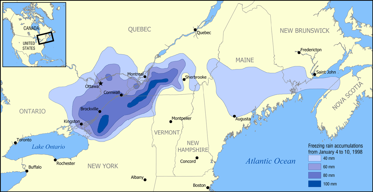
English: A map showing the extent of the January 1998 North American ice storm that affected eastern Ontario, southwest Quebec, New Brunswick, and parts of New York, Vermont, New Hampshire, and Maine. The map shows the accumulation of ice in millimetres from January 4 to January 10, 1998. Increments shown are 40 mm (1.6 in), 60 mm (2.4 in), 80 mm (3.1 in), and 100 mm (3.9 in). |
| Date | |
| Source | Based on data from Environment Canada. |
| Auteur | NormanEinstein |
Moi, en tant que détenteur des droits d’auteur sur cette œuvre, je la publie sous les licences suivantes :

|
Vous avez la permission de copier, distribuer et modifier ce document selon les termes de la GNU Free Documentation License version 1.2 ou toute version ultérieure publiée par la Free Software Foundation, sans sections inaltérables, sans texte de première page de couverture et sans texte de dernière page de couverture. Un exemplaire de la licence est inclus dans la section intitulée GNU Free Documentation License. |
| Ce fichier est disponible selon les termes de la licence Creative Commons Attribution – Partage dans les Mêmes Conditions 3.0 (non transposée). | ||
| ||
| Ce bandeau de licence a été ajouté à ce fichier dans le cadre de la procédure de mise à jour des licences des images sous GFDL. |
Vous pouvez choisir l’une de ces licences.
| Annotations | Cette image est annotée : Voir les annotations sur Wikimedia Commons |
Historique du fichier
Cliquer sur une date et heure pour voir le fichier tel qu'il était à ce moment-là.
| Date et heure | Vignette | Dimensions | Utilisateur | Commentaire | |
|---|---|---|---|---|---|
| actuel | 30 janvier 2006 à 19:52 | | 1 500 × 772 (519 kio) | NormanEinstein | A map showing the extent of the 1998 Ice Storm that affected eastern Ontario, southwest Quebec, New Brunswick, and parts of New York, Vermont, New Hampshire, and Maine. The map shows the accumulation of ice in millimetres from January 4 to January 10, 19 |
Utilisation du fichier
La page suivante utilise ce fichier :
Usage global du fichier
Les autres wikis suivants utilisent ce fichier :
- Utilisation sur ca.wikipedia.org
- Utilisation sur de.wikipedia.org
- Utilisation sur en.wikipedia.org
- Utilisation sur es.wikipedia.org
- Utilisation sur hr.wikipedia.org
- Utilisation sur ja.wikipedia.org
- Utilisation sur pl.wikipedia.org
- Utilisation sur ru.wikipedia.org
- Utilisation sur sh.wikipedia.org
- Utilisation sur www.wikidata.org