
Fichier:1801 Cary Map of Upper Saxony, Germany ( Berlin, Dresden ) - Geographicus - UpperSaxony-cary-1799.jpg

Taille de cet aperçu : 670 × 600 pixels. Autres résolutions : 268 × 240 pixels | 536 × 480 pixels | 858 × 768 pixels | 1 144 × 1 024 pixels | 2 289 × 2 048 pixels | 5 000 × 4 474 pixels.
Fichier d’origine (5 000 × 4 474 pixels, taille du fichier : 8,33 Mio, type MIME : image/jpeg)
Ce fichier et sa description proviennent de Wikimedia Commons.
_-_Geographicus_-_UpperSaxony-cary-1799.jpg?uselang=fr)
| Titre |
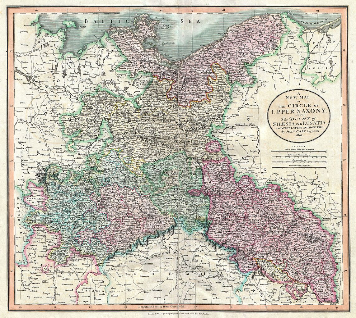
A New Map of the Circle of Upper Saxony; with the Duchy of Silesia and Lusatia, from the Latest Authorities. |
|||||||||
| Description |
English: An attractive example of John Cary’s 1801 map of Upper Saxony, Germany. Covers from the Baltic Sea south to Franconia, Bavaria, Bohemia and Moravia. Extends eastward as far as Poland. Includes the Duchy of Silesia, the Duchy of Lusatia, Prussian Pomerania, Electoral Mark of Brandenburg, and the Margraviate of Meissen. Notes the cities of Berlin, Prague, Dresden, and Leipzig among many others. Highly detailed with color coding according to region. Shows forests, cities, palaces, forts, roads and rivers. All in all, one of the most interesting and attractive atlas maps of Upper Saxony to appear in first years of the 19th century. Prepared in 1801 by John Cary for issue in his magnificent 1808 New Universal Atlas . |
|||||||||
| Date | (dated) | |||||||||
| Source |
Cary, John, Cary's New Universal Atlas, containing distinct maps of all the principal states and kingdoms throughout the World. From the latest and best authorities extant. London: Printed for J. Cary, Engraver and Map-seller, No. 181, near Norfolk Street, Strand, 1808.
|
|||||||||
| Autorisation (Réutilisation de ce fichier) |
|
|||||||||
| Données géotemporelles | ||||||||||
| Rectangle englobant |
|
|||||||||
| Géoréférencement | ||||||||||
| Données d'archives | ||||||||||
| Numéro d’inventaire |
liens Geographicus : UpperSaxony-cary-1799 |
|||||||||
| Dimensions | hauteur : 18,5 pouces (46,9 cm) ; largeur : 20,5 pouces (52 cm) | |||||||||
- Error in {{Map}} template: unknown parameter "artist".
Historique du fichier
Cliquer sur une date et heure pour voir le fichier tel qu'il était à ce moment-là.
| Date et heure | Vignette | Dimensions | Utilisateur | Commentaire | |
|---|---|---|---|---|---|
| actuel | 22 mars 2011 à 14:35 | | 5 000 × 4 474 (8,33 Mio) | BotMultichillT | {{subst:User:Multichill/Geographicus |link=http://www.geographicus.com/P/AntiqueMap/UpperSaxony-cary-1799 |product_name=1801 Cary Map of Upper Saxony, Germany ( Berlin, Dresden ) |map_title=A New Map of the Circle of Upper Saxony; with the Duchy of Silesi |
Utilisation du fichier
Les 3 pages suivantes utilisent ce fichier :
_-_Geographicus_-_UpperSaxony-cary-1799.jpg)