File:Carte Haute-Bretagne.svg
Jump to navigation
Jump to search

Size of this PNG preview of this SVG file: 800 × 543 pixels. Other resolutions: 320 × 217 pixels | 640 × 435 pixels | 1,024 × 696 pixels | 1,280 × 869 pixels | 2,560 × 1,739 pixels | 1,032 × 701 pixels.
Original file (SVG file, nominally 1,032 × 701 pixels, file size: 423 KB)
Captions
Captions
Add a one-line explanation of what this file represents
Summary[edit]
| Description |
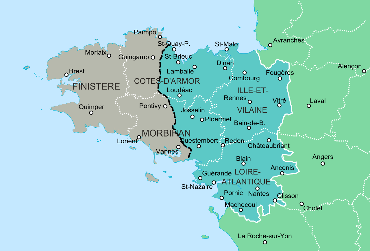
Français : Carte de la Haute-Bretagne séparée de la Basse-Bretagne par la limite linguistique du breton selon Francis Gourvil en 1952. |
| Date | |
| Source | Limite selon Pierre Gourvil : Histoire de la langue bretonne, Hervé Abalain, éd. Jean-Paul Gisserot, 2000, p. 32. |
| Author | Oie blanche |
Licensing[edit]
I, the copyright holder of this work, hereby publish it under the following license:
This file is licensed under the Creative Commons Attribution-Share Alike 3.0 Unported license.
- You are free:
- to share – to copy, distribute and transmit the work
- to remix – to adapt the work
- Under the following conditions:
- attribution – You must give appropriate credit, provide a link to the license, and indicate if changes were made. You may do so in any reasonable manner, but not in any way that suggests the licensor endorses you or your use.
- share alike – If you remix, transform, or build upon the material, you must distribute your contributions under the same or compatible license as the original.
File history
Click on a date/time to view the file as it appeared at that time.
| Date/Time | Thumbnail | Dimensions | User | Comment | |
|---|---|---|---|---|---|
| current | 02:34, 20 April 2014 | | 1,032 × 701 (423 KB) | Oie blanche (talk | contribs) | Modif. mineures. |
| 15:56, 19 April 2014 |  | 1,032 × 701 (416 KB) | Oie blanche (talk | contribs) | User created page with UploadWizard |
You cannot overwrite this file.
File usage on Commons
There are no pages that use this file.
File usage on other wikis
The following other wikis use this file:
- Usage on de.wikipedia.org
- Usage on fr.wikipedia.org
- Usage on gl.wikipedia.org