
Fichier:Traversing and Offsetting DP 79152.png
Taille de cet aperçu : 535 × 599 pixels. Autres résolutions : 214 × 240 pixels | 429 × 480 pixels | 893 × 1 000 pixels.
Fichier d’origine (893 × 1 000 pixels, taille du fichier : 109 kio, type MIME : image/png)
Ce fichier et sa description proviennent de Wikimedia Commons.
Description
| Description |
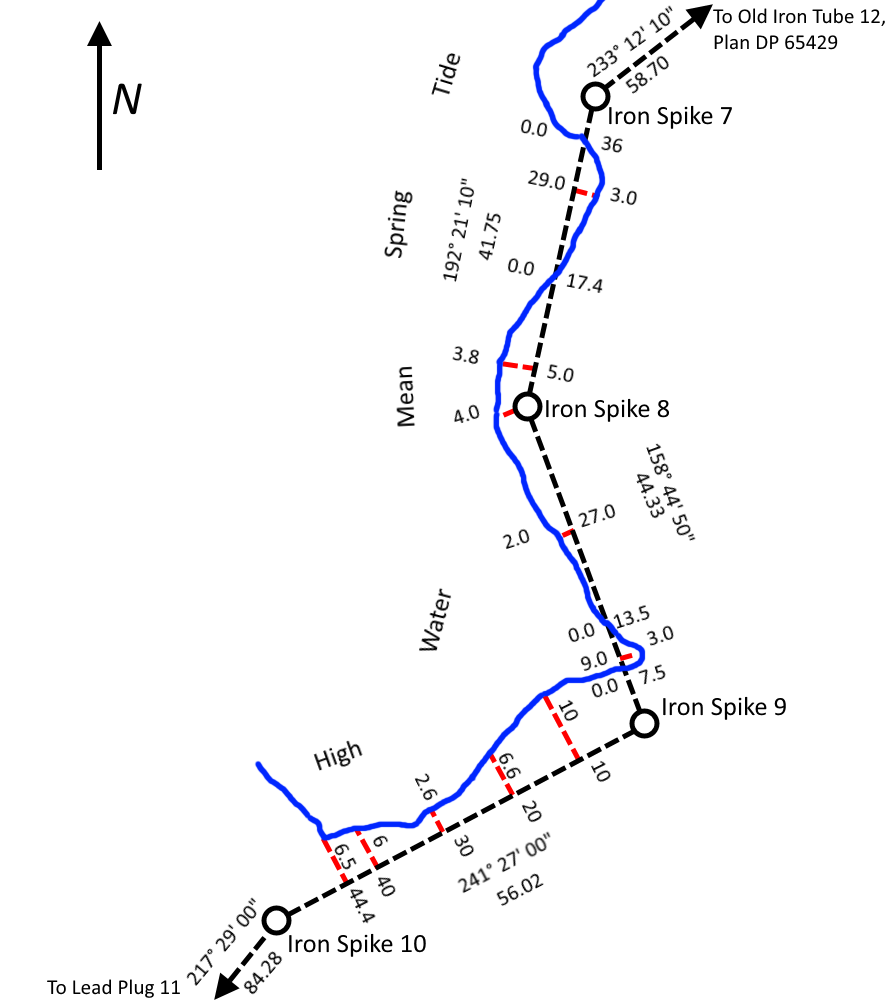
English: A simplified tracing of part of North Auckland Deposited Plan 79152 showing survey reference markers, traverse lines and offset measurements used to determine the location of a shoreline being used as a legal boundary line.
This work is based on/includes LINZ’s data which are licensed by Land Information New Zealand (LINZ) for re-use under the Creative Commons Attribution 3.0 New Zealand licence. |
| Date | |
| Source | This work is based on/includes LINZ’s data which are licensed by Land Information New Zealand (LINZ) for re-use under the Creative Commons Attribution 3.0 New Zealand licence. |
| Auteur | Land Information New Zealand, Derivative work by TBP25 |
Conditions d’utilisation
Ce fichier est disponible selon les termes de la licence Creative Commons Attribution 3.0 Non transposée.
- Vous êtes libre :
- de partager – de copier, distribuer et transmettre cette œuvre
- d’adapter – de modifier cette œuvre
- Sous les conditions suivantes :
- paternité – Vous devez donner les informations appropriées concernant l'auteur, fournir un lien vers la licence et indiquer si des modifications ont été faites. Vous pouvez faire cela par tout moyen raisonnable, mais en aucune façon suggérant que l’auteur vous soutient ou approuve l’utilisation que vous en faites.
Historique du fichier
Cliquer sur une date et heure pour voir le fichier tel qu'il était à ce moment-là.
| Date et heure | Vignette | Dimensions | Utilisateur | Commentaire | |
|---|---|---|---|---|---|
| actuel | 23 juillet 2014 à 11:32 | | 893 × 1 000 (109 kio) | TBP25 | Colour coded - red lines are offset measurements |
| 18 juillet 2014 à 14:28 |  | 893 × 1 000 (109 kio) | TBP25 | User created page with UploadWizard |
Utilisation du fichier
Aucune page n’utilise ce fichier.
Usage global du fichier
Les autres wikis suivants utilisent ce fichier :
- Utilisation sur en.wikipedia.org
- Utilisation sur ja.wikipedia.org
- Utilisation sur te.wikipedia.org