
Fichier:PAK orthographic.svg

Taille de cet aperçu PNG pour ce fichier SVG : 553 × 553 pixels. Autres résolutions : 240 × 240 pixels | 480 × 480 pixels | 768 × 768 pixels | 1 024 × 1 024 pixels | 2 048 × 2 048 pixels.
Fichier d’origine (Fichier SVG, nominalement de 553 × 553 pixels, taille : 451 kio)
Ce fichier et sa description proviennent de Wikimedia Commons.
Description
| Description |
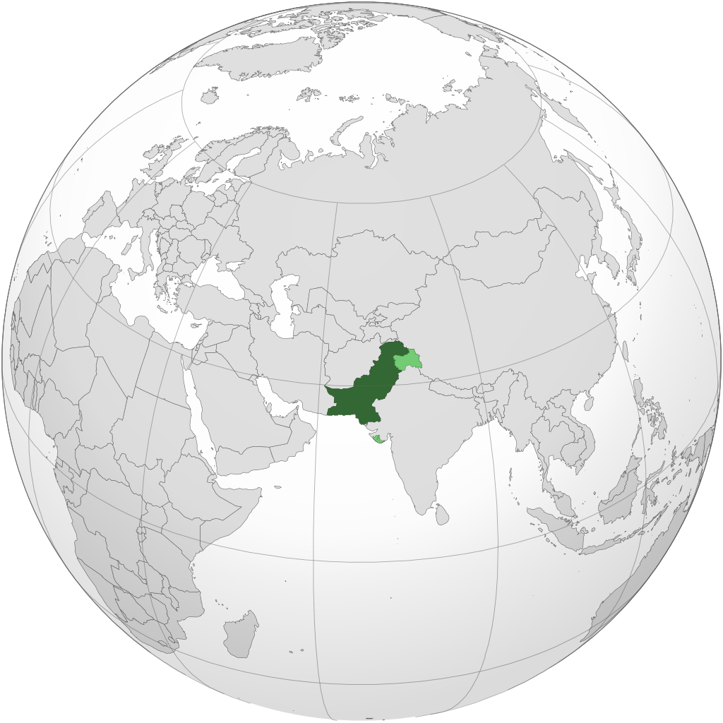
English: Orthographic map of Pakistan. Official source for claimed territories
Administered territory
Claimed territories اردو: پاکستان کا آرتھوگرافک نقشہ
زیر انتظام علاقہ
دعوی کردہ علاقے Français : Carte orthographique du Pakistan
Territoires administrés
Territoires revendiqués |
| Date | |
| Source | Travail personnel |
| Auteur | Maanshen |
.svg)
.svg)
.svg)
.svg)
.svg)
.svg)
.svg)
.svg)
.svg)
.svg)
.svg)
.svg)
.svg)
.svg)
.svg)
.svg)
.svg)
.svg)
.svg)
.svg)
.svg)
.svg)
.svg)
.svg)
.svg)
.svg)
.svg)
.svg)
.svg)
.svg)
.svg)
.svg)
.svg)
.svg)
.svg)
.svg)
.svg)
.svg)
.svg)
.svg)
.svg)
.svg)
.svg)
.svg)
.svg)
.svg)
.svg)
.svg)
.svg)
.svg)
.svg)
.svg)
.svg)
.svg)
.svg)
.svg)
.svg)
.svg)
.svg)
.svg)
.svg)
.svg)
.svg)
.svg)
.svg)
.svg)
.svg)
.svg)
.svg)
.svg)
.svg)
.svg)
.svg)
.svg)

.svg)

.svg)

.svg)
.svg)
.svg)
.svg)
.svg)
.svg)
.svg)


.svg)
.svg)
.svg)
.svg)
.svg)
.svg)
.svg)

.svg)
.svg)
.svg)
.svg)
.svg)
.svg)
.svg)
.svg)
.svg)
.svg)

.svg)
.svg)
.svg)
.svg)
.svg)
.svg)
.svg)
_without_national_boundaries.svg)
.svg)
.svg)
.svg)
.svg)
.svg)
.svg)

.svg)
.svg)
.png)
.svg)
.svg)
.svg)
.svg)

.svg)
.svg)
.svg)
.svg)
.svg)
.svg)
.svg)
.svg)
.svg)
.svg)
.svg)

.svg)
.svg)
.svg)
.svg)
.svg)
.svg)
.svg)
.svg)
.svg)

.svg)
.svg)

.svg)
.svg)
.svg)
.svg)
.svg)
.svg)
.svg)
.svg)
.svg)
.svg)
.svg)
.svg)
.svg)
.svg)
.svg)
.svg)
.svg)
.svg)
.svg)
.svg)
.svg)
.svg)
.svg)
.svg)
.svg)
.svg)
.svg)
_-_Crimea_disputed.svg)
.svg)
.svg)
.svg)
.svg)
.svg)
.svg)
.svg)
.svg)
.svg)
.svg)
.svg)
_political.svg)
.svg)
.svg)
.svg)
.svg)
_-_Crimea_disputed_-_no_borders.svg)
.svg)
.svg)
.svg)
.svg)
.svg)
.svg)
.svg)
.svg)
.svg)
.svg)
.svg)

.svg)
.svg)
.svg)

.png)
.svg)
.svg)
.svg)
.svg)
.svg)
.svg)
.svg)
.svg)
.svg)
.svg)
.svg)
.svg)
.svg)
.svg)
.svg)
.svg)
.svg)
.svg)
.svg)
.svg)
.svg)
.svg)
.svg)
.svg)
.svg)
.svg)
.svg)
.svg)
.svg)
.svg)
.svg)
.svg)
.svg)
.svg)
.png)
.svg)
.svg)
.svg)
_(orthographic_projection).png)
| Orthographic projections maps created by Ssolbergj |
|---|
| Orthographic projections maps created by Ssolbergj: |
.svg)
.svg)
Conditions d’utilisation
Moi, en tant que détenteur des droits d’auteur sur cette œuvre, je la publie sous la licence suivante :
Ce fichier est sous la licence Creative Commons Attribution – Partage dans les Mêmes Conditions 4.0 International.
- Vous êtes libre :
- de partager – de copier, distribuer et transmettre cette œuvre
- d’adapter – de modifier cette œuvre
- Sous les conditions suivantes :
- paternité – Vous devez donner les informations appropriées concernant l'auteur, fournir un lien vers la licence et indiquer si des modifications ont été faites. Vous pouvez faire cela par tout moyen raisonnable, mais en aucune façon suggérant que l’auteur vous soutient ou approuve l’utilisation que vous en faites.
- partage à l’identique – Si vous modifiez, transformez, ou vous basez sur cette œuvre, vous devez distribuer votre contribution sous la même licence ou une licence compatible avec celle de l’original.
Historique du fichier
Cliquer sur une date et heure pour voir le fichier tel qu'il était à ce moment-là.
| Date et heure | Vignette | Dimensions | Utilisateur | Commentaire | |
|---|---|---|---|---|---|
| actuel | 22 janvier 2024 à 06:10 | | 553 × 553 (451 kio) | Zinderboff | Reverted to version as of 18:02, 8 July 2023 (UTC) |
| 21 janvier 2024 à 06:10 |  | 553 × 553 (448 kio) | CD967119 | nobody talkin about it | |
| 8 juillet 2023 à 20:02 |  | 553 × 553 (451 kio) | Infrish 2 | Reverted to version as of 22:15, 8 March 2023 (UTC)Their official map shows it | |
| 18 juin 2023 à 00:46 |  | 553 × 553 (448 kio) | Hellorld4 | Reverted to version as of 05:38, 20 February 2023 (UTC) Junagadh is not disputed territory | |
| 9 mars 2023 à 00:15 |  | 553 × 553 (451 kio) | Red-tailed hawk | Reverted to version as of 15:30, 31 January 2023 (UTC) Officially annexed it has been, but that doesn't mean Pakistan doesn't claim it. See: <https://thehimalayantimes.com/world/pakistan-unveils-new-political-map-claiming-jammu-india-retorts>. | |
| 20 février 2023 à 07:38 |  | 553 × 553 (448 kio) | 5ysksos6 | Reverted to version as of 09:46, 20 December 2022 (UTC). Junagarh was annexed officially to India and is not claimed by Pakistan. | |
| 31 janvier 2023 à 17:30 |  | 553 × 553 (451 kio) | XavierGreen | Reverted to version as of 15:52, 20 May 2022 (UTC) Pakistani official maps include Jundagah | |
| 20 décembre 2022 à 11:46 |  | 553 × 553 (448 kio) | Jargo Nautilus | Reverted to version as of 04:42, 10 March 2022 (UTC) Reverted to remove Junagadh as per discussion at "List of territorial disputes" Wikipedia article talk page | |
| 20 mai 2022 à 17:52 |  | 553 × 553 (451 kio) | Crab2814 | Read the source provided in the file description area. | |
| 10 mars 2022 à 06:42 |  | 553 × 553 (448 kio) | Maanshen | Uploaded own work with UploadWizard |
Utilisation du fichier
Aucune page n’utilise ce fichier.
Usage global du fichier
Les autres wikis suivants utilisent ce fichier :
- Utilisation sur ar.wikipedia.org
- Utilisation sur arz.wikipedia.org
- Utilisation sur ast.wikipedia.org
- Utilisation sur bn.wikipedia.org
- Utilisation sur ca.wikipedia.org
- Utilisation sur el.wikipedia.org
- Utilisation sur en.wikipedia.org
- Utilisation sur en.wiktionary.org
- Utilisation sur es.wikipedia.org
- Utilisation sur fa.wikipedia.org
- Utilisation sur ia.wikipedia.org
- Utilisation sur incubator.wikimedia.org
- Utilisation sur it.wikipedia.org
- Utilisation sur ko.wikipedia.org
- Utilisation sur lt.wikipedia.org
- Utilisation sur mn.wikipedia.org
- Utilisation sur pt.wikipedia.org
- Utilisation sur ro.wikipedia.org
- Utilisation sur ru.wikipedia.org
- Utilisation sur sat.wikipedia.org
- Utilisation sur sa.wikipedia.org
- Utilisation sur shi.wikipedia.org
- Utilisation sur simple.wikipedia.org
- Utilisation sur simple.wiktionary.org
- Utilisation sur sq.wikipedia.org
- Utilisation sur ta.wikipedia.org
- Utilisation sur uz.wikipedia.org
- Utilisation sur www.wikidata.org
- Utilisation sur zh.wikipedia.org
.svg)