
Fichier:England counties population.png
Taille de cet aperçu : 445 × 599 pixels. Autres résolutions : 178 × 240 pixels | 356 × 480 pixels | 570 × 768 pixels | 1 083 × 1 458 pixels.
Fichier d’origine (1 083 × 1 458 pixels, taille du fichier : 229 kio, type MIME : image/png)
Ce fichier et sa description proviennent de Wikimedia Commons.
Description
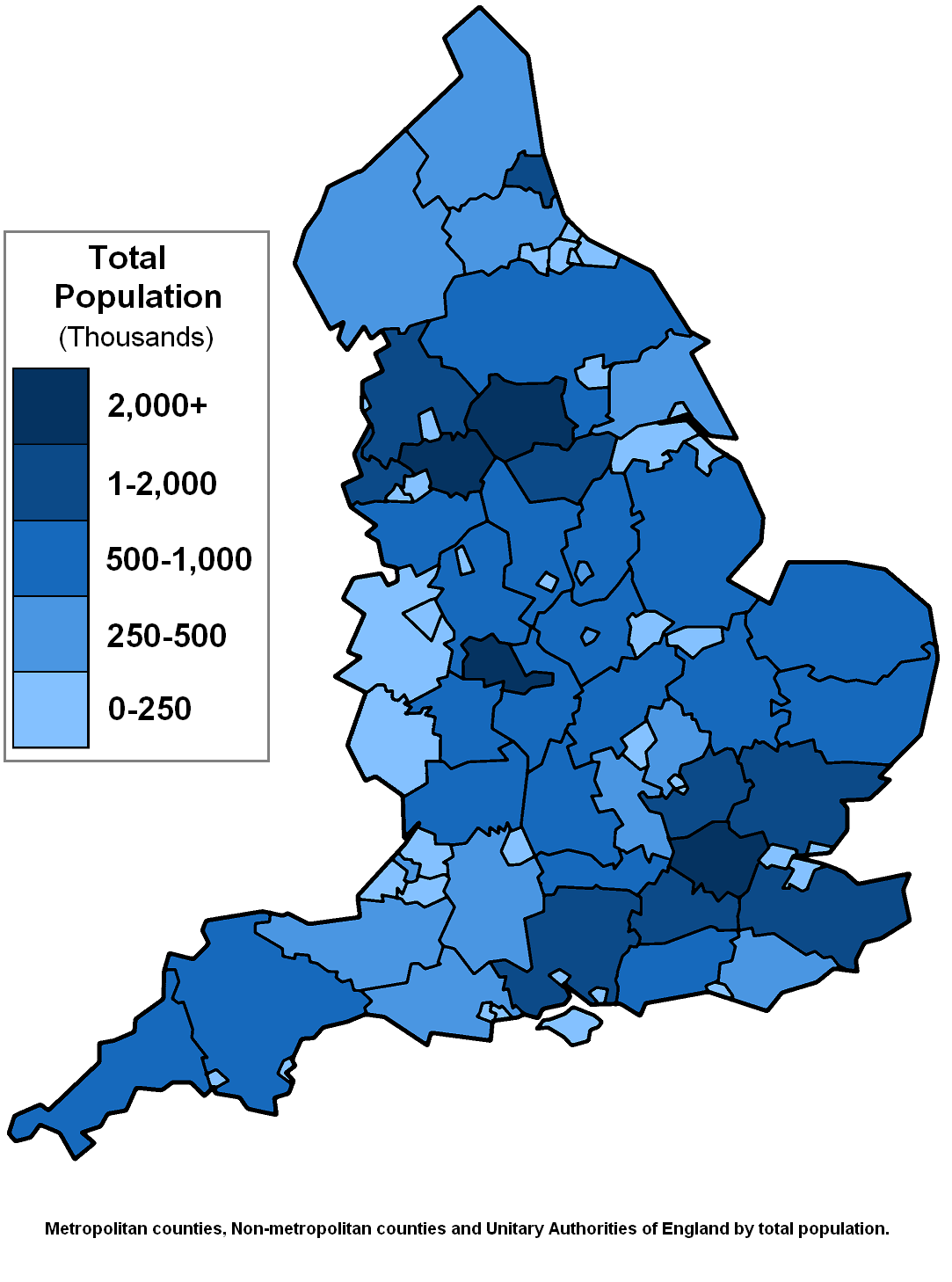
Counties of England by population, based on GNU map here as listed on w:List of English counties by population
Conditions d’utilisation

|
Vous avez la permission de copier, distribuer et modifier ce document selon les termes de la GNU Free Documentation License version 1.2 ou toute version ultérieure publiée par la Free Software Foundation, sans sections inaltérables, sans texte de première page de couverture et sans texte de dernière page de couverture. Un exemplaire de la licence est inclus dans la section intitulée GNU Free Documentation License. |
| Ce fichier est disponible selon les termes de la licence Creative Commons Attribution – Partage dans les Mêmes Conditions 3.0 (non transposée). | ||
| ||
| Ce bandeau de licence a été ajouté à ce fichier dans le cadre de la procédure de mise à jour des licences des images sous GFDL. |
Historique du fichier
Cliquer sur une date et heure pour voir le fichier tel qu'il était à ce moment-là.
| Date et heure | Vignette | Dimensions | Utilisateur | Commentaire | |
|---|---|---|---|---|---|
| actuel | 4 mars 2008 à 15:17 | | 1 083 × 1 458 (229 kio) | Roke~commonswiki | fix Herefordshire |
| 3 août 2007 à 16:14 |  | 1 083 × 1 458 (217 kio) | Roke~commonswiki | thousands... oops | |
| 21 mars 2007 à 14:58 |  | 1 083 × 1 458 (217 kio) | Roke~commonswiki | Counties of England by population, based on GNU map [http://en.wikipedia.org/wiki/Image:BlankMap-EnglandAdministrativeCounties1974.png here] as listed on w:List of English counties by population Category:Maps of England |
Utilisation du fichier
Aucune page n’utilise ce fichier.
Usage global du fichier
Les autres wikis suivants utilisent ce fichier :
- Utilisation sur ca.wikipedia.org
- Utilisation sur cv.wikipedia.org
- Utilisation sur de.wikipedia.org
- Utilisation sur en.wikipedia.org
- Utilisation sur it.wikipedia.org