
Fichier:Yazoo river.gif

Taille de cet aperçu : 477 × 599 pixels. Autres résolutions : 191 × 240 pixels | 382 × 480 pixels | 776 × 975 pixels.
Fichier d’origine (776 × 975 pixels, taille du fichier : 46 kio, type MIME : image/gif)
Ce fichier et sa description proviennent de Wikimedia Commons.
| Description |
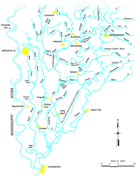
Map of the Yazoo River watershed — located in Mississippi.
|
|||
| Source |
http://www.mvk.usace.army.mil/offices/pp/projects/yazoobackwater/docs/01app4.pdf[lien mort] |
|||
| Auteur | ||||
| Autorisation (Réutilisation de ce fichier) |
|
Historique du fichier
Cliquer sur une date et heure pour voir le fichier tel qu'il était à ce moment-là.
| Date et heure | Vignette | Dimensions | Utilisateur | Commentaire | |
|---|---|---|---|---|---|
| actuel | 19 novembre 2006 à 21:19 | | 776 × 975 (46 kio) | PhilFree | Yazoo River, USA. The image uploaded is modified from the original created by U. S. Army Corps of Engineers' Vicksburg District ([http://www.mvk.usace.army.mil/offices/pp/projects/yazoobackwater/docs/01app4.pdf Yazoo Backwater Reformulation Report (pdf)]) |
Utilisation du fichier
La page suivante utilise ce fichier :
Usage global du fichier
Les autres wikis suivants utilisent ce fichier :
- Utilisation sur ar.wikipedia.org
- Utilisation sur cs.wikipedia.org
- Utilisation sur da.wikipedia.org
- Utilisation sur de.wikipedia.org
- Utilisation sur en.wikipedia.org
- Utilisation sur es.wikipedia.org
- Utilisation sur fy.wikipedia.org
- Utilisation sur it.wikipedia.org
- Utilisation sur pl.wikipedia.org
- Utilisation sur sv.wikipedia.org
- Utilisation sur www.wikidata.org