
Fichier:Wicken Fen NT map.svg

Fichier d’origine (Fichier SVG, nominalement de 988 × 1 318 pixels, taille : 1 009 kio)
Ce fichier et sa description proviennent de Wikimedia Commons.
Description
| Description |
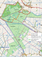
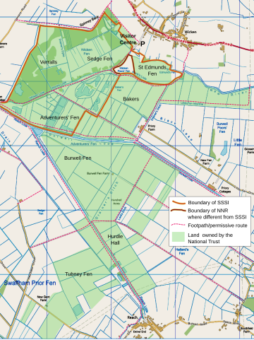
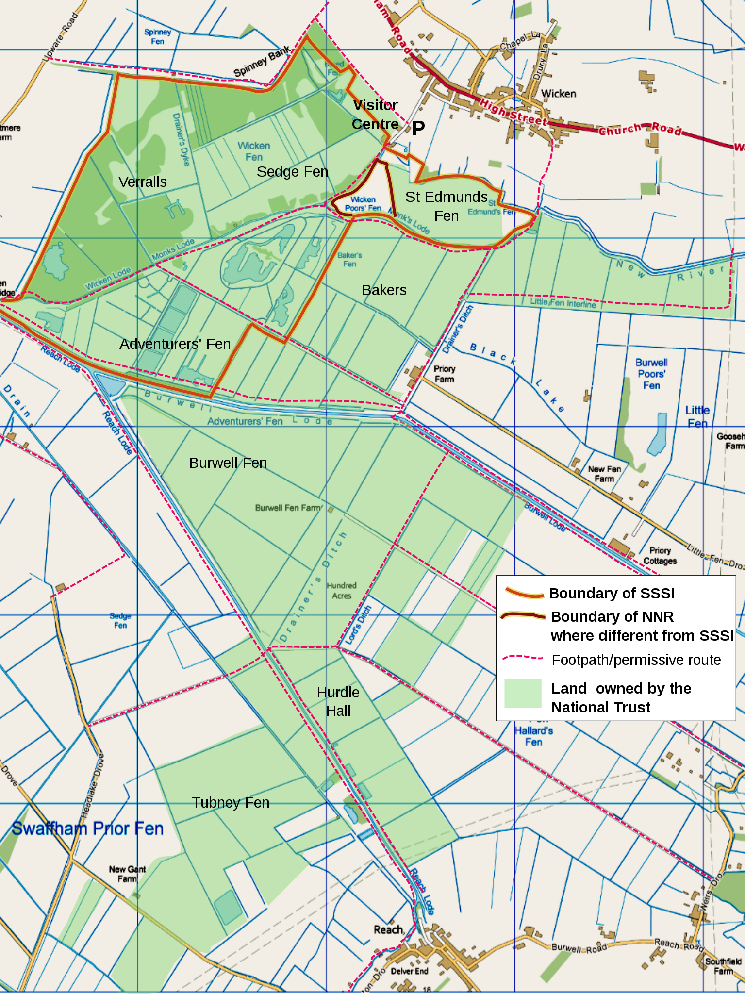
English: map of Wicken Fen National Trust land holdings, Cambridgeshire, UK, using the following for additional information shown:
OS map projection (nb: Not WGS 84 datum) with OS 1km grid squares shown. SW origin is TL543660 Geographic limits:
|
||||||
| Date | |||||||
| Source |
Ordnance Survey OpenData viewer.
|
||||||
| Auteur | User:RobinLeicester created using Ordnance Survey data | ||||||
| Autorisation (Réutilisation de ce fichier) |
|
_(St_Edwards_Crown).svg)
Assembled from 1km squares generated by OS OpenData Viewer at scale '4-from-top'. Edited using a combination of Inkscape and Gimp. Colours shifted to get close to Nilfanion's standard (eg Waltham Forest). My Method: Gimp [Color] [Levels...] 'Input Levels' min=195, max=253. The resulting png imported into Inkscape, for additional text, boundary lines, etc.
Geographic limits can be discovered using this locator page
Conditions d’utilisation

|
Le détenteur des droits d’auteur de ce fichier autorise n’importe qui à l’utiliser pour n’importe quelle utilisation, pourvu que le détenteur des droits d’auteur soit correctement attribué. La redistribution, les œuvres dérivées, l’utilisation commerciale et toutes les autres utilisations sont autorisées. |
|
|
Historique du fichier
Cliquer sur une date et heure pour voir le fichier tel qu'il était à ce moment-là.
| Date et heure | Vignette | Dimensions | Utilisateur | Commentaire | |
|---|---|---|---|---|---|
| actuel | 16 décembre 2011 à 02:52 | | 988 × 1 318 (1 009 kio) | RobinLeicester | {{Information |Description ={{en|1=map of Wicken Fen National Trust land holdings, Cambridgeshire, UK, using the following for additional information shown: *{{legend|#667fff|Motorways}} *{{legend|#4cb336|Primary routes}} *{{legend|#fc744c|Non-primary |
Utilisation du fichier
La page suivante utilise ce fichier :
Usage global du fichier
Les autres wikis suivants utilisent ce fichier :
- Utilisation sur de.wikipedia.org
- Utilisation sur en.wikipedia.org