
Fichier:VijayanagarGreatest1335-1570.png

Taille de cet aperçu : 800 × 500 pixels. Autres résolutions : 320 × 200 pixels | 640 × 400 pixels | 1 024 × 640 pixels | 1 554 × 972 pixels.
Fichier d’origine (1 554 × 972 pixels, taille du fichier : 55 kio, type MIME : image/png)
Ce fichier et sa description proviennent de Wikimedia Commons.
Description
| Description |
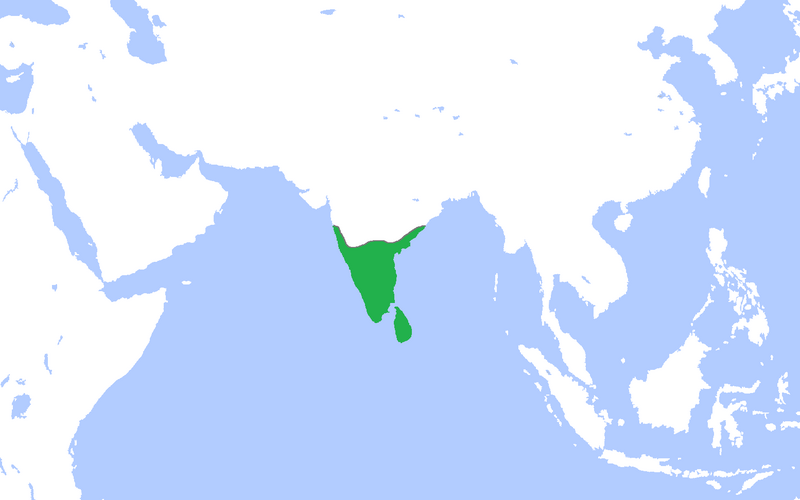
English: Locator map of the Vijayanagar Empire at its peak.
(Partially based on Atlas of World History (2007) - South and Southeast Asia, States and Empires 300-1525, map) |
| Date | |
| Source | Travail personnel |
| Auteur | Gabagool |
Conditions d’utilisation
Moi, en tant que détenteur des droits d’auteur sur cette œuvre, je la publie sous la licence suivante :
Ce fichier est disponible selon les termes de la licence Creative Commons Attribution 3.0 Non transposée.
- Vous êtes libre :
- de partager – de copier, distribuer et transmettre cette œuvre
- d’adapter – de modifier cette œuvre
- Sous les conditions suivantes :
- paternité – Vous devez donner les informations appropriées concernant l'auteur, fournir un lien vers la licence et indiquer si des modifications ont été faites. Vous pouvez faire cela par tout moyen raisonnable, mais en aucune façon suggérant que l’auteur vous soutient ou approuve l’utilisation que vous en faites.
Historique du fichier
Cliquer sur une date et heure pour voir le fichier tel qu'il était à ce moment-là.
| Date et heure | Vignette | Dimensions | Utilisateur | Commentaire | |
|---|---|---|---|---|---|
| actuel | 24 avril 2009 à 17:39 | | 1 554 × 972 (55 kio) | Gabagool | {{Information |Description={{en|1=Locator map of the Vijayanagar Empire at its peak. (Partially based on ''Atlas of World History'' (2007) - South and Southeast Asia, States and Empires 300-1525, map)}} |Source=Own work by uploader |Author=[[User:Gabagoo |
Utilisation du fichier
La page suivante utilise ce fichier :