
Fichier:Uruk Archaeological site at Warka, Iraq MOD 45156521.jpg

Taille de cet aperçu : 800 × 531 pixels. Autres résolutions : 320 × 213 pixels | 640 × 425 pixels | 1 024 × 680 pixels | 1 280 × 850 pixels | 3 000 × 1 993 pixels.
Fichier d’origine (3 000 × 1 993 pixels, taille du fichier : 4,12 Mio, type MIME : image/jpeg)
Ce fichier et sa description proviennent de Wikimedia Commons.
Description
| Description |
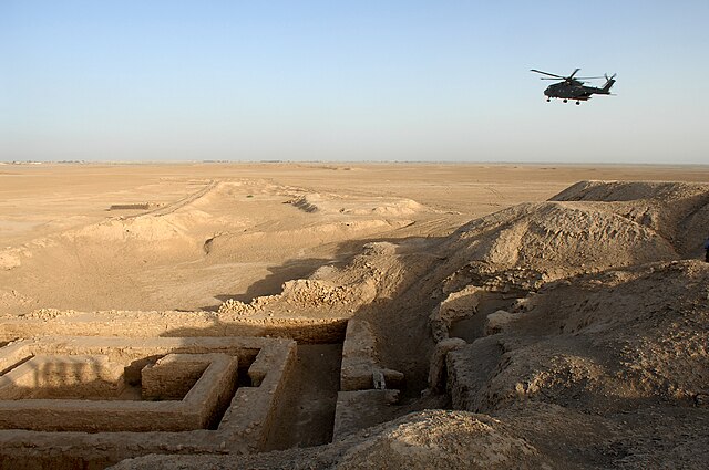
 English: A general view of the Uruk archaeological site at Warka in Iraq.
The site of Uruk was discovered in 1849 by William Kennett Loftus who led the first excavations from 1850 to 1854. The Arabic name of Babylonia, al-ʿIrāq, is thought to be derived from the name Uruk, via Aramaic (Erech) and possibly Middle Persian (Erāq) transmission.
|
| Date | |
| Source | |
| Auteur | SAC Andy Holmes (RAF) |
| Autorisation (Réutilisation de ce fichier) |
Images are downloadable at high resolution, made available at http://www.defenceimagery.mod.uk for reuse under the OGL (Open Government License). |
| Lieu de la prise de vue | | Voir cet endroit et d’autres images sur : OpenStreetMap |
|---|
Conditions d’utilisation
_(St_Edwards_Crown).svg)
|
This file is licensed under the Open Government Licence version 1.0 (OGL v1.0).
|
|---|---|
| Attribution:Photo: SAC Andy Holmes (RAF)/MOD | |
|
You are free to:
See the Open Government Licence page on Meta-Wiki for more information.
|

|
Ce document a été réalisé avec l’équipement de Wikimedia UK.
|
Historique du fichier
Cliquer sur une date et heure pour voir le fichier tel qu'il était à ce moment-là.
| Date et heure | Vignette | Dimensions | Utilisateur | Commentaire | |
|---|---|---|---|---|---|
| actuel | 10 mars 2014 à 21:40 | | 3 000 × 1 993 (4,12 Mio) | Fæ | == {{int:filedesc}} == {{information |description={{en|A general view of the Uruk archaeological site at Warka in Iraq. The site of Uruk was discovered in 1849 by William Kennett Loftus who led the first excavations from 1850 to 1854. The Arabic nam... |
Utilisation du fichier
La page suivante utilise ce fichier :
Usage global du fichier
Les autres wikis suivants utilisent ce fichier :
- Utilisation sur cs.wikipedia.org
- Utilisation sur cv.wikipedia.org
- Utilisation sur da.wikipedia.org
- Utilisation sur de.wikivoyage.org
- Utilisation sur es.wikipedia.org
- Utilisation sur fa.wikipedia.org
- Utilisation sur fi.wikipedia.org
- Utilisation sur he.wiktionary.org
- Utilisation sur hr.wikipedia.org
- Utilisation sur hu.wikipedia.org
- Utilisation sur hy.wikipedia.org
- Utilisation sur incubator.wikimedia.org
- Utilisation sur io.wikipedia.org
- Utilisation sur it.wikipedia.org
- Utilisation sur ja.wikipedia.org
- Utilisation sur lt.wikipedia.org
- Utilisation sur lv.wikipedia.org
- Utilisation sur nl.wikipedia.org
- Utilisation sur pl.wikipedia.org
- Utilisation sur ro.wikipedia.org
- Utilisation sur uk.wikipedia.org
- Utilisation sur war.wikipedia.org
- Utilisation sur zh.wikipedia.org