
Fichier:United States Virgin Islands Saint Croix location map.svg

Fichier d’origine (Fichier SVG, nominalement de 3 331 × 1 871 pixels, taille : 9,49 Mio)
Ce fichier et sa description proviennent de Wikimedia Commons.
Description
| Description |
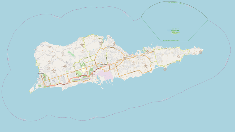
English: United States Virgin Islands Saint Croix location map with boundries of top=17.7964, left=-64.9182, right=-64.5502, bottom=17.6659 |
| Date | |
| Source | https://www.openstreetmap.org/export#map=12/17.7240/-64.7222&layers=H |
| Auteur | OpenStreetMap contributors |
| SVG information |

| Description |
SVG generated from openstreetmap.org export feature of Saint Croix. Cette carte de Saint Croix a été créée à partir des données du projet OpenStreetMap. Cette carte est peut-être incomplète et peut contenir des erreurs. Ne vous fiez pas uniquement à elle pour vos déplacements. |
|||
| Date | ||||
| Source | Il existe probablement une [page https://wiki.openstreetmap.org/wiki/Saint+Croix sur le wiki d'OpenStreetMap sur ce sujet : Saint Croix] | |||
| Créé par |
contributeurs d'OpenStreetMap |
|||
| Autorisation (Réutilisation de ce fichier) |
Les données d'OpenStreetMap sont disponibles sous la license Open Database (détails). Les cartes sont publiées sous license Creative Commons Attribution-Partage dans les Mêmes Conditions 2.0 (CC-BY-SA 2.0).
Ce fichier est disponible selon les termes de la licence Creative Commons Attribution – Partage dans les Mêmes Conditions 2.0 Générique
|
|||
| Géoréférencement | Si c'est inapproprié, définissez warp_status = skip pour masquer. |
Conditions d’utilisation
Historique du fichier
Cliquer sur une date et heure pour voir le fichier tel qu'il était à ce moment-là.
| Date et heure | Vignette | Dimensions | Utilisateur | Commentaire | |
|---|---|---|---|---|---|
| actuel | 7 mai 2020 à 16:15 | | 3 331 × 1 871 (9,49 Mio) | Pwhite098 | Updated map with SVG from openstreetmap.org |
| 4 mai 2020 à 11:08 | 1 077 × 405 (167 kio) | Trần Nguyễn Minh Huy | Reverted to version as of 17:27, 8 March 2017 (UTC) already used in locator map, can not upload with the new geocode | ||
| 4 mai 2020 à 11:03 |  | 1 444 × 723 (5,33 Mio) | Trần Nguyễn Minh Huy | better SVG map (extract from OSM) | |
| 8 mars 2017 à 19:27 | 1 077 × 405 (167 kio) | Id4abel | User created page with UploadWizard |
Utilisation du fichier
La page suivante utilise ce fichier :
Usage global du fichier
Les autres wikis suivants utilisent ce fichier :
- Utilisation sur azb.wikipedia.org
- Utilisation sur en.wikipedia.org
- Saint Croix
- Buck Island Reef National Monument
- Christiansted, U.S. Virgin Islands
- Frederiksted, U.S. Virgin Islands
- Salt River Bay National Historical Park and Ecological Preserve
- Christiansted National Historic Site
- Scouting in the United States Virgin Islands
- Cruzan Rum
- Green Cay National Wildlife Refuge
- Sandy Point National Wildlife Refuge
- St. George Village Botanical Garden
- National Capital Area Council
- Christiansted Harbor Seaplane Base
- Fort Frederik
- Frederiksted Historic District
- Point Udall (U.S. Virgin Islands)
- Altona, Saint Croix, U.S. Virgin Islands
- Annaberg, Saint Croix, U.S. Virgin Islands
- Bellevue, Saint Croix, U.S. Virgin Islands
- Bonne Esperance, Saint Croix, U.S. Virgin Islands
- Concordia, U.S. Virgin Islands
- Frederiks Haab, U.S. Virgin Islands
- Friedensfeld, U.S. Virgin Islands
- Great Pond (Saint Croix)
- Green Kay, U.S. Virgin Islands
- Hermitage, Saint Croix, U.S. Virgin Islands
- Mount Pleasant, Saint Croix, U.S. Virgin Islands
- Sion Hill, U.S. Virgin Islands
- Mount Eagle (U.S. Virgin Islands)
- Friedensfeld Midlands Moravian Church and Manse
- Estate Little Princess
- Frederiksted Pier
- Protestant Cay
- Danish West India and Guinea Company Warehouse
- St Croix East End Marine Park
- Module:Location map/data/USA VI Saint Croix
- Module:Location map/data/USA VI Saint Croix/doc
- Diamond School
- Whim (United States Virgin Islands)
- St. John's Episcopal Church (Christiansted, U.S. Virgin Islands)
- Richmond Prison Detention and Workhouse
- Slob Historic District
- User:AridCeption/sandbox
- Utilisation sur fa.wikipedia.org
- Utilisation sur si.wikipedia.org
Voir davantage sur l’utilisation globale de ce fichier.