
Fichier:USA Guam satellite image location map.jpg

Taille de cet aperçu : 600 × 600 pixels. Autres résolutions : 240 × 240 pixels | 480 × 480 pixels | 768 × 768 pixels | 1 200 × 1 200 pixels.
Fichier d’origine (1 200 × 1 200 pixels, taille du fichier : 540 kio, type MIME : image/jpeg)
Ce fichier et sa description proviennent de Wikimedia Commons.
Description
| Description |
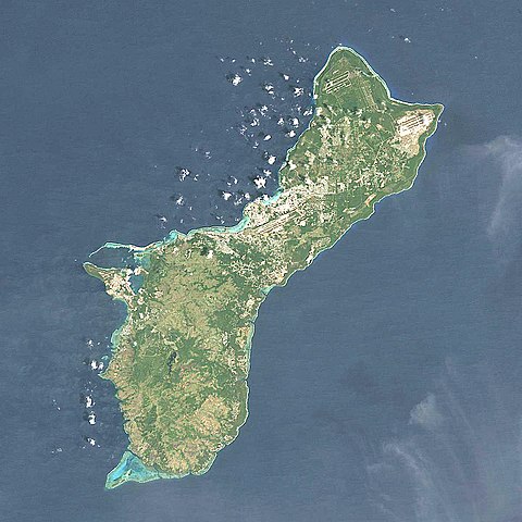
Quadratische Plattkarte, N-S-Streckung 100.0 %. Geographische Begrenzung der Karte: Equirectangular projection, N/S stretching 100.0 %. Geographic limits of the map:
|
| Date | |
| Source | NASA, Landsat7 visual, http://onearth.jpl.nasa.gov |
| Auteur | Alexrk2 |
| Autres versions |
|


|
Cette carte a été créée ou améliorée dans le Kartenwerkstatt (Atelier cartographique allemand). Vous pouvez également y proposer des cartes à améliorer.
|
Conditions d’utilisation
Moi, en tant que détenteur des droits d’auteur sur cette œuvre, je la publie sous la licence suivante :
Ce fichier est disponible selon les termes de la licence Creative Commons Attribution – Partage dans les Mêmes Conditions 3.0 (non transposée).
- Vous êtes libre :
- de partager – de copier, distribuer et transmettre cette œuvre
- d’adapter – de modifier cette œuvre
- Sous les conditions suivantes :
- paternité – Vous devez donner les informations appropriées concernant l'auteur, fournir un lien vers la licence et indiquer si des modifications ont été faites. Vous pouvez faire cela par tout moyen raisonnable, mais en aucune façon suggérant que l’auteur vous soutient ou approuve l’utilisation que vous en faites.
- partage à l’identique – Si vous modifiez, transformez, ou vous basez sur cette œuvre, vous devez distribuer votre contribution sous la même licence ou une licence compatible avec celle de l’original.
Historique du fichier
Cliquer sur une date et heure pour voir le fichier tel qu'il était à ce moment-là.
| Date et heure | Vignette | Dimensions | Utilisateur | Commentaire | |
|---|---|---|---|---|---|
| actuel | 14 mars 2010 à 19:05 | | 1 200 × 1 200 (540 kio) | Alexrk2 | == Beschreibung == {{Information |Description= {{de|Satellitenfoto von Guam, USA}} Quadratische Plattkarte, N-S-Streckung 100.0 %. Geographische Begrenzung der Karte: {{en|Satellite Image of Guam, USA}} Eq |
Utilisation du fichier
Les 4 pages suivantes utilisent ce fichier :
Usage global du fichier
Les autres wikis suivants utilisent ce fichier :
- Utilisation sur af.wikipedia.org
- Utilisation sur ar.wikipedia.org
- Utilisation sur ast.wikipedia.org
- Utilisation sur az.wikipedia.org
- Utilisation sur bcl.wikipedia.org
- Utilisation sur be.wikipedia.org
- Utilisation sur bg.wikipedia.org
- Utilisation sur ceb.wikipedia.org
- Utilisation sur ce.wikipedia.org
- Utilisation sur cs.wikipedia.org
- Utilisation sur da.wikipedia.org
- Utilisation sur de.wikipedia.org
- Utilisation sur de.wikivoyage.org
- Utilisation sur en.wikipedia.org
- War in the Pacific National Historical Park
- Mount Lamlam
- Mount Jumullong Manglo
- Mount Alifan
- Talofofo Bay
- Fena Lake
- Cocos Lagoon
- Module:Location map/data/USA Guam/doc
- Pago River
- Talofofo River
- Agat Bay
- Agaga River
- Agfayan River
- Aguada River
- Ajayan River
- Alatgue River
- Almagosa River
- Aplacho River
- Asalonso River
- Aslinget River
- Asmafines River
- Astaban River
- Atantano River
- Atate River
- Big Guatali River
- Bile River
- Bolanos River
- Bonya River
- Bubulao River
- Cetti River
- Chagame River
- Chaot River
- Dante River
Voir davantage sur l’utilisation globale de ce fichier.