
Fichier:Tizi'n'Toubkal.jpg

Taille de cet aperçu : 800 × 600 pixels. Autres résolutions : 320 × 240 pixels | 640 × 480 pixels | 1 024 × 768 pixels | 1 280 × 960 pixels | 1 600 × 1 200 pixels.
Fichier d’origine (1 600 × 1 200 pixels, taille du fichier : 436 kio, type MIME : image/jpeg)
Ce fichier et sa description proviennent de Wikimedia Commons.
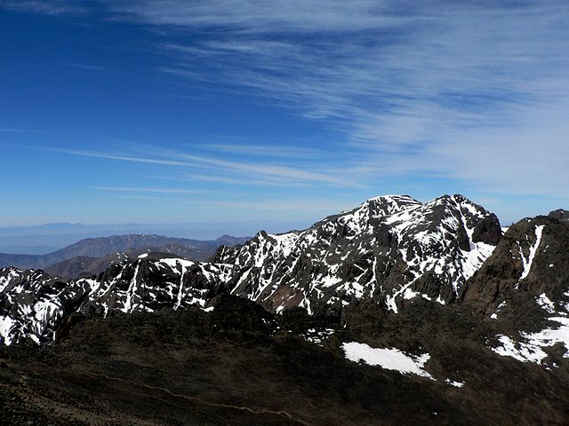
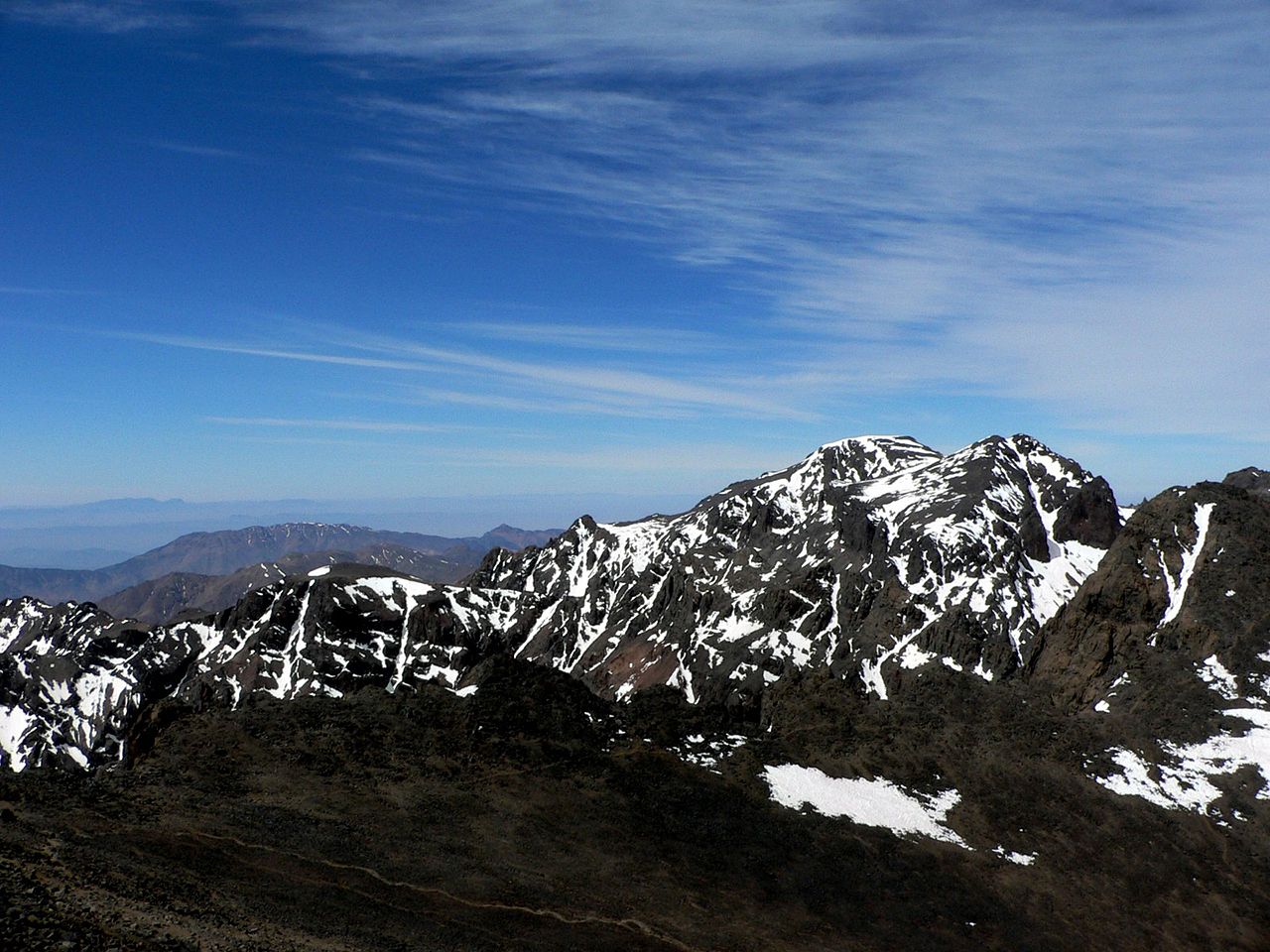
| Description | View of the saddle under Jebel Toubkal (3,940 m or 12,930 ft elevation), from the final ridge |
| Date | Prise le 26 avril 2005 |
| Source | Travail personnel |
| Auteur | Kobersky (d · contributions) |
| Autorisation (Réutilisation de ce fichier) |
Ce fichier est disponible selon les termes de la licence Creative Commons Attribution – Partage dans les Mêmes Conditions 2.5 Générique
|
Historique du fichier
Cliquer sur une date et heure pour voir le fichier tel qu'il était à ce moment-là.
| Date et heure | Vignette | Dimensions | Utilisateur | Commentaire | |
|---|---|---|---|---|---|
| actuel | 16 septembre 2005 à 12:50 | | 1 600 × 1 200 (436 kio) | Kobersky | View of the saddle (3940 meters above sea level) under the Jebel Toubkal from the final ridge. Source: Self-made {{cc-by-sa-2.5}} Category:Photos\ |
Utilisation du fichier
Les 3 pages suivantes utilisent ce fichier :
Usage global du fichier
Les autres wikis suivants utilisent ce fichier :
- Utilisation sur ace.wikipedia.org
- Utilisation sur ar.wikipedia.org
- جبال الأطلس
- بني ملال
- بوابة:المغرب
- الأطلس الكبير
- متنزه سوس ماسة الوطني
- متنزه خنيفيس الوطني
- متنزه تازكة
- المنتزه الوطني للحسيمة
- متنزه تلاسمطان الوطني
- قالب:متنزهات وطنية بالمغرب
- محمية جبل بوهاشم الطبيعية
- محمية سيدي شيكر الطبيعية
- متنزه إفران الوطني
- قائمة المتنزهات الوطنية في المغرب
- بوابة:المغرب/قوائم:جغرافيا
- بوابة:جبال
- بوابة:جبال/مقالة مختارة
- بوابة:جبال/مقالة مختارة/أرشيف
- بوابة:جبال/مقالة مختارة/3
- بوابة:علوم/هل تعلم/أرشيف
- بوابة:علوم/هل تعلم/5
- متنزه توبقال الوطني
- المتنزه الوطني إيريكي
- المنتزه الوطني الأطلس الكبير الشرقي
- منتزه خنيفرة الوطني
- عين أسردون
- قصر بني ملال
- منتزه الداخلة الوطني
- Utilisation sur ast.wikipedia.org
- Utilisation sur be-tarask.wikipedia.org
- Utilisation sur be.wikipedia.org
- Utilisation sur bh.wikipedia.org
- Utilisation sur bn.wikipedia.org
- Utilisation sur ca.wikipedia.org
- Utilisation sur cs.wikipedia.org
- Utilisation sur cy.wikipedia.org
- Utilisation sur da.wikipedia.org
- Utilisation sur de.wikipedia.org
- Utilisation sur el.wikipedia.org
- Utilisation sur en.wikipedia.org
Voir davantage sur l’utilisation globale de ce fichier.