
Fichier:Tarso Toh.jpg
Pas de plus haute résolution disponible.
Tarso_Toh.jpg (640 × 458 pixels, taille du fichier : 164 kio, type MIME : image/jpeg)
Ce fichier et sa description proviennent de Wikimedia Commons.
Description
| Description |
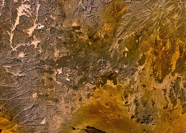
English: Small cinder cones and lava flows of the Tarso Tôh volcanic field can be seen in the large darker-brownish area at the center of this NASA Landsat image. This Pleistocene-to-Holocene volcanic field in the Tibesti Range of Chad covers a 30 x 80 km area and contains 150 scoria cones and two maars. Basaltic lava flows at Tarso Tôh were erupted over a basement of Precambrian schists and Paleozoic sandstones. The black lava flows at the very bottom-center are distal lava flows from Tarso Toussidé volcano. |
| Date | Date inconnue |
| Source | http://www.volcano.si.edu/world/volcano.cfm?vnum=0205-009&volpage=photos&photo=119033 |
| Auteur | NASA Landsat7 image (worldwind.arc.nasa.gov) |
Conditions d’utilisation
| Cette image est dans le domaine public car elle est constituée d'une capture d'écran du logiciel World Wind de la NASA qui utilise des données du domaine public, comme Blue Marble, MODIS, Landsat, SRTM, USGS ou GLOBE.
|
 |
Historique du fichier
Cliquer sur une date et heure pour voir le fichier tel qu'il était à ce moment-là.
| Date et heure | Vignette | Dimensions | Utilisateur | Commentaire | |
|---|---|---|---|---|---|
| actuel | 23 juin 2010 à 01:28 | | 640 × 458 (164 kio) | Michael Metzger | {{Information |Description={{en|1=Small cinder cones and lava flows of the Tarso Tôh volcanic field can be seen in the large darker-brownish area at the center of this NASA Landsat image. This Pleistocene-to-Holocene volcanic field in the Tibesti Range o |
Utilisation du fichier
La page suivante utilise ce fichier :
Usage global du fichier
Les autres wikis suivants utilisent ce fichier :
- Utilisation sur cs.wikipedia.org
- Utilisation sur de.wikipedia.org
- Utilisation sur en.wikipedia.org
- Utilisation sur fa.wikipedia.org
- Utilisation sur ru.wikipedia.org
- Utilisation sur sk.wikipedia.org
- Utilisation sur uk.wikipedia.org
- Utilisation sur www.wikidata.org