
Fichier:ScotlandOrkneyIslands.png
Pas de plus haute résolution disponible.
ScotlandOrkneyIslands.png (225 × 350 pixels, taille du fichier : 3 kio, type MIME : image/png)
Ce fichier et sa description proviennent de Wikimedia Commons.
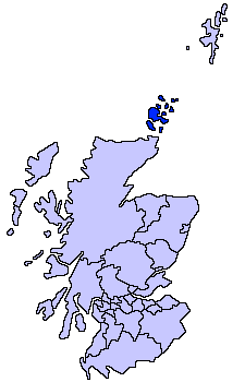
Orkney Islands unitary council
Slightly edited version of a map drawn by Morwen

|
Vous avez la permission de copier, distribuer et modifier ce document selon les termes de la GNU Free Documentation License version 1.2 ou toute version ultérieure publiée par la Free Software Foundation, sans sections inaltérables, sans texte de première page de couverture et sans texte de dernière page de couverture. Un exemplaire de la licence est inclus dans la section intitulée GNU Free Documentation License. |
| Ce fichier est disponible selon les termes de la licence Creative Commons Attribution – Partage dans les Mêmes Conditions 3.0 (non transposée). | ||
| ||
| Ce bandeau de licence a été ajouté à ce fichier dans le cadre de la procédure de mise à jour des licences des images sous GFDL. |

|
Une version vectorielle de cette image existe, dans le format « SVG ». Si elle n’est pas inférieure, elle devrait être utilisée à la place de la présente version pour des affichages en plus grandes dimensions ou nécessitant une meilleure résolution.
File:ScotlandOrkneyIslands.png → File:ScotlandOrkneyIslands.svg
Pour plus d’informations sur les images vectorielles, consultez la page de transition de Commons vers le format SVG. Voir aussi les informations à propos de la manière dont le logiciel MediaWiki gère les images au format SVG. |
 |
derivative works
Œuvres dérivées de ce fichier : ScotlandOrkneyIslands.svg
Historique du fichier
Cliquer sur une date et heure pour voir le fichier tel qu'il était à ce moment-là.
| Date et heure | Vignette | Dimensions | Utilisateur | Commentaire | |
|---|---|---|---|---|---|
| actuel | 4 août 2005 à 18:32 | | 225 × 350 (3 kio) | Tornad | size optimized |
| 17 mai 2005 à 23:40 |  | 225 × 350 (5 kio) | Voyager | Orkney Islands unitary council Slightly edited version of a map drawn by Morwen {{GFDL}} Category:Maps of Scottish unitary councils |
Utilisation du fichier
La page suivante utilise ce fichier :
Usage global du fichier
Les autres wikis suivants utilisent ce fichier :
- Utilisation sur af.wikipedia.org
- Utilisation sur ar.wikipedia.org
- Utilisation sur ast.wikipedia.org
- Utilisation sur be.wikipedia.org
- Utilisation sur bg.wikipedia.org
- Utilisation sur br.wikipedia.org
- Utilisation sur cy.wikipedia.org
- Utilisation sur da.wikipedia.org
- Utilisation sur de.wikipedia.org
- Utilisation sur dsb.wikipedia.org
- Utilisation sur eu.wikipedia.org
- Orkadak
- Lankide:Euskaldunaa
- Mainland (Orkadak)
- Kirkwall
- Hoy uhartea
- Stromness
- Txantiloi:Orkadak
- Wikiproiektu:Irlanda, Gales eta Eskoziako udalerriak
- Balfour (Orkadak)
- Ancumtoun
- Backaland
- Bimbister
- Braeswick
- Brims
- Brinian
- Broughtown
- Burwick (Orkadak)
- Bustatoun
- Dounby
- Evie (Orkadak)
- Finstown
- Herston (Orkadak)
- Houton
- Hoxa (Orkadak)
- Longhope (Orkadak)
- Lyness
- Odness
- Pierowall
- St Margaret's Hope
- St Mary's (Orkadak)
- Stenness
- Tankerness
- Toab (Orkadak)
- Twatt (Orkadak)
- Voy
- Whitehall (Orkadak)
- Birsay
- Cairston
- Deerness
- Firth (Orkadak)
Voir davantage sur l’utilisation globale de ce fichier.