
Fichier:Portugal topographic map-fr.svg

Taille de cet aperçu PNG pour ce fichier SVG : 339 × 599 pixels. Autres résolutions : 136 × 240 pixels | 272 × 480 pixels | 435 × 768 pixels | 579 × 1 024 pixels | 1 159 × 2 048 pixels | 1 738 × 3 070 pixels.
Fichier d’origine (Fichier SVG, nominalement de 1 738 × 3 070 pixels, taille : 11,35 Mio)
Ce fichier et sa description proviennent de Wikimedia Commons.
| Description |
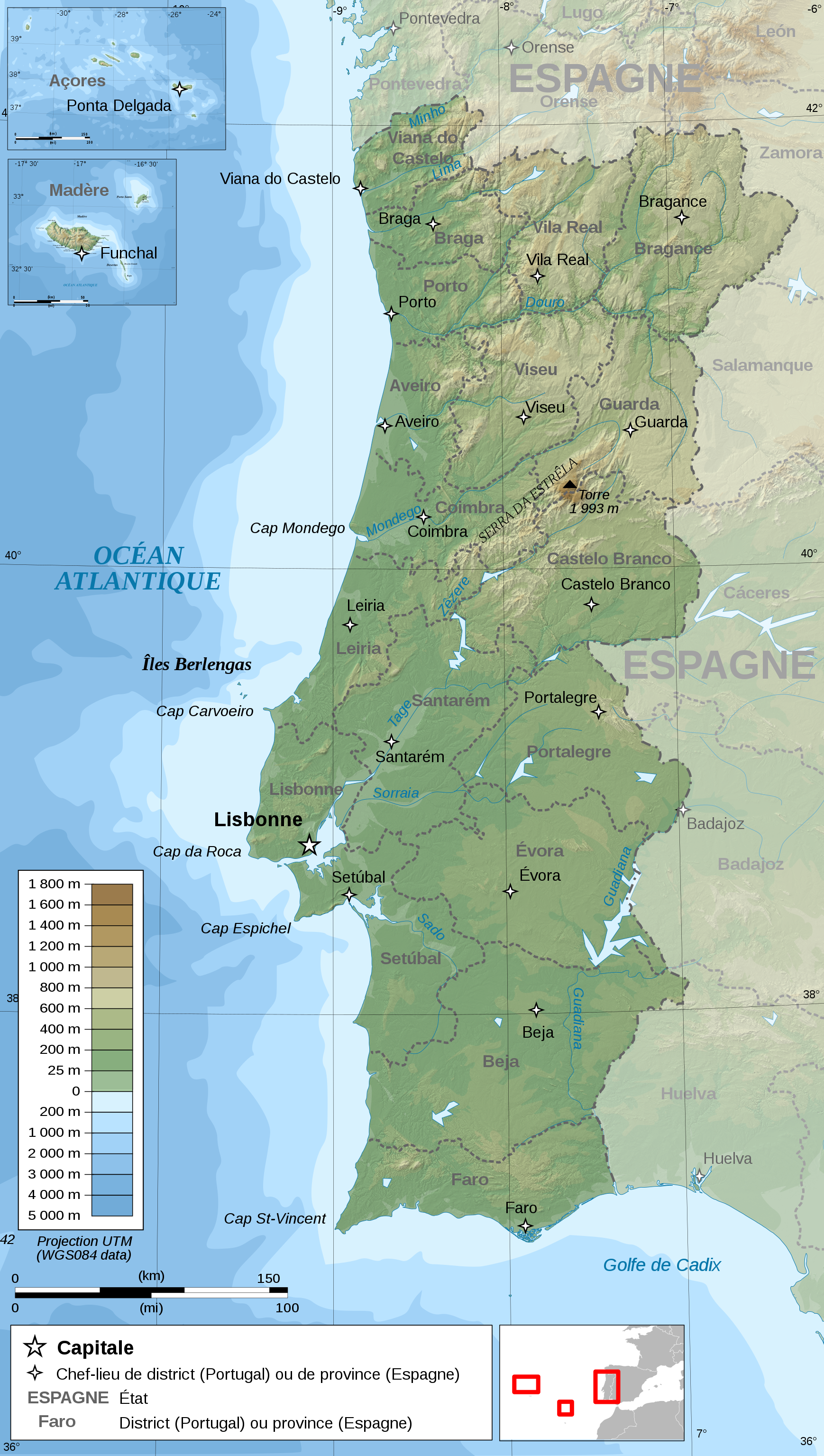
Français : Carte topographique et administrative en français du Portugal
Português: Carta topográfica e da administração do Portugal, em francês
Deutsch: Topographische Karte von Portugal, französische Version English: Topographic and administrative map in French of Portugal Español: Mapa topográfico y administrativo en francés de Portugal Italiano: Carta topografica e amministrativa de Portogallo 日本語: フランス語で表示したポルトガル地形·行政地図 |
||
| Date | |||
| Source |
English: Own work ;
Français : Création personnelle ;
|
||
| Auteur | Bourrichon - fr:Bourrichon | ||
| Autorisation (Réutilisation de ce fichier) |
Moi, en tant que détenteur des droits d’auteur sur cette œuvre, je la publie sous les licences suivantes :
Ce fichier est sous licence Creative Commons Attribution – Partage dans les Mêmes Conditions 3.0 (non transposée), 2.5 Générique, 2.0 Générique et 1.0 Générique.
Vous pouvez choisir l’une de ces licences. |
||
| Autres versions |
Œuvres dérivées de ce fichier : Portugal topographic map-en.svg
|


|
Ce fichier SVG contient du texte encapsulé pouvant facilement être traduit dans votre langue en utilisant n'importe quel éditeur de fichier SVG ou de texte, ou par l'outil de traduction de fichiers SVG. Pour plus d'informations, voir : A propos de la traduction des fichiers SVG. |
Cette image vectorielle SVG non W3C-spécifiée a été créée avec Inkscape .
Historique du fichier
Cliquer sur une date et heure pour voir le fichier tel qu'il était à ce moment-là.
| Date et heure | Vignette | Dimensions | Utilisateur | Commentaire | |
|---|---|---|---|---|---|
| actuel | 15 février 2010 à 19:08 | | 1 738 × 3 070 (11,35 Mio) | Bourrichon | simplification |
| 28 avril 2009 à 19:57 |  | 1 738 × 3 070 (12,42 Mio) | Bourrichon | key | |
| 26 avril 2009 à 14:04 |  | 1 738 × 3 070 (12,42 Mio) | Bourrichon | +corr bathy color | |
| 25 avril 2009 à 19:47 |  | 1 738 × 3 070 (12,42 Mio) | Bourrichon | d.e. | |
| 25 avril 2009 à 19:08 |  | 1 738 × 3 070 (12,42 Mio) | Bourrichon | +corr bathy | |
| 25 avril 2009 à 18:34 |  | 1 738 × 3 070 (12,27 Mio) | Bourrichon | corr bug | |
| 25 avril 2009 à 18:18 |  | 1 738 × 3 070 (7,43 Mio) | Bourrichon | {{Information |Description= {{fr|Carte topographique et administrative en français du fr:Portugal}} {{po|Carta em francês topográfica e da administração do Portugal}} {{de|Topographische Karte von Portugal, fra |
Utilisation du fichier
Les 2 pages suivantes utilisent ce fichier :